Property Record
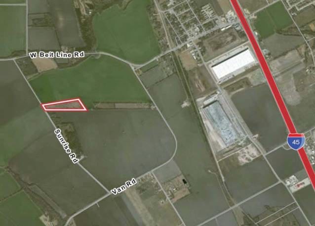
300 S Sunrise Rd, Wilmer, TX 75172


NEARBY LISTINGS FOR SALE OR LEASE
Property Detail
300 S Sunrise Rd
65128779510020000
Major W Spencer
Commercialnec
MAJOR W SPENCER ABST 1287 PG 795 TR 2 ACS 64.844 INT202200019467 DD01202022 CO-DC 1287795100200 4CT12877951
X
Dallas
48113C0655K
Texas
2024
64.84 AC
2025
Southwest Dallas
016903
Dallas/Ft Worth
132,780 SF
Dallas-Fort Worth-Arlington, TX
DEMOGRAPHICS near 300 S Sunrise Rd
1 Mile
3 Mile
5 Mile
2024 Total Population
341
7,612
38,726
2029 Population
344
7,856
41,179
Pop Growth 2024-2029
+ 0.88%
+ 3.21%
+ 6.33%
Average Age
33
34
35
2024 Total Households
101
2,332
12,406
HH Growth 2024-2029
+ 0.99%
+ 3.09%
+ 6.26%
Median Household Inc
$33,749
$51,110
$55,261
Avg Household Size
3.20
3.20
3.10
2024 Avg HH Vehicles
2.00
2.00
2.00
Median Home Value
$73,749
$104,850
$167,061
Median Year Built
1992
1997
1988
Nearby Places
Map Layers
Map Styles
 Street
 Aerial
- Restaurants
- Banks
- Shops
- Fitness
- Groceries
PUBLIC TRANSPORTATION
AIRPORT
Dallas Love Field
DRIVE
WALK
Distance
Dallas Love Field
35 min
23.1 mi
Dallas-Fort Worth International
DRIVE
WALK
Distance
Dallas-Fort Worth International
50 min
39.0 mi
Freight Ports
Port of Shreveport
DRIVE
WALK
Distance
Port of Shreveport
215 min
199.1 mi
Nearby Properties
Address
Land Use
TOTAL SIZE
Lot Size
Zoning
Address
Land Use
TOTAL SIZE
Lot Size
Zoning
2,492,806 SF
273.09 AC
Z34
Address
Land Use
TOTAL SIZE
Lot Size
Zoning
62.41 AC
Z31
Address
Land Use
TOTAL SIZE
Lot Size
Zoning
36.33 AC
Z31
Address
Land Use
TOTAL SIZE
Lot Size
Zoning
1,409,184 SF
75.72 AC
Z31
Address
Land Use
TOTAL SIZE
Lot Size
Zoning
1,358,690 SF
94.91 AC
Z268
Address
Land Use
TOTAL SIZE
Lot Size
Zoning
1,225,000 SF
69.44 AC
Z04
Address
Land Use
TOTAL SIZE
Lot Size
Zoning
735,000 SF
159.91 AC
Z04
Address
Land Use
TOTAL SIZE
Lot Size
Zoning
1,073,520 SF
55.17 AC
Z123
Address
Land Use
TOTAL SIZE
Lot Size
Zoning
1,021,601 SF
79.42 AC
Z268
Address
Land Use
TOTAL SIZE
Lot Size
Zoning
1,020,000 SF
56.30 AC
Z31
Address
Land Use
TOTAL SIZE
Lot Size
Zoning
799,765 SF
45.66 AC
Z31
Address
Land Use
TOTAL SIZE
Lot Size
Zoning
754,897 SF
42.75 AC
Z123
Address
Land Use
TOTAL SIZE
Lot Size
Zoning
660,000 SF
39.24 AC
Z31
Address
Land Use
TOTAL SIZE
Lot Size
Zoning
750,000 SF
37.12 AC
Z31
Address
Land Use
TOTAL SIZE
Lot Size
Zoning
540,000 SF
40.02 AC
Z67
Address
Land Use
TOTAL SIZE
Lot Size
Zoning
506,285 SF
26.49 AC
Address
Land Use
TOTAL SIZE
Lot Size
Zoning
570,000 SF
30.48 AC
Z251
Address
Land Use
TOTAL SIZE
Lot Size
Zoning
565,259 SF
38.69 AC
Z123
Address
Land Use
TOTAL SIZE
Lot Size
Zoning
826,620 SF
39.67 AC
Z123
Address
Land Use
TOTAL SIZE
Lot Size
Zoning
416,000 SF
28.69 AC
Z123
Address
Land Use
TOTAL SIZE
Lot Size
Zoning
611,040 SF
39.98 AC
Z251
Address
Land Use
TOTAL SIZE
Lot Size
Zoning
481,520 SF
26.82 AC
Z31
Address
Land Use
TOTAL SIZE
Lot Size
Zoning
431,190 SF
46.46 AC
Z251
Address
Land Use
TOTAL SIZE
Lot Size
Zoning
472,836 SF
31.34 AC
Z123
Address
Land Use
TOTAL SIZE
Lot Size
Zoning
349,936 SF
24.34 AC
Z31
Address
Land Use
TOTAL SIZE
Lot Size
Zoning
202,439 SF
12.48 AC
Z31
Address
Land Use
TOTAL SIZE
Lot Size
Zoning
103,340 SF
219.50 AC
Z04
Address
Land Use
TOTAL SIZE
Lot Size
Zoning
422,644 SF
28.43 AC
Z268
Address
Land Use
TOTAL SIZE
Lot Size
Zoning
392,066 SF
23.52 AC
The World's #1 Commercial Real Estate Marketplace
Connect with us
© 2025 CoStar Group
The information above has been obtained from sources believed reliable. While we do not doubt its accuracy we have not verified it and make no guarantee, warranty or representation about it. It is your responsibility to independently confirm its accuracy and completeness. Any projections, opinions, assumptions, or estimates used are for example only and do not represent the current or future performance of the property. The value of this transaction to you depends on tax and other factors which should be evaluated by your tax, financial, and legal advisors. You and your advisors should conduct a careful, independent investigation of the property to determine to your satisfaction the suitability of the property for your needs.