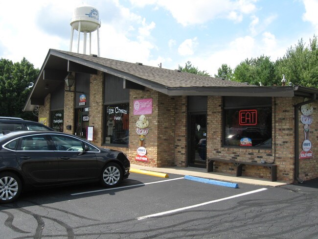
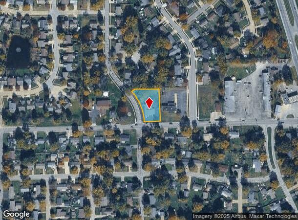
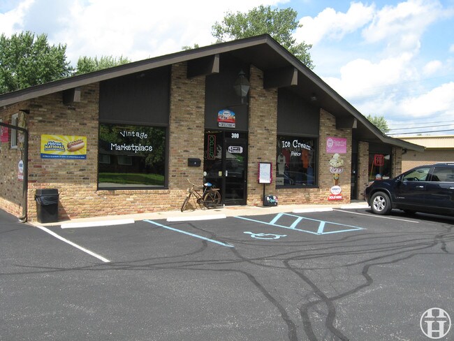
Property Record
300 Tracy Rd, Whiteland, IN 46184
NEARBY LISTINGS FOR SALE OR LEASE
-
-
View all Whiteland listings for sale on LoopNet.com
Property Detail
300 Tracy Rd
41-05-16-034-044.001-027
SW. S16 T13 R4. 300 TRACY RD
Storebuilding
Johnson
X
Indiana
18081C0128D
0.57 AC
2024
Far South Johnson Cty
2025
Indianapolis
610102
Indianapolis-Carmel-Anderson, IN
2,940 SF
DEMOGRAPHICS near 300 Tracy Rd
1 Mile
3 Mile
5 Mile
2024 Total Population
7,170
41,143
99,764
2029 Population
7,623
43,927
106,480
Pop Growth 2024-2029
+ 6.32%
+ 6.77%
+ 6.73%
Average Age
38
37
38
2024 Total Households
2,573
14,892
37,515
HH Growth 2024-2029
+ 6.45%
+ 6.94%
+ 6.91%
Median Household Inc
$76,152
$80,210
$78,465
Avg Household Size
2.80
2.70
2.60
2024 Avg HH Vehicles
2.00
2.00
2.00
Median Home Value
$168,079
$190,159
$220,506
Median Year Built
1982
1997
1994
Nearby Places
Map Layers
Map Styles
 Street
 Aerial
- Restaurants
- Banks
- Shops
- Fitness
- Groceries
PUBLIC TRANSPORTATION
AIRPORT
Indianapolis International
DRIVE
WALK
Distance
Indianapolis International
41 min
24.5 mi
Freight Ports
Port of Toledo
DRIVE
WALK
Distance
Port of Toledo
290 min
239.8 mi
SALE & LEASE HISTORY
LISTING DATE
SALE/LEASE

Oct 22, 2019
For Sale
Feb 21, 2019
For Lease
Aug 15, 2018
For Sale
Nearby Properties
Address
Land Use
TOTAL SIZE
Lot Size
Zoning
Address
Land Use
TOTAL SIZE
Lot Size
Zoning
1,057,350 SF
60.62 AC
Address
Land Use
TOTAL SIZE
Lot Size
Zoning
984,410 SF
73.31 AC
Address
Land Use
TOTAL SIZE
Lot Size
Zoning
845,880 SF
45.31 AC
Address
Land Use
TOTAL SIZE
Lot Size
Zoning
997,650 SF
67.25 AC
Address
Land Use
TOTAL SIZE
Lot Size
Zoning
816,376 SF
65.10 AC
Address
Land Use
TOTAL SIZE
Lot Size
Zoning
826,800 SF
62.89 AC
Address
Land Use
TOTAL SIZE
Lot Size
Zoning
34.59 AC
Address
Land Use
TOTAL SIZE
Lot Size
Zoning
530,400 SF
29.63 AC
Address
Land Use
TOTAL SIZE
Lot Size
Zoning
39,866 SF
19.99 AC
Address
Land Use
TOTAL SIZE
Lot Size
Zoning
32.60 AC
Address
Land Use
TOTAL SIZE
Lot Size
Zoning
4,027 SF
24.71 AC
Address
Land Use
TOTAL SIZE
Lot Size
Zoning
56,100 SF
50.05 AC
Address
Land Use
TOTAL SIZE
Lot Size
Zoning
342,627 SF
69.52 AC
Address
Land Use
TOTAL SIZE
Lot Size
Zoning
69,444 SF
2.99 AC
Address
Land Use
TOTAL SIZE
Lot Size
Zoning
6,272 SF
21.91 AC
Address
Land Use
TOTAL SIZE
Lot Size
Zoning
2,008 SF
9.86 AC
Address
Land Use
TOTAL SIZE
Lot Size
Zoning
1,951 SF
26.87 AC
Address
Land Use
TOTAL SIZE
Lot Size
Zoning
3,406 SF
20.34 AC
Address
Land Use
TOTAL SIZE
Lot Size
Zoning
178,880 SF
9.03 AC
Address
Land Use
TOTAL SIZE
Lot Size
Zoning
58,711 SF
13.71 AC
Address
Land Use
TOTAL SIZE
Lot Size
Zoning
168,480 SF
8.42 AC
Address
Land Use
TOTAL SIZE
Lot Size
Zoning
130,440 SF
10.05 AC
Address
Land Use
TOTAL SIZE
Lot Size
Zoning
114,852 SF
8.50 AC
Address
Land Use
TOTAL SIZE
Lot Size
Zoning
3,877 SF
12.91 AC
Address
Land Use
TOTAL SIZE
Lot Size
Zoning
7.19 AC
Address
Land Use
TOTAL SIZE
Lot Size
Zoning
15,504 SF
72.69 AC
Address
Land Use
TOTAL SIZE
Lot Size
Zoning
65,600 SF
8.22 AC
Address
Land Use
TOTAL SIZE
Lot Size
Zoning
88,000 SF
26.01 AC
Address
Land Use
TOTAL SIZE
Lot Size
Zoning
88,925 SF
11.24 AC
Address
Land Use
TOTAL SIZE
Lot Size
Zoning
5,832 SF
10.41 AC
The World's #1 Commercial Real Estate Marketplace
Connect with us
© 2025 CoStar Group
The information above has been obtained from sources believed reliable. While we do not doubt its accuracy we have not verified it and make no guarantee, warranty or representation about it. It is your responsibility to independently confirm its accuracy and completeness. Any projections, opinions, assumptions, or estimates used are for example only and do not represent the current or future performance of the property. The value of this transaction to you depends on tax and other factors which should be evaluated by your tax, financial, and legal advisors. You and your advisors should conduct a careful, independent investigation of the property to determine to your satisfaction the suitability of the property for your needs.