Property Record
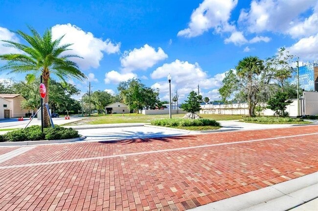
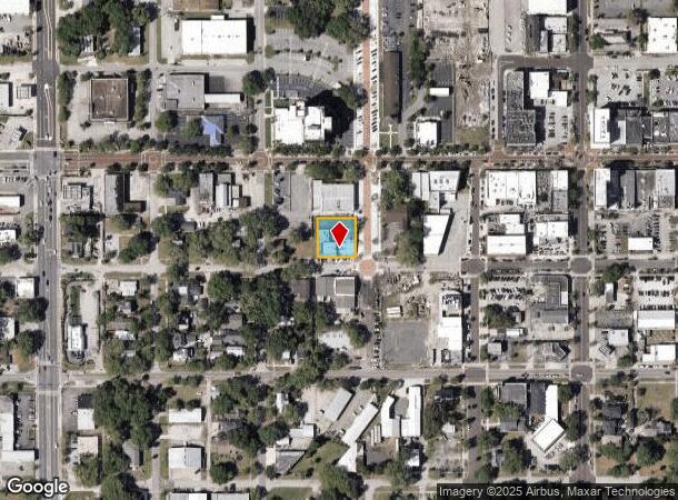
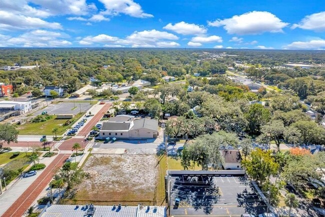
300 W 2Nd St, Sanford, FL 32771
This Property Is For Sale
NEARBY LISTINGS FOR SALE OR LEASE
Property Detail
300 W 2Nd St
Orlando-Kissimmee-Sanford, FL
Sanford Town Of
25-19-30-5AG-0306-0060
LOTS 6 7 & 8 BLK 3 TR 6 TOWN OF SANFORD PB 1 PGS 56-64
Commercialacreage
Seminole
X
Florida
12069C0450E
6
2025
0.33 AC
2025
Sanford
020101
Orlando
5,031 SF
DEMOGRAPHICS near 300 W 2Nd St
1 Mile
3 Mile
5 Mile
2024 Total Population
6,600
44,529
107,754
2029 Population
6,989
46,949
113,785
Pop Growth 2024-2029
+ 5.89%
+ 5.43%
+ 5.60%
Average Age
41
38
39
2024 Total Households
2,741
16,715
40,889
HH Growth 2024-2029
+ 5.65%
+ 5.52%
+ 5.74%
Median Household Inc
$46,296
$52,120
$60,429
Avg Household Size
2.20
2.50
2.50
2024 Avg HH Vehicles
2.00
2.00
2.00
Median Home Value
$264,426
$238,150
$257,897
Median Year Built
1969
1985
1993
Nearby Places
Map Layers
Map Styles
 Street
 Aerial
- Restaurants
- Banks
- Shops
- Fitness
- Groceries
PUBLIC TRANSPORTATION
COMMUTER RAIL
DRIVE
WALK
Distance
4 min
1.6 mi
DRIVE
WALK
Distance
5 min
1.8 mi
AIRPORT
Orlando Sanford International
DRIVE
WALK
Distance
Orlando Sanford International
11 min
4.9 mi
Orlando International
DRIVE
WALK
Distance
Orlando International
44 min
34.4 mi
Daytona Beach International
DRIVE
WALK
Distance
Daytona Beach International
45 min
35.6 mi
Nearby Properties
Address
Land Use
TOTAL SIZE
Lot Size
Zoning
Address
Land Use
TOTAL SIZE
Lot Size
Zoning
36.94 AC
A1
Address
Land Use
TOTAL SIZE
Lot Size
Zoning
312 SF
10.47 AC
Address
Land Use
TOTAL SIZE
Lot Size
Zoning
413,982 SF
0.05 AC
RI1
Address
Land Use
TOTAL SIZE
Lot Size
Zoning
250 SF
14.29 AC
RMOI
Address
Land Use
TOTAL SIZE
Lot Size
Zoning
615.80 AC
RI1
Address
Land Use
TOTAL SIZE
Lot Size
Zoning
504,437 SF
20.84 AC
A1
Address
Land Use
TOTAL SIZE
Lot Size
Zoning
1,001 SF
12.02 AC
MR3
Address
Land Use
TOTAL SIZE
Lot Size
Zoning
938 SF
9.46 AC
SC3
Address
Land Use
TOTAL SIZE
Lot Size
Zoning
245,806 SF
24.93 AC
RMOI
Address
Land Use
TOTAL SIZE
Lot Size
Zoning
864 SF
9.99 AC
A1
Address
Land Use
TOTAL SIZE
Lot Size
Zoning
209,424 SF
12.93 AC
MR2
Address
Land Use
TOTAL SIZE
Lot Size
Zoning
209,950 SF
16.28 AC
RMOI
Address
Land Use
TOTAL SIZE
Lot Size
Zoning
376.01 AC
C2
Address
Land Use
TOTAL SIZE
Lot Size
Zoning
492,285 SF
19.58 AC
PD
Address
Land Use
TOTAL SIZE
Lot Size
Zoning
216,071 SF
77 AC
A1
Address
Land Use
TOTAL SIZE
Lot Size
Zoning
110,310 SF
19.33 AC
PD
Address
Land Use
TOTAL SIZE
Lot Size
Zoning
9.54 AC
M1
Address
Land Use
TOTAL SIZE
Lot Size
Zoning
428,525 SF
20.81 AC
A1
Address
Land Use
TOTAL SIZE
Lot Size
Zoning
19.57 AC
PD
Address
Land Use
TOTAL SIZE
Lot Size
Zoning
115,946 SF
47.65 AC
PD
Address
Land Use
TOTAL SIZE
Lot Size
Zoning
184,276 SF
20.70 AC
SR1
Address
Land Use
TOTAL SIZE
Lot Size
Zoning
112,312 SF
9.40 AC
Address
Land Use
TOTAL SIZE
Lot Size
Zoning
115,431 SF
61 AC
PLI
Address
Land Use
TOTAL SIZE
Lot Size
Zoning
2.21 AC
GC2
Address
Land Use
TOTAL SIZE
Lot Size
Zoning
148,697 SF
11.44 AC
RI1
Address
Land Use
TOTAL SIZE
Lot Size
Zoning
480 SF
16.38 AC
MR3
Address
Land Use
TOTAL SIZE
Lot Size
Zoning
204,618 SF
11.92 AC
PD
Address
Land Use
TOTAL SIZE
Lot Size
Zoning
5,150 SF
17.30 AC
SC3
Address
Land Use
TOTAL SIZE
Lot Size
Zoning
146,000 SF
8.57 AC
A1
Address
Land Use
TOTAL SIZE
Lot Size
Zoning
208,260 SF
1.79 AC
RMOI
The World's #1 Commercial Real Estate Marketplace
Connect with us
© 2026 CoStar Group
The information above has been obtained from sources believed reliable. While we do not doubt its accuracy we have not verified it and make no guarantee, warranty or representation about it. It is your responsibility to independently confirm its accuracy and completeness. Any projections, opinions, assumptions, or estimates used are for example only and do not represent the current or future performance of the property. The value of this transaction to you depends on tax and other factors which should be evaluated by your tax, financial, and legal advisors. You and your advisors should conduct a careful, independent investigation of the property to determine to your satisfaction the suitability of the property for your needs.