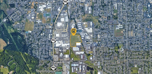
Property Record
3000 Calapooia St Sw, Albany, OR 97322

Property Detail
3000 Calapooia St Sw
0124228
11S03W18B0
Stateproperty
Linn
HI
Oregon
B and X Area of moderate flood hazard, usually the area between the limits of the 100-year and 500-year floods.
28.17 AC
2025
Linn County
2025
Portland
020802
Albany, OR
NEARBY LISTINGS FOR SALE OR LEASE
DEMOGRAPHICS near 3000 Calapooia St Sw
1 mile
3 mile
5 mile
2025 Total Population
11,412
48,250
62,725
2030 Population
11,528
48,969
63,752
Pop Growth 2025-2030
+ 1.02%
+ 1.49%
+ 1.64%
Average Age
39
40
41
2025 Total Households
4,317
19,166
24,483
HH Growth 2025-2030
+ 1.07%
+ 1.56%
+ 1.68%
Median Household Inc
$70,493
$69,383
$74,172
Avg Household Size
2.50
2.40
2.50
2025 Avg HH Vehicles
2.00
2.00
2.00
Median Home Value
$356,267
$381,077
$407,191
Median Year Built
1970
1977
1979
Nearby Places
Map Layers
Map Styles
 Street
 Aerial
Layers
 Traffic
 Biking
Places
Listings with unknown addresses are not visible on the map
- Restaurants
- Banks
- Shops
- Fitness
- Groceries
PUBLIC TRANSPORTATION
COMMUTER RAIL
Albany Amtrak Station (Amtrak Cascades - Amtrak, Coast Starlight - Amtrak)
Drive
Walk
Distance
Albany Amtrak Station (Amtrak Cascades - Amtrak, Coast Starlight - Amtrak)
3 min
1.2 mi
Freight Ports
Port of Portland
Drive
Walk
Distance
Port of Portland
95 min
74.0 mi
SALE & LEASE HISTORY
LISTING DATE
SALE/LEASE

Dec 18, 2025
For Sale
Nearby Properties
Address
Land Use
TOTAL SIZE
Lot Size
Zoning
Address
Land Use
TOTAL SIZE
Lot Size
Zoning
1.94 AC
Address
Land Use
TOTAL SIZE
Lot Size
Zoning
8,842 SF
73.88 AC
RS-6.5
Address
Land Use
TOTAL SIZE
Lot Size
Zoning
104.75 AC
LI
Address
Land Use
TOTAL SIZE
Lot Size
Zoning
9.32 AC
LI
Address
Land Use
TOTAL SIZE
Lot Size
Zoning
41.22 AC
LI
Address
Land Use
TOTAL SIZE
Lot Size
Zoning
84,415 SF
70.68 AC
RS-6.5
Address
Land Use
TOTAL SIZE
Lot Size
Zoning
18.57 AC
RC
Address
Land Use
TOTAL SIZE
Lot Size
Zoning
33,540 SF
2.19 AC
ES
Address
Land Use
TOTAL SIZE
Lot Size
Zoning
23,340 SF
10.60 AC
CC
Address
Land Use
TOTAL SIZE
Lot Size
Zoning
58,202 SF
5.14 AC
RM
Address
Land Use
TOTAL SIZE
Lot Size
Zoning
20.04 AC
LI
Address
Land Use
TOTAL SIZE
Lot Size
Zoning
3.75 AC
OP
Address
Land Use
TOTAL SIZE
Lot Size
Zoning
13.01 AC
RC
Address
Land Use
TOTAL SIZE
Lot Size
Zoning
67,716 SF
6.90 AC
LI
Address
Land Use
TOTAL SIZE
Lot Size
Zoning
43.06 AC
RS-6.5
Address
Land Use
TOTAL SIZE
Lot Size
Zoning
84,000 SF
8.99 AC
RC
Address
Land Use
TOTAL SIZE
Lot Size
Zoning
50,648 SF
8.35 AC
RS-6.5
Address
Land Use
TOTAL SIZE
Lot Size
Zoning
45,543 SF
24.28 AC
LI
Address
Land Use
TOTAL SIZE
Lot Size
Zoning
11.01 AC
CC
Address
Land Use
TOTAL SIZE
Lot Size
Zoning
666 SF
6.32 AC
RM
Address
Land Use
TOTAL SIZE
Lot Size
Zoning
11,296 SF
1.36 AC
HM
Address
Land Use
TOTAL SIZE
Lot Size
Zoning
3,591 SF
2.15 AC
RM
Address
Land Use
TOTAL SIZE
Lot Size
Zoning
151,290 SF
5.45 AC
RM
Address
Land Use
TOTAL SIZE
Lot Size
Zoning
5.27 AC
MUC
Address
Land Use
TOTAL SIZE
Lot Size
Zoning
52,626 SF
5.40 AC
RS-6.5
Address
Land Use
TOTAL SIZE
Lot Size
Zoning
Address
Land Use
TOTAL SIZE
Lot Size
Zoning
1,795 SF
8.98 AC
RC
Address
Land Use
TOTAL SIZE
Lot Size
Zoning
31,192 SF
8.20 AC
RMA
Address
Land Use
TOTAL SIZE
Lot Size
Zoning
94,070 SF
6.52 AC
RC
The World's #1 Commercial Real Estate Marketplace
Connect with us
© 2026 CoStar Group
The information above has been obtained from sources believed reliable. While we do not doubt its accuracy we have not verified it and make no guarantee, warranty or representation about it. It is your responsibility to independently confirm its accuracy and completeness. Any projections, opinions, assumptions, or estimates used are for example only and do not represent the current or future performance of the property. The value of this transaction to you depends on tax and other factors which should be evaluated by your tax, financial, and legal advisors. You and your advisors should conduct a careful, independent investigation of the property to determine to your satisfaction the suitability of the property for your needs.