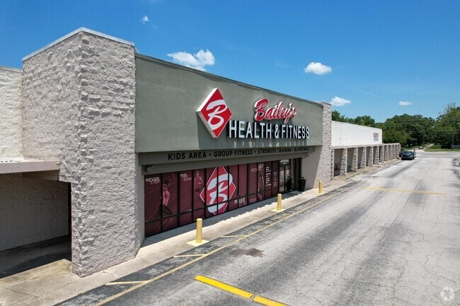
Property Record
3000 Dunn Ave, Jacksonville, FL 32218

Current Lease Availabilities
Property Detail
3000 Dunn Ave
020160-1010
9-1S-26E 8.5 PT NE1/4 OF NE1/4 RECD O/R 18289-80
Regionalshoppingcenterormallwithanchorstore
Duval
CCG-1
Florida
B and X Area of moderate flood hazard, usually the area between the limits of the 100-year and 500-year floods.
8.57 AC
2025
Northwest Jacksonville
2026
Jacksonville (Florida)
010503
Jacksonville, FL
82,640 SF
NEARBY LISTINGS FOR SALE OR LEASE
DEMOGRAPHICS near 3000 Dunn Ave
1 mile
3 mile
5 mile
2025 Total Population
8,252
51,766
104,872
2030 Population
8,774
55,025
112,078
Pop Growth 2025-2030
+ 6.33%
+ 6.30%
+ 6.87%
Average Age
38
39
39
2025 Total Households
3,083
19,488
40,355
HH Growth 2025-2030
+ 6.52%
+ 6.51%
+ 7.17%
Median Household Inc
$58,717
$58,564
$53,431
Avg Household Size
2.60
2.60
2.50
2025 Avg HH Vehicles
2.00
2.00
2.00
Median Home Value
$274,812
$241,676
$217,804
Median Year Built
1999
1985
1978
Nearby Places
Map Layers
Map Styles
 Street
 Aerial
Transit
 Traffic
 Biking
Places
Listings with unknown addresses are not visible on the map
- Restaurants
- Banks
- Shops
- Fitness
- Groceries
PUBLIC TRANSPORTATION
COMMUTER RAIL
Jacksonville (Silver Meteor - Amtrak, Silver Star - Amtrak)
Drive
Walk
Distance
Jacksonville (Silver Meteor - Amtrak, Silver Star - Amtrak)
15 min
8.4 mi
AIRPORT
Jacksonville International
Drive
Walk
Distance
Jacksonville International
15 min
6.3 mi
Freight Ports
Jacksonville Port
Drive
Walk
Distance
Jacksonville Port
19 min
9.5 mi
Nearby Properties
Address
Land Use
TOTAL SIZE
Lot Size
Zoning
Address
Land Use
TOTAL SIZE
Lot Size
Zoning
877,030 SF
135.59 AC
IBP
Address
Land Use
TOTAL SIZE
Lot Size
Zoning
1,170,252 SF
201.15 AC
IH
Address
Land Use
TOTAL SIZE
Lot Size
Zoning
658,743 SF
36.71 AC
PUD
Address
Land Use
TOTAL SIZE
Lot Size
Zoning
226,596 SF
13.23 AC
PUD
Address
Land Use
TOTAL SIZE
Lot Size
Zoning
556,924 SF
29.11 AC
PUD
Address
Land Use
TOTAL SIZE
Lot Size
Zoning
395,655 SF
21.86 AC
PUD
Address
Land Use
TOTAL SIZE
Lot Size
Zoning
321,938 SF
29.46 AC
CCG-1
Address
Land Use
TOTAL SIZE
Lot Size
Zoning
284,023 SF
25.30 AC
RMD-C
Address
Land Use
TOTAL SIZE
Lot Size
Zoning
287,410 SF
43.31 AC
RMD-C
Address
Land Use
TOTAL SIZE
Lot Size
Zoning
214,742 SF
20.13 AC
PUD
Address
Land Use
TOTAL SIZE
Lot Size
Zoning
313,741 SF
37.05 AC
RMD-C
Address
Land Use
TOTAL SIZE
Lot Size
Zoning
210,520 SF
34.87 AC
PUD
Address
Land Use
TOTAL SIZE
Lot Size
Zoning
6,300 SF
744.81 AC
PUD
Address
Land Use
TOTAL SIZE
Lot Size
Zoning
283,689 SF
21.28 AC
RLD-60
Address
Land Use
TOTAL SIZE
Lot Size
Zoning
119,362 SF
20.32 AC
RMD-C
Address
Land Use
TOTAL SIZE
Lot Size
Zoning
258,700 SF
25.43 AC
RMD-D
Address
Land Use
TOTAL SIZE
Lot Size
Zoning
254,693 SF
40.76 AC
RMD-D
Address
Land Use
TOTAL SIZE
Lot Size
Zoning
225,829 SF
140.47 AC
PBF-1
Address
Land Use
TOTAL SIZE
Lot Size
Zoning
39,251 SF
55.24 AC
PUD
Address
Land Use
TOTAL SIZE
Lot Size
Zoning
110,055 SF
6.87 AC
IBP
Address
Land Use
TOTAL SIZE
Lot Size
Zoning
57,495 SF
1.95 AC
CCG-1
Address
Land Use
TOTAL SIZE
Lot Size
Zoning
126,930 SF
20.47 AC
PUD
Address
Land Use
TOTAL SIZE
Lot Size
Zoning
95,080 SF
9.35 AC
CRO
Address
Land Use
TOTAL SIZE
Lot Size
Zoning
240,692 SF
30.32 AC
CCG-1
Address
Land Use
TOTAL SIZE
Lot Size
Zoning
85,326 SF
26.76 AC
PUD
Address
Land Use
TOTAL SIZE
Lot Size
Zoning
130,885 SF
8.37 AC
RMD-D
Address
Land Use
TOTAL SIZE
Lot Size
Zoning
48,772 SF
2.45 AC
RMD-C
Address
Land Use
TOTAL SIZE
Lot Size
Zoning
116,632 SF
10.07 AC
RMD-C
Address
Land Use
TOTAL SIZE
Lot Size
Zoning
238,052 SF
30.81 AC
RHD-A
Address
Land Use
TOTAL SIZE
Lot Size
Zoning
139,063 SF
13.95 AC
RMD-C
The World's #1 Commercial Real Estate Marketplace
Connect with us
© 2026 CoStar Group
The information above has been obtained from sources believed reliable. While we do not doubt its accuracy we have not verified it and make no guarantee, warranty or representation about it. It is your responsibility to independently confirm its accuracy and completeness. Any projections, opinions, assumptions, or estimates used are for example only and do not represent the current or future performance of the property. The value of this transaction to you depends on tax and other factors which should be evaluated by your tax, financial, and legal advisors. You and your advisors should conduct a careful, independent investigation of the property to determine to your satisfaction the suitability of the property for your needs.