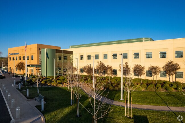
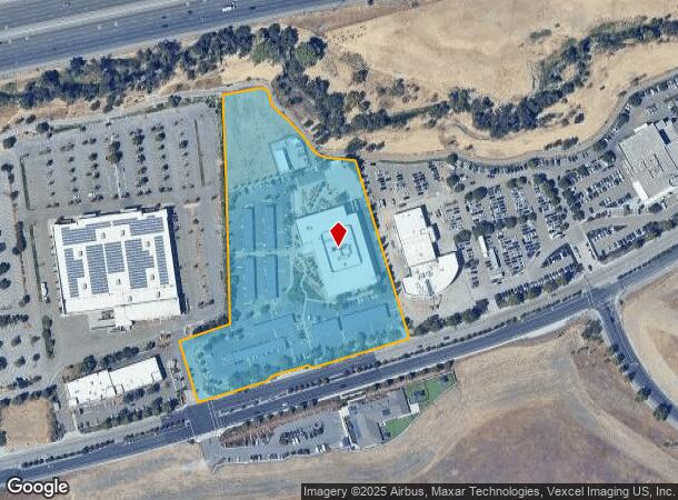
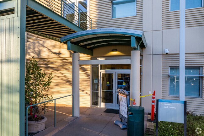
Property Record
3000 Las Positas Rd, Livermore, CA 94551
NEARBY LISTINGS FOR SALE OR LEASE
Property Detail
3000 Las Positas Rd
099-0015-057-00
LOT: 00002 BLK: 0027 AR: 0099 PAGE: 0015
Medicalbuilding
Alameda
X
California
06001C0334G
7.13 AC
2024
Livermore
2025
East Bay/Oakland
451401
Oakland-Hayward-Berkeley, CA
70,472 SF
DEMOGRAPHICS near 3000 Las Positas Rd
1 Mile
3 Mile
5 Mile
2024 Total Population
6,618
75,452
92,973
2029 Population
6,408
72,934
89,777
Pop Growth 2024-2029
(3.17%)
(3.34%)
(3.44%)
Average Age
41
41
41
2024 Total Households
2,449
27,139
32,535
HH Growth 2024-2029
(3.39%)
(3.52%)
(3.63%)
Median Household Inc
$97,315
$136,571
$150,963
Avg Household Size
2.60
2.70
2.80
2024 Avg HH Vehicles
2.00
2.00
2.00
Median Home Value
$886,239
$868,377
$946,960
Median Year Built
1986
1978
1981
Nearby Places
Map Layers
Map Styles
 Street
 Aerial
- Restaurants
- Banks
- Shops
- Fitness
- Groceries
PUBLIC TRANSPORTATION
COMMUTER RAIL
Livermore (Altamont Corridor Express - Altamont Commuter Express (ACE))
DRIVE
WALK
Distance
Livermore (Altamont Corridor Express - Altamont Commuter Express (ACE))
4 min
1.7 mi
Livermore Station (ACE Train - Altamont Corridor Express)
DRIVE
WALK
Distance
Livermore Station (ACE Train - Altamont Corridor Express)
4 min
1.9 mi
AIRPORT
Metro Oakland International
DRIVE
WALK
Distance
Metro Oakland International
35 min
27.9 mi
Norman Y Mineta San Jose International
DRIVE
WALK
Distance
Norman Y Mineta San Jose International
46 min
33.7 mi
Freight Ports
Port of Redwood City
DRIVE
WALK
Distance
Port of Redwood City
57 min
42.9 mi
Nearby Properties
Address
Land Use
TOTAL SIZE
Lot Size
Zoning
Address
Land Use
TOTAL SIZE
Lot Size
Zoning
635,533 SF
32.55 AC
Address
Land Use
TOTAL SIZE
Lot Size
Zoning
212,048 SF
4.04 AC
Address
Land Use
TOTAL SIZE
Lot Size
Zoning
646,841 SF
38.83 AC
Address
Land Use
TOTAL SIZE
Lot Size
Zoning
372,220 SF
19.11 AC
Address
Land Use
TOTAL SIZE
Lot Size
Zoning
372,574 SF
19.75 AC
Address
Land Use
TOTAL SIZE
Lot Size
Zoning
294,940 SF
16.54 AC
Address
Land Use
TOTAL SIZE
Lot Size
Zoning
322,482 SF
15.52 AC
Address
Land Use
TOTAL SIZE
Lot Size
Zoning
183,774 SF
15.21 AC
Address
Land Use
TOTAL SIZE
Lot Size
Zoning
89,049 SF
8.17 AC
Address
Land Use
TOTAL SIZE
Lot Size
Zoning
178,938 SF
7 AC
Address
Land Use
TOTAL SIZE
Lot Size
Zoning
144,058 SF
11.52 AC
Address
Land Use
TOTAL SIZE
Lot Size
Zoning
116,167 SF
11.53 AC
Address
Land Use
TOTAL SIZE
Lot Size
Zoning
94,332 SF
8.89 AC
Address
Land Use
TOTAL SIZE
Lot Size
Zoning
40.97 AC
Address
Land Use
TOTAL SIZE
Lot Size
Zoning
128,622 SF
6.68 AC
Address
Land Use
TOTAL SIZE
Lot Size
Zoning
92,905 SF
5.20 AC
Address
Land Use
TOTAL SIZE
Lot Size
Zoning
150,063 SF
4.96 AC
Address
Land Use
TOTAL SIZE
Lot Size
Zoning
88,789 SF
5.63 AC
Address
Land Use
TOTAL SIZE
Lot Size
Zoning
178,145 SF
15.32 AC
Address
Land Use
TOTAL SIZE
Lot Size
Zoning
99,280 SF
6.11 AC
Address
Land Use
TOTAL SIZE
Lot Size
Zoning
105,596 SF
7.89 AC
Address
Land Use
TOTAL SIZE
Lot Size
Zoning
75,236 SF
6.42 AC
Address
Land Use
TOTAL SIZE
Lot Size
Zoning
121,735 SF
7.03 AC
Address
Land Use
TOTAL SIZE
Lot Size
Zoning
135,039 SF
13.45 AC
Address
Land Use
TOTAL SIZE
Lot Size
Zoning
244,337 SF
8.27 AC
Address
Land Use
TOTAL SIZE
Lot Size
Zoning
111,172 SF
6.06 AC
Address
Land Use
TOTAL SIZE
Lot Size
Zoning
157,610 SF
12.84 AC
Address
Land Use
TOTAL SIZE
Lot Size
Zoning
88,633 SF
9.54 AC
Address
Land Use
TOTAL SIZE
Lot Size
Zoning
51,178 SF
2.09 AC
CO
The World's #1 Commercial Real Estate Marketplace
Connect with us
© 2026 CoStar Group
The information above has been obtained from sources believed reliable. While we do not doubt its accuracy we have not verified it and make no guarantee, warranty or representation about it. It is your responsibility to independently confirm its accuracy and completeness. Any projections, opinions, assumptions, or estimates used are for example only and do not represent the current or future performance of the property. The value of this transaction to you depends on tax and other factors which should be evaluated by your tax, financial, and legal advisors. You and your advisors should conduct a careful, independent investigation of the property to determine to your satisfaction the suitability of the property for your needs.