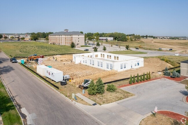
Property Record
3000 N Hill Rd, Lincoln, NE 68504

NEARBY LISTINGS FOR SALE OR LEASE
Property Detail
3000 N Hill Rd
Lincoln, NE
King Ridge 6Th Addition
17-06-109-001-000
KING RIDGE 6TH ADDITION, LOT 1
Commercialnec
Lancaster
X
Nebraska
31109C0310F
1
2024
2.03 AC
2025
Northeast
002900
Lincoln
6,324 SF
DEMOGRAPHICS near 3000 N Hill Rd
1 Mile
3 Mile
5 Mile
2024 Total Population
10,026
66,058
156,388
2029 Population
10,428
68,497
162,434
Pop Growth 2024-2029
+ 4.01%
+ 3.69%
+ 3.87%
Average Age
38
36
36
2024 Total Households
4,387
26,844
64,914
HH Growth 2024-2029
+ 4.10%
+ 3.82%
+ 4.14%
Median Household Inc
$60,700
$50,583
$51,587
Avg Household Size
2.30
2.30
2.20
2024 Avg HH Vehicles
2.00
2.00
2.00
Median Home Value
$230,175
$177,685
$182,664
Median Year Built
2000
1984
1975
Nearby Places
Map Layers
Map Styles
 Street
 Aerial
- Restaurants
- Banks
- Shops
- Fitness
- Groceries
PUBLIC TRANSPORTATION
AIRPORT
Lincoln
DRIVE
WALK
Distance
Lincoln
12 min
7.4 mi
Nearby Properties
Address
Land Use
TOTAL SIZE
Lot Size
Zoning
Address
Land Use
TOTAL SIZE
Lot Size
Zoning
382,244 SF
44.25 AC
R6
Address
Land Use
TOTAL SIZE
Lot Size
Zoning
30,018 SF
100.37 AC
R3
Address
Land Use
TOTAL SIZE
Lot Size
Zoning
293,488 SF
570.28 AC
Address
Land Use
TOTAL SIZE
Lot Size
Zoning
35,233 SF
28.52 AC
NULL
Address
Land Use
TOTAL SIZE
Lot Size
Zoning
48,088 SF
28.06 AC
R5
Address
Land Use
TOTAL SIZE
Lot Size
Zoning
27,171 SF
14.68 AC
NULL
Address
Land Use
TOTAL SIZE
Lot Size
Zoning
65,064 SF
1.39 AC
R6
Address
Land Use
TOTAL SIZE
Lot Size
Zoning
32,110 SF
9.64 AC
B2
Address
Land Use
TOTAL SIZE
Lot Size
Zoning
22,552 SF
16.68 AC
NULL
Address
Land Use
TOTAL SIZE
Lot Size
Zoning
41,456 SF
4.95 AC
B2
Address
Land Use
TOTAL SIZE
Lot Size
Zoning
8,824 SF
12.33 AC
R5
Address
Land Use
TOTAL SIZE
Lot Size
Zoning
65,967 SF
11.65 AC
NULL
Address
Land Use
TOTAL SIZE
Lot Size
Zoning
63,914 SF
12.22 AC
R5
Address
Land Use
TOTAL SIZE
Lot Size
Zoning
141,120 SF
21 AC
O3
Address
Land Use
TOTAL SIZE
Lot Size
Zoning
63,003 SF
1.22 AC
O3
Address
Land Use
TOTAL SIZE
Lot Size
Zoning
46,906 SF
2.88 AC
Address
Land Use
TOTAL SIZE
Lot Size
Zoning
38,769 SF
11.81 AC
NULL
Address
Land Use
TOTAL SIZE
Lot Size
Zoning
92,054 SF
6.22 AC
R5
Address
Land Use
TOTAL SIZE
Lot Size
Zoning
405,207 SF
29.97 AC
I2
Address
Land Use
TOTAL SIZE
Lot Size
Zoning
69,760 SF
1.81 AC
Address
Land Use
TOTAL SIZE
Lot Size
Zoning
41,172 SF
5.16 AC
P
Address
Land Use
TOTAL SIZE
Lot Size
Zoning
283,600 SF
46.07 AC
I2
Address
Land Use
TOTAL SIZE
Lot Size
Zoning
360,422 SF
23.53 AC
B5
Address
Land Use
TOTAL SIZE
Lot Size
Zoning
152,292 SF
20.28 AC
O3
Address
Land Use
TOTAL SIZE
Lot Size
Zoning
69,652 SF
3.10 AC
B3
Address
Land Use
TOTAL SIZE
Lot Size
Zoning
154.12 AC
P
Address
Land Use
TOTAL SIZE
Lot Size
Zoning
759,282 SF
40.67 AC
I1
Address
Land Use
TOTAL SIZE
Lot Size
Zoning
53,234 SF
5.01 AC
B2
Address
Land Use
TOTAL SIZE
Lot Size
Zoning
141.81 AC
P
Address
Land Use
TOTAL SIZE
Lot Size
Zoning
73,010 SF
9.67 AC
R3
The World's #1 Commercial Real Estate Marketplace
Connect with us
© 2026 CoStar Group
The information above has been obtained from sources believed reliable. While we do not doubt its accuracy we have not verified it and make no guarantee, warranty or representation about it. It is your responsibility to independently confirm its accuracy and completeness. Any projections, opinions, assumptions, or estimates used are for example only and do not represent the current or future performance of the property. The value of this transaction to you depends on tax and other factors which should be evaluated by your tax, financial, and legal advisors. You and your advisors should conduct a careful, independent investigation of the property to determine to your satisfaction the suitability of the property for your needs.