Property Record
3000 S 99Th Ave, Tolleson, AZ 85353
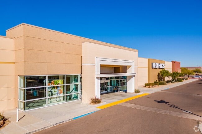

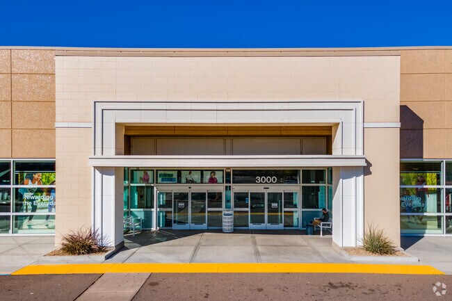

Property Detail
3000 S 99Th Ave
101-25-852
VILLAGE AT COUNTRY CORNERS MCR 1013-08
Departmentstore
Maricopa
C-C
Arizona
C and X Area of minimal flood hazard, usually depicted on FIRMs as above the 500-year flood level.
1
2025
8.66 AC
2025
Tolleson
082212
Phoenix
87,491 SF
Phoenix-Mesa-Chandler, AZ
NEARBY LISTINGS FOR SALE OR LEASE
DEMOGRAPHICS near 3000 S 99Th Ave
1 mile
3 mile
5 mile
2025 Total Population
18,179
81,675
204,395
2030 Population
19,051
85,635
212,996
Pop Growth 2025-2030
+ 4.80%
+ 4.85%
+ 4.21%
Average Age
31
32
33
2025 Total Households
4,626
21,565
57,776
HH Growth 2025-2030
+ 4.91%
+ 4.92%
+ 4.21%
Median Household Inc
$103,105
$95,942
$84,692
Avg Household Size
3.80
3.70
3.40
2025 Avg HH Vehicles
3.00
2.00
2.00
Median Home Value
$425,530
$408,738
$392,095
Median Year Built
2007
2006
2003
Nearby Places
Map Layers
Map Styles
 Street
 Aerial
Layers
 Traffic
 Biking
Places
Listings with unknown addresses are not visible on the map
- Restaurants
- Banks
- Shops
- Fitness
- Groceries
PUBLIC TRANSPORTATION
AIRPORT
Phoenix Sky Harbor International
Drive
Walk
Distance
Phoenix Sky Harbor International
30 min
20.6 mi
Freight Ports
Port of San Diego
Drive
Walk
Distance
Port of San Diego
386 min
346.2 mi
SALE & LEASE HISTORY
LISTING DATE
SALE/LEASE

Jan 31, 2018
For Lease
Nearby Properties
Address
Land Use
TOTAL SIZE
Lot Size
Zoning
Address
Land Use
TOTAL SIZE
Lot Size
Zoning
4,100 SF
467.51 AC
R-43
Address
Land Use
TOTAL SIZE
Lot Size
Zoning
206.08 AC
PAD
Address
Land Use
TOTAL SIZE
Lot Size
Zoning
Address
Land Use
TOTAL SIZE
Lot Size
Zoning
Address
Land Use
TOTAL SIZE
Lot Size
Zoning
889,089 SF
83.11 AC
I-1
Address
Land Use
TOTAL SIZE
Lot Size
Zoning
134.65 AC
S1
Address
Land Use
TOTAL SIZE
Lot Size
Zoning
899,427 SF
73.79 AC
R1-6
Address
Land Use
TOTAL SIZE
Lot Size
Zoning
177,052 SF
2.69 AC
THEBLVDD
Address
Land Use
TOTAL SIZE
Lot Size
Zoning
728,550 SF
41.98 AC
Address
Land Use
TOTAL SIZE
Lot Size
Zoning
301,329 SF
50.60 AC
AG
Address
Land Use
TOTAL SIZE
Lot Size
Zoning
763,410 SF
45.50 AC
Address
Land Use
TOTAL SIZE
Lot Size
Zoning
697,149 SF
37.60 AC
CP/GCP
Address
Land Use
TOTAL SIZE
Lot Size
Zoning
750,037 SF
49.40 AC
I1
Address
Land Use
TOTAL SIZE
Lot Size
Zoning
466,868 SF
45.99 AC
I-1
Address
Land Use
TOTAL SIZE
Lot Size
Zoning
797,310 SF
36.82 AC
I-1
Address
Land Use
TOTAL SIZE
Lot Size
Zoning
569,792 SF
32.25 AC
I-1
Address
Land Use
TOTAL SIZE
Lot Size
Zoning
628,480 SF
34.45 AC
PAD
Address
Land Use
TOTAL SIZE
Lot Size
Zoning
660,980 SF
40.15 AC
Address
Land Use
TOTAL SIZE
Lot Size
Zoning
397,132 SF
27.52 AC
I1
Address
Land Use
TOTAL SIZE
Lot Size
Zoning
487,424 SF
30.05 AC
CPGCP
Address
Land Use
TOTAL SIZE
Lot Size
Zoning
409,088 SF
21.34 AC
PAD
Address
Land Use
TOTAL SIZE
Lot Size
Zoning
630,285 SF
36.02 AC
R-43AG
Address
Land Use
TOTAL SIZE
Lot Size
Zoning
13.45 AC
Address
Land Use
TOTAL SIZE
Lot Size
Zoning
379,828 SF
21.98 AC
CPGCP
Address
Land Use
TOTAL SIZE
Lot Size
Zoning
386,100 SF
21.13 AC
I-2
Address
Land Use
TOTAL SIZE
Lot Size
Zoning
401,437 SF
25.82 AC
Address
Land Use
TOTAL SIZE
Lot Size
Zoning
359,040 SF
21.33 AC
CPGCP
Address
Land Use
TOTAL SIZE
Lot Size
Zoning
327,840 SF
22.20 AC
PAD
Address
Land Use
TOTAL SIZE
Lot Size
Zoning
535,852 SF
31.22 AC
I-1
The World's #1 Commercial Real Estate Marketplace
Connect with us
© 2026 CoStar Group
The information above has been obtained from sources believed reliable. While we do not doubt its accuracy we have not verified it and make no guarantee, warranty or representation about it. It is your responsibility to independently confirm its accuracy and completeness. Any projections, opinions, assumptions, or estimates used are for example only and do not represent the current or future performance of the property. The value of this transaction to you depends on tax and other factors which should be evaluated by your tax, financial, and legal advisors. You and your advisors should conduct a careful, independent investigation of the property to determine to your satisfaction the suitability of the property for your needs.