Property Record
3000 S Broadway, Englewood, CO 80113


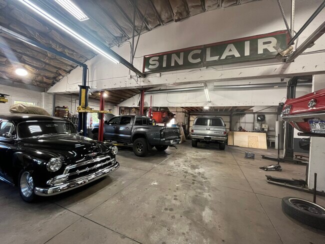
This Property Is For Sale
NEARBY LISTINGS FOR SALE OR LEASE
Property Detail
3000 S Broadway
Denver-Aurora-Lakewood, CO
Strayers Broadway Heights
1971-34-1-12-001
LOTS 1-2 BLK 8 STRAYERS BDWY HTS
Miscellaneous
Arapahoe
X
Colorado
0800460211J
1
2021
0.14 AC
2025
Central
005800
Denver
3,264 SF
DEMOGRAPHICS near 3000 S Broadway
1 Mile
3 Mile
5 Mile
2024 Total Population
17,636
128,871
391,277
2029 Population
17,815
129,647
393,727
Pop Growth 2024-2029
+ 1.01%
+ 0.60%
+ 0.63%
Average Age
40
38
40
2024 Total Households
8,974
54,445
173,688
HH Growth 2024-2029
+ 1.03%
+ 0.60%
+ 0.72%
Median Household Inc
$66,132
$79,433
$81,190
Avg Household Size
1.90
2.20
2.20
2024 Avg HH Vehicles
1.00
2.00
2.00
Median Home Value
$659,990
$606,502
$585,903
Median Year Built
1969
1960
1969
Nearby Places
Map Layers
Map Styles
 Street
 Aerial
- Restaurants
- Banks
- Shops
- Fitness
- Groceries
PUBLIC TRANSPORTATION
TRANSIT/SUBWAY
Englewood (C Line - Denver Regional Transportation District Light Rail (TheRide), D Line - Denver Regional Transportation District Light Rail (TheRide))
DRIVE
WALK
Distance
Englewood (C Line - Denver Regional Transportation District Light Rail (TheRide), D Line - Denver Regional Transportation District Light Rail (TheRide))
4 min
20 min
1.0 mi
COMMUTER RAIL
Union Station: LoDo-Coors Field-16th Street Mall (C Line - Denver Regional Transportation District Light Rail (TheRide), E Line - Denver Regional Transportation District Light Rail (TheRide), W Line - Denver Regional Transportation District Light Rail (TheRide))
DRIVE
WALK
Distance
Union Station: LoDo-Coors Field-16th Street Mall (C Line - Denver Regional Transportation District Light Rail (TheRide), E Line - Denver Regional Transportation District Light Rail (TheRide), W Line - Denver Regional Transportation District Light Rail (TheRide))
13 min
7.5 mi
DRIVE
WALK
Distance
13 min
7.5 mi
AIRPORT
Denver International
DRIVE
WALK
Distance
Denver International
42 min
31.4 mi
Nearby Properties
Address
Land Use
TOTAL SIZE
Lot Size
Zoning
Address
Land Use
TOTAL SIZE
Lot Size
Zoning
1,137,044 SF
35.49 AC
CMP-EI
Address
Land Use
TOTAL SIZE
Lot Size
Zoning
117,535 SF
4.76 AC
Address
Land Use
TOTAL SIZE
Lot Size
Zoning
441,643 SF
9.79 AC
H-1-B
Address
Land Use
TOTAL SIZE
Lot Size
Zoning
550,760 SF
13.25 AC
CMP-EI
Address
Land Use
TOTAL SIZE
Lot Size
Zoning
543,122 SF
13.43 AC
CMP-EI
Address
Land Use
TOTAL SIZE
Lot Size
Zoning
248,291 SF
128.77 AC
CMP-H2
Address
Land Use
TOTAL SIZE
Lot Size
Zoning
330,776 SF
48.11 AC
CMP-H2
Address
Land Use
TOTAL SIZE
Lot Size
Zoning
416,096 SF
5.20 AC
C-MX-20
Address
Land Use
TOTAL SIZE
Lot Size
Zoning
240,545 SF
2.35 AC
C-MX-20
Address
Land Use
TOTAL SIZE
Lot Size
Zoning
281,456 SF
36.55 AC
R-5
Address
Land Use
TOTAL SIZE
Lot Size
Zoning
174,244 SF
17.26 AC
E-SU-DX
Address
Land Use
TOTAL SIZE
Lot Size
Zoning
362,988 SF
4.71 AC
T-MU-30
Address
Land Use
TOTAL SIZE
Lot Size
Zoning
98,523 SF
4.17 AC
Address
Land Use
TOTAL SIZE
Lot Size
Zoning
68,500 SF
2.14 AC
Address
Land Use
TOTAL SIZE
Lot Size
Zoning
214,192 SF
0.03 AC
Address
Land Use
TOTAL SIZE
Lot Size
Zoning
124,658 SF
2.13 AC
CMP-EI
Address
Land Use
TOTAL SIZE
Lot Size
Zoning
356,004 SF
4.59 AC
C-MX-12
Address
Land Use
TOTAL SIZE
Lot Size
Zoning
341,493 SF
4.22 AC
T-MU-30
Address
Land Use
TOTAL SIZE
Lot Size
Zoning
533,298 SF
3.23 AC
C-MX
Address
Land Use
TOTAL SIZE
Lot Size
Zoning
158,805 SF
3.71 AC
CMP-EI
Address
Land Use
TOTAL SIZE
Lot Size
Zoning
381 SF
66.05 AC
I-B
Address
Land Use
TOTAL SIZE
Lot Size
Zoning
205,129 SF
2.94 AC
C-MX-20
Address
Land Use
TOTAL SIZE
Lot Size
Zoning
377,735 SF
1.72 AC
G-RX
Address
Land Use
TOTAL SIZE
Lot Size
Zoning
208,529 SF
34.81 AC
R-5
Address
Land Use
TOTAL SIZE
Lot Size
Zoning
169,350 SF
19.74 AC
H-1-B
Address
Land Use
TOTAL SIZE
Lot Size
Zoning
33,500 SF
53.33 AC
Address
Land Use
TOTAL SIZE
Lot Size
Zoning
148,088 SF
10.61 AC
B-3
Address
Land Use
TOTAL SIZE
Lot Size
Zoning
368,527 SF
18.71 AC
S-SU-D
Address
Land Use
TOTAL SIZE
Lot Size
Zoning
208,192 SF
1.80 AC
S-MX-12
Address
Land Use
TOTAL SIZE
Lot Size
Zoning
110,016 SF
1.29 AC
The World's #1 Commercial Real Estate Marketplace
Connect with us
© 2025 CoStar Group
The information above has been obtained from sources believed reliable. While we do not doubt its accuracy we have not verified it and make no guarantee, warranty or representation about it. It is your responsibility to independently confirm its accuracy and completeness. Any projections, opinions, assumptions, or estimates used are for example only and do not represent the current or future performance of the property. The value of this transaction to you depends on tax and other factors which should be evaluated by your tax, financial, and legal advisors. You and your advisors should conduct a careful, independent investigation of the property to determine to your satisfaction the suitability of the property for your needs.