Property Record
3000 S College Ave, Fort Collins, CO 80525


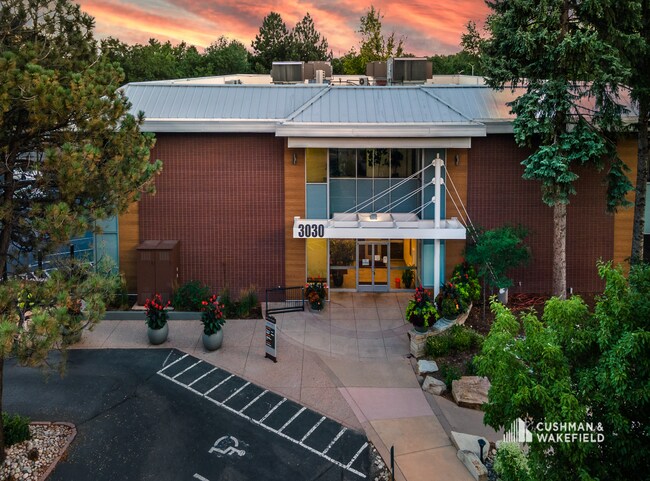

Property Detail
3000 S College Ave
97252-43-001
ALL BLK 2, THUNDERBIRD EST 9TH, TOG WITH VAC 30 FT RD ADJ SD BLK ON W, TOG WITH VAC S 30 FT DEL CLAIR RD ADJ SD BLK ON N, FTC
Regulatingdistrictsassessmentstaxabatement
LARIMER
C
Colorado
B and X Area of moderate flood hazard, usually the area between the limits of the 100-year and 500-year floods.
2.64 AC
2024
Fort Collins/Loveland
2025
Denver
001003
Fort Collins-Loveland, CO
46,616 SF
NEARBY LISTINGS FOR SALE OR LEASE
DEMOGRAPHICS near 3000 S College Ave
1 mile
3 mile
5 mile
2024 Total Population
14,142
122,557
186,191
2029 Population
14,639
126,685
192,615
Pop Growth 2024-2029
+ 3.51%
+ 3.37%
+ 3.45%
Average Age
37
36
37
2024 Total Households
6,439
49,732
75,087
HH Growth 2024-2029
+ 3.77%
+ 3.95%
+ 3.88%
Median Household Inc
$70,057
$75,797
$80,853
Avg Household Size
2.10
2.20
2.30
2024 Avg HH Vehicles
2.00
2.00
2.00
Median Home Value
$484,809
$615,889
$613,735
Median Year Built
1978
1989
1992
Nearby Places
Map Layers
Map Styles
 Street
 Aerial
Transit
 Traffic
 Biking
Places
Listings with unknown addresses are not visible on the map
- Restaurants
- Banks
- Shops
- Fitness
- Groceries
SALE & LEASE HISTORY
LISTING DATE
SALE/LEASE

Sep 25, 2016
For Lease
Nov 20, 2020
For Lease
May 14, 2018
For Lease
Nearby Properties
Address
Land Use
TOTAL SIZE
Lot Size
Zoning
Address
Land Use
TOTAL SIZE
Lot Size
Zoning
850,000 SF
21.76 AC
E
Address
Land Use
TOTAL SIZE
Lot Size
Zoning
235,094 SF
20.06 AC
HC
Address
Land Use
TOTAL SIZE
Lot Size
Zoning
1,096,874 SF
72 AC
CSU
Address
Land Use
TOTAL SIZE
Lot Size
Zoning
360,725 SF
33.93 AC
MMN
Address
Land Use
TOTAL SIZE
Lot Size
Zoning
440,160 SF
29 AC
CSU
Address
Land Use
TOTAL SIZE
Lot Size
Zoning
333,130 SF
47.74 AC
Address
Land Use
TOTAL SIZE
Lot Size
Zoning
521,085 SF
80.60 AC
CSU
Address
Land Use
TOTAL SIZE
Lot Size
Zoning
222,592 SF
21.69 AC
HC
Address
Land Use
TOTAL SIZE
Lot Size
Zoning
95,880 SF
16.69 AC
Address
Land Use
TOTAL SIZE
Lot Size
Zoning
283,141 SF
24 AC
RL
Address
Land Use
TOTAL SIZE
Lot Size
Zoning
180,030 SF
18.80 AC
Address
Land Use
TOTAL SIZE
Lot Size
Zoning
172,211 SF
1.92 AC
D
Address
Land Use
TOTAL SIZE
Lot Size
Zoning
137,014 SF
13.64 AC
HC
Address
Land Use
TOTAL SIZE
Lot Size
Zoning
281,945 SF
15.01 AC
NCL
Address
Land Use
TOTAL SIZE
Lot Size
Zoning
170,119 SF
12.83 AC
C
Address
Land Use
TOTAL SIZE
Lot Size
Zoning
337,566 SF
2.62 AC
Address
Land Use
TOTAL SIZE
Lot Size
Zoning
173,575 SF
28.86 AC
RL
Address
Land Use
TOTAL SIZE
Lot Size
Zoning
155,149 SF
3.67 AC
D
Address
Land Use
TOTAL SIZE
Lot Size
Zoning
98,518 SF
7.54 AC
MMN
Address
Land Use
TOTAL SIZE
Lot Size
Zoning
290,000 SF
3.67 AC
D
Address
Land Use
TOTAL SIZE
Lot Size
Zoning
227,180 SF
39 AC
E
Address
Land Use
TOTAL SIZE
Lot Size
Zoning
139,965 SF
8.62 AC
CSU
Address
Land Use
TOTAL SIZE
Lot Size
Zoning
115,260 SF
9.08 AC
HC
Address
Land Use
TOTAL SIZE
Lot Size
Zoning
181,956 SF
5 AC
C
Address
Land Use
TOTAL SIZE
Lot Size
Zoning
312,405 SF
16.01 AC
Address
Land Use
TOTAL SIZE
Lot Size
Zoning
211,255 SF
20.73 AC
C
Address
Land Use
TOTAL SIZE
Lot Size
Zoning
71,244 SF
5.96 AC
C
Address
Land Use
TOTAL SIZE
Lot Size
Zoning
375,679 SF
17.13 AC
The World's #1 Commercial Real Estate Marketplace
Connect with us
© 2026 CoStar Group
The information above has been obtained from sources believed reliable. While we do not doubt its accuracy we have not verified it and make no guarantee, warranty or representation about it. It is your responsibility to independently confirm its accuracy and completeness. Any projections, opinions, assumptions, or estimates used are for example only and do not represent the current or future performance of the property. The value of this transaction to you depends on tax and other factors which should be evaluated by your tax, financial, and legal advisors. You and your advisors should conduct a careful, independent investigation of the property to determine to your satisfaction the suitability of the property for your needs.