Property Record
3001 2Nd St Sw, Albuquerque, NM 87105
NEARBY LISTINGS FOR SALE OR LEASE
Property Detail
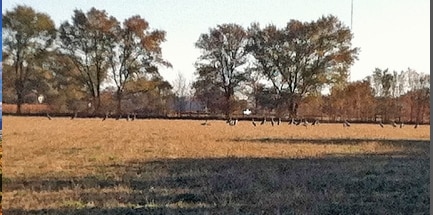
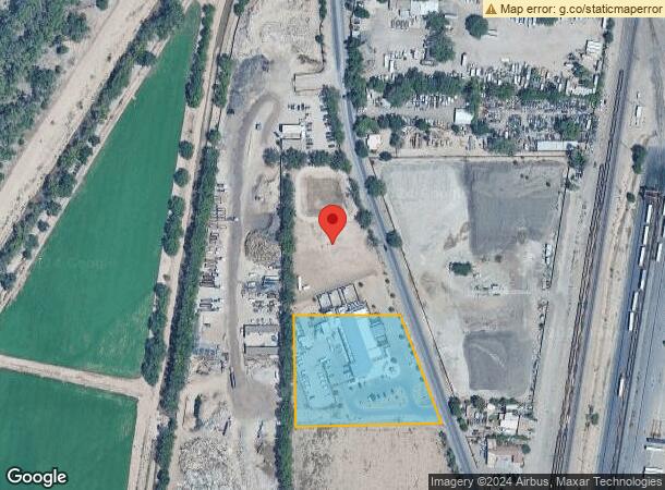
3001 2Nd St Sw
Albuquerque, NM
The Middle Rio Grande Conservancy Distri
1-014-055-019074-3-01-04
MRGCD MAP # 44 TR 100-B CONT 2.6500 AC
Realpropertynec
Bernalillo
X
New Mexico
35001C0341G
2.65 AC
0
South Valley
2025
Albuquerque
004001
DEMOGRAPHICS near 3001 2Nd St Sw
1 Mile
3 Mile
5 Mile
2024 Total Population
2,935
58,557
184,851
2029 Population
2,921
58,621
184,292
Pop Growth 2024-2029
(0.48%)
+ 0.11%
(0.30%)
Average Age
39
39
39
2024 Total Households
1,034
24,083
74,828
HH Growth 2024-2029
(0.58%)
+ 0.21%
(0.20%)
Median Household Inc
$33,195
$38,427
$46,162
Avg Household Size
2.70
2.30
2.30
2024 Avg HH Vehicles
2.00
2.00
2.00
Median Home Value
$144,925
$191,489
$208,514
Median Year Built
1959
1966
1973
Nearby Places
Map Layers
Map Styles
 Street
 Aerial
- Restaurants
- Banks
- Shops
- Fitness
- Groceries
PUBLIC TRANSPORTATION
COMMUTER RAIL
Bernalillo County-International Sunport (NMRX - Rio Metro Regional Transit District, Rail Runner Express - Rio Metro Regional Transit District)
DRIVE
WALK
Distance
Bernalillo County-International Sunport (NMRX - Rio Metro Regional Transit District, Rail Runner Express - Rio Metro Regional Transit District)
5 min
2.3 mi
Downtown Albuquerque (NMRX - Rio Metro Regional Transit District, Rail Runner Express - Rio Metro Regional Transit District)
DRIVE
WALK
Distance
Downtown Albuquerque (NMRX - Rio Metro Regional Transit District, Rail Runner Express - Rio Metro Regional Transit District)
6 min
2.7 mi
AIRPORT
Albuquerque International Sunport
DRIVE
WALK
Distance
Albuquerque International Sunport
23 min
9.3 mi
Freight Ports
Tulsa Port Of Catoosa
DRIVE
WALK
Distance
Tulsa Port Of Catoosa
695 min
666.6 mi
Nearby Properties
Address
Land Use
TOTAL SIZE
Lot Size
Zoning
Address
Land Use
TOTAL SIZE
Lot Size
Zoning
2,286.01 AC
Address
Land Use
TOTAL SIZE
Lot Size
Zoning
607,287 SF
8.26 AC
Address
Land Use
TOTAL SIZE
Lot Size
Zoning
849,036 SF
8.12 AC
Address
Land Use
TOTAL SIZE
Lot Size
Zoning
4,279 SF
13.72 AC
Address
Land Use
TOTAL SIZE
Lot Size
Zoning
179,231 SF
1,213.98 AC
Address
Land Use
TOTAL SIZE
Lot Size
Zoning
472,156 SF
1.78 AC
Address
Land Use
TOTAL SIZE
Lot Size
Zoning
Address
Land Use
TOTAL SIZE
Lot Size
Zoning
37,700 SF
4.43 AC
Address
Land Use
TOTAL SIZE
Lot Size
Zoning
355,645 SF
11.98 AC
Address
Land Use
TOTAL SIZE
Lot Size
Zoning
287,781 SF
38.18 AC
Address
Land Use
TOTAL SIZE
Lot Size
Zoning
381,985 SF
1.84 AC
Address
Land Use
TOTAL SIZE
Lot Size
Zoning
380,018 SF
0.13 AC
Address
Land Use
TOTAL SIZE
Lot Size
Zoning
61,072 SF
130.31 AC
Address
Land Use
TOTAL SIZE
Lot Size
Zoning
27.32 AC
Address
Land Use
TOTAL SIZE
Lot Size
Zoning
370,665 SF
1.66 AC
Address
Land Use
TOTAL SIZE
Lot Size
Zoning
Address
Land Use
TOTAL SIZE
Lot Size
Zoning
Address
Land Use
TOTAL SIZE
Lot Size
Zoning
313,812 SF
0.77 AC
Address
Land Use
TOTAL SIZE
Lot Size
Zoning
267,101 SF
3.40 AC
Address
Land Use
TOTAL SIZE
Lot Size
Zoning
41.40 AC
Address
Land Use
TOTAL SIZE
Lot Size
Zoning
36,200 SF
12.21 AC
Address
Land Use
TOTAL SIZE
Lot Size
Zoning
6,631 SF
21.01 AC
Address
Land Use
TOTAL SIZE
Lot Size
Zoning
89,661 SF
6.12 AC
Address
Land Use
TOTAL SIZE
Lot Size
Zoning
Address
Land Use
TOTAL SIZE
Lot Size
Zoning
1.89 AC
Address
Land Use
TOTAL SIZE
Lot Size
Zoning
134,349 SF
38.81 AC
Address
Land Use
TOTAL SIZE
Lot Size
Zoning
149,648 SF
8.70 AC
Address
Land Use
TOTAL SIZE
Lot Size
Zoning
244,800 SF
0.64 AC
Address
Land Use
TOTAL SIZE
Lot Size
Zoning
201,777 SF
1.08 AC
The World's #1 Commercial Real Estate Marketplace
Connect with us
© 2026 CoStar Group
The information above has been obtained from sources believed reliable. While we do not doubt its accuracy we have not verified it and make no guarantee, warranty or representation about it. It is your responsibility to independently confirm its accuracy and completeness. Any projections, opinions, assumptions, or estimates used are for example only and do not represent the current or future performance of the property. The value of this transaction to you depends on tax and other factors which should be evaluated by your tax, financial, and legal advisors. You and your advisors should conduct a careful, independent investigation of the property to determine to your satisfaction the suitability of the property for your needs.