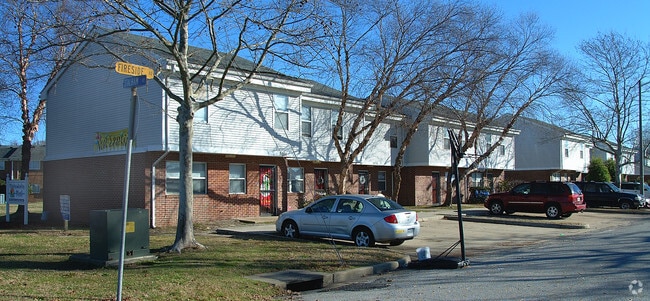
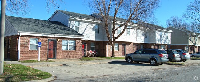
Property Record
3001 Fireside Rd, Chesapeake, VA 23324

Save to a Folder
{{folder.Name}}
{{folder.ListingIds.length}} Properties
{{folder.ListingIds.length}} Property
Create a New Folder
Property Detail
3001 Fireside Rd
1360000000105
ADMINISTRATIVE PARCEL 1.98AC
Taxexempt
CHESAPEAKE
RMF1: MULT
Virginia
B and X Area of moderate flood hazard, usually the area between the limits of the 100-year and 500-year floods.
1.98 AC
0
Indian River
2025
Hampton Roads
020100
Virginia Beach-Chesapeake-Norfolk, VA-NC
37,514 SF
NEARBY LISTINGS FOR SALE OR LEASE
DEMOGRAPHICS near 3001 Fireside Rd
1 mile
3 mile
5 mile
2025 Total Population
15,716
93,323
272,043
2030 Population
15,900
93,842
271,183
Pop Growth 2025-2030
+ 1.17%
+ 0.56%
(0.32%)
Average Age
38
38
39
2025 Total Households
6,126
35,965
109,408
HH Growth 2025-2030
+ 1.22%
+ 0.56%
(0.37%)
Median Household Inc
$64,629
$62,121
$69,009
Avg Household Size
2.50
2.40
2.40
2025 Avg HH Vehicles
2.00
2.00
2.00
Median Home Value
$279,650
$274,790
$304,923
Median Year Built
1974
1977
1977
Nearby Places
Map Layers
Map Styles
 Street
 Aerial
Layers
 Traffic
 Biking
Places
Listings with unknown addresses are not visible on the map
- Restaurants
- Banks
- Shops
- Fitness
- Groceries
PUBLIC TRANSPORTATION
COMMUTER RAIL
Norfolk (Northeast Regional - Amtrak)
Drive
Walk
Distance
Norfolk (Northeast Regional - Amtrak)
8 min
3.5 mi
AIRPORT
Norfolk International
Drive
Walk
Distance
Norfolk International
19 min
8.7 mi
Newport News/Williamsburg International
Drive
Walk
Distance
Newport News/Williamsburg International
50 min
32.5 mi
Freight Ports
Virginia Port Authority - Portsmouth
Drive
Walk
Distance
Virginia Port Authority - Portsmouth
18 min
8.3 mi
Nearby Properties
Address
Land Use
TOTAL SIZE
Lot Size
Zoning
Address
Land Use
TOTAL SIZE
Lot Size
Zoning
439,870 SF
24.90 AC
PUD: PLANN
Address
Land Use
TOTAL SIZE
Lot Size
Zoning
55.11 AC
IN2
Address
Land Use
TOTAL SIZE
Lot Size
Zoning
743,121 SF
57.42 AC
RMF1: MULT
Address
Land Use
TOTAL SIZE
Lot Size
Zoning
689,954 SF
63.25 AC
Address
Land Use
TOTAL SIZE
Lot Size
Zoning
358,908 SF
22.21 AC
MULTI: MUL
Address
Land Use
TOTAL SIZE
Lot Size
Zoning
258,000 SF
1.38 AC
M2: GENERA
Address
Land Use
TOTAL SIZE
Lot Size
Zoning
1 SF
20.80 AC
A18
Address
Land Use
TOTAL SIZE
Lot Size
Zoning
17.04 AC
A24
Address
Land Use
TOTAL SIZE
Lot Size
Zoning
209,403 SF
2.81 AC
PUD: PLANN
Address
Land Use
TOTAL SIZE
Lot Size
Zoning
264,213 SF
17.59 AC
PUD: PLANN
Address
Land Use
TOTAL SIZE
Lot Size
Zoning
Address
Land Use
TOTAL SIZE
Lot Size
Zoning
252,524 SF
20 AC
R8S: RESID
Address
Land Use
TOTAL SIZE
Lot Size
Zoning
188,152 SF
16.93 AC
Address
Land Use
TOTAL SIZE
Lot Size
Zoning
168,391 SF
28.39 AC
B2: GENERA
Address
Land Use
TOTAL SIZE
Lot Size
Zoning
32,163 SF
17.59 AC
MULTI: MUL
Address
Land Use
TOTAL SIZE
Lot Size
Zoning
270,962 SF
6.17 AC
MXD-U: MIX
Address
Land Use
TOTAL SIZE
Lot Size
Zoning
262,920 SF
20.94 AC
PUD: PLANN
Address
Land Use
TOTAL SIZE
Lot Size
Zoning
366,720 SF
23 AC
RMF1: MULT
Address
Land Use
TOTAL SIZE
Lot Size
Zoning
401,302 SF
18.74 AC
M2: GENERA
Address
Land Use
TOTAL SIZE
Lot Size
Zoning
128,596 SF
16.91 AC
M2: GENERA
Address
Land Use
TOTAL SIZE
Lot Size
Zoning
142,656 SF
22.17 AC
RMF1: MULT
Address
Land Use
TOTAL SIZE
Lot Size
Zoning
287,268 SF
83.63 AC
MULTI: MUL
Address
Land Use
TOTAL SIZE
Lot Size
Zoning
240,547 SF
6.18 AC
PUD: PLANN
Address
Land Use
TOTAL SIZE
Lot Size
Zoning
34.54 AC
IN2
Address
Land Use
TOTAL SIZE
Lot Size
Zoning
20.11 AC
Address
Land Use
TOTAL SIZE
Lot Size
Zoning
330,353 SF
17.61 AC
O2
Address
Land Use
TOTAL SIZE
Lot Size
Zoning
162,291 SF
2.98 AC
PUD: PLANN
Address
Land Use
TOTAL SIZE
Lot Size
Zoning
175,679 SF
9.83 AC
IN1
Address
Land Use
TOTAL SIZE
Lot Size
Zoning
1,880 SF
13.30 AC
PUD: PLANN
Address
Land Use
TOTAL SIZE
Lot Size
Zoning
22,845 SF
6.33 AC
PUD: PLANN
The World's #1 Commercial Real Estate Marketplace
Connect with us
© 2026 CoStar Group
The information above has been obtained from sources believed reliable. While we do not doubt its accuracy we have not verified it and make no guarantee, warranty or representation about it. It is your responsibility to independently confirm its accuracy and completeness. Any projections, opinions, assumptions, or estimates used are for example only and do not represent the current or future performance of the property. The value of this transaction to you depends on tax and other factors which should be evaluated by your tax, financial, and legal advisors. You and your advisors should conduct a careful, independent investigation of the property to determine to your satisfaction the suitability of the property for your needs.