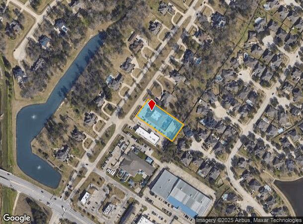
Property Record
30016 Aldine Westfield Rd, Spring, TX 77386

NEARBY LISTINGS FOR SALE OR LEASE
-
-
-
-
-
-
-
-
-
-
-
I-45 Feeder Road South Of Sawdust & Pruitt Road
Spring, TX 77380
Rent Upon Request
1.79 AC Lots
Land
-
-
-
-
-
-
-
View all Spring listings for sale on LoopNet.com
Property Detail
30016 Aldine Westfield Rd
Houston-Pasadena-The Woodlands, TX
Montg Co Sch Land
0350-08-00700
A0350 - MONTG CO SCH LAND, TRACT 7 (GRAND OAKS PARTNERS LLC # 2016020692, BLOCK 1, RESERVE), ACRES 0.968
Commercialnec
Montgomery
X
Texas
48339C0685G
4
2024
0.97 AC
2025
The Woodlands
692005
Houston
10,800 SF
DEMOGRAPHICS near 30016 Aldine Westfield Rd
1 Mile
3 Mile
5 Mile
2024 Total Population
16,126
78,189
152,310
2029 Population
19,497
94,024
178,213
Pop Growth 2024-2029
+ 20.90%
+ 20.25%
+ 17.01%
Average Age
35
34
36
2024 Total Households
5,126
25,936
54,265
HH Growth 2024-2029
+ 21.05%
+ 20.15%
+ 17.27%
Median Household Inc
$88,622
$108,159
$97,794
Avg Household Size
3.10
3.00
2.80
2024 Avg HH Vehicles
2.00
2.00
2.00
Median Home Value
$238,858
$277,441
$270,390
Median Year Built
2002
2006
2004
Nearby Places
Map Layers
Map Styles
 Street
 Aerial
- Restaurants
- Banks
- Shops
- Fitness
- Groceries
PUBLIC TRANSPORTATION
AIRPORT
George Bush Intcntl/Houston
DRIVE
WALK
Distance
George Bush Intcntl/Houston
26 min
18.9 mi
William P Hobby
DRIVE
WALK
Distance
William P Hobby
61 min
40.7 mi
Freight Ports
Port of Houston
DRIVE
WALK
Distance
Port of Houston
49 min
34.6 mi
Nearby Properties
Address
Land Use
TOTAL SIZE
Lot Size
Zoning
Address
Land Use
TOTAL SIZE
Lot Size
Zoning
1,186,001 SF
13.27 AC
Address
Land Use
TOTAL SIZE
Lot Size
Zoning
974,064 SF
11.79 AC
Address
Land Use
TOTAL SIZE
Lot Size
Zoning
354,981 SF
72.09 AC
Address
Land Use
TOTAL SIZE
Lot Size
Zoning
970,101 SF
48.05 AC
Address
Land Use
TOTAL SIZE
Lot Size
Zoning
457,883 SF
3.74 AC
Address
Land Use
TOTAL SIZE
Lot Size
Zoning
296,094 SF
10.19 AC
Address
Land Use
TOTAL SIZE
Lot Size
Zoning
153,729 SF
17.94 AC
Address
Land Use
TOTAL SIZE
Lot Size
Zoning
388,855 SF
19.86 AC
6
Address
Land Use
TOTAL SIZE
Lot Size
Zoning
327,690 SF
14.50 AC
Address
Land Use
TOTAL SIZE
Lot Size
Zoning
141,454 SF
21.13 AC
Address
Land Use
TOTAL SIZE
Lot Size
Zoning
471,015 SF
6.63 AC
Address
Land Use
TOTAL SIZE
Lot Size
Zoning
397,984 SF
6.42 AC
Address
Land Use
TOTAL SIZE
Lot Size
Zoning
333,146 SF
14.81 AC
6
Address
Land Use
TOTAL SIZE
Lot Size
Zoning
293,997 SF
12.87 AC
6
Address
Land Use
TOTAL SIZE
Lot Size
Zoning
278,533 SF
14.79 AC
6
Address
Land Use
TOTAL SIZE
Lot Size
Zoning
331,264 SF
12.92 AC
Address
Land Use
TOTAL SIZE
Lot Size
Zoning
321,024 SF
8.73 AC
6
Address
Land Use
TOTAL SIZE
Lot Size
Zoning
446,410 SF
9.31 AC
6
Address
Land Use
TOTAL SIZE
Lot Size
Zoning
446,924 SF
3.55 AC
6
Address
Land Use
TOTAL SIZE
Lot Size
Zoning
180,061 SF
8.78 AC
6
Address
Land Use
TOTAL SIZE
Lot Size
Zoning
216,833 SF
15.97 AC
Address
Land Use
TOTAL SIZE
Lot Size
Zoning
215,741 SF
14 AC
Address
Land Use
TOTAL SIZE
Lot Size
Zoning
196,000 SF
19.44 AC
Address
Land Use
TOTAL SIZE
Lot Size
Zoning
72,823 SF
6.15 AC
6
Address
Land Use
TOTAL SIZE
Lot Size
Zoning
179,426 SF
5.70 AC
Address
Land Use
TOTAL SIZE
Lot Size
Zoning
89,090 SF
10.93 AC
Address
Land Use
TOTAL SIZE
Lot Size
Zoning
86,611 SF
9.92 AC
6
Address
Land Use
TOTAL SIZE
Lot Size
Zoning
144,502 SF
11.25 AC
6
Address
Land Use
TOTAL SIZE
Lot Size
Zoning
399,474 SF
2.64 AC
6
Address
Land Use
TOTAL SIZE
Lot Size
Zoning
237,944 SF
7.08 AC
The World's #1 Commercial Real Estate Marketplace
Connect with us
© 2026 CoStar Group
The information above has been obtained from sources believed reliable. While we do not doubt its accuracy we have not verified it and make no guarantee, warranty or representation about it. It is your responsibility to independently confirm its accuracy and completeness. Any projections, opinions, assumptions, or estimates used are for example only and do not represent the current or future performance of the property. The value of this transaction to you depends on tax and other factors which should be evaluated by your tax, financial, and legal advisors. You and your advisors should conduct a careful, independent investigation of the property to determine to your satisfaction the suitability of the property for your needs.