Property Record
3002 E Phillips Rd, Eloy, AZ 85131
Property Detail
3002 E Phillips Rd
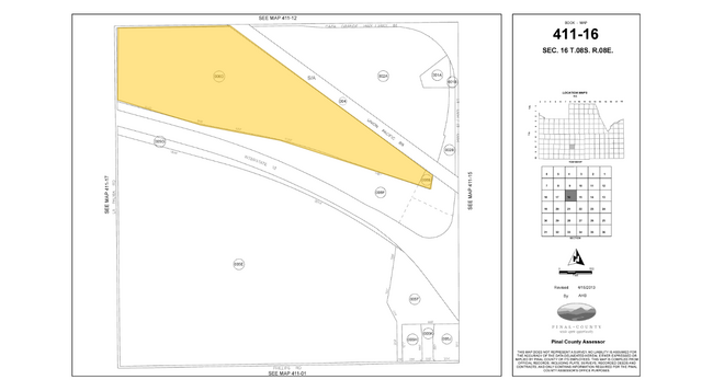
411-15-007
BEG @ SE COR SEC 16-08S-08E TH W-955.75 TH N-651.67 TH N 27D W-33 4.09 TH N 10D E-301.11 TH N 08D E-620.82 TH SWLY ALONG I-10 ROW L INE TO EAST LINE OF SEC 16 TH S ALONG SEC LINE TO POB EXC S-33.00 AND EXC E-33.00 AND EXC PCL BEG @ SE COR SEC 16 TH W
Orchard
PINAL
A Areas with a 1% annual chance of flooding and a 26% chance of flooding over the life of a 30-year mortgage.
Arizona
2024
7 AC
2025
Pinal County
0021022039
Phoenix
1,711 SF
Phoenix-Mesa-Chandler, AZ
NEARBY LISTINGS FOR SALE OR LEASE
DEMOGRAPHICS near 3002 E Phillips Rd
1 mile
3 mile
5 mile
2025 Total Population
27
6,250
7,321
2030 Population
32
7,367
8,629
Pop Growth 2025-2030
+ 18.52%
+ 17.87%
+ 17.87%
Average Age
36
36
36
2025 Total Households
9
1,990
2,314
HH Growth 2025-2030
+ 22.22%
+ 17.69%
+ 17.59%
Median Household Inc
$29,999
$41,119
$42,908
Avg Household Size
3.30
3.10
3.10
2025 Avg HH Vehicles
2.00
2.00
2.00
Median Home Value
$99,999
$133,457
$148,939
Median Year Built
1984
1981
1981
Nearby Places
Map Layers
Map Styles
 Street
 Aerial
Transit
 Traffic
 Biking
Places
Listings with unknown addresses are not visible on the map
- Restaurants
- Banks
- Shops
- Fitness
- Groceries
Nearby Properties
Address
Land Use
TOTAL SIZE
Lot Size
Zoning
Address
Land Use
TOTAL SIZE
Lot Size
Zoning
350,596 SF
27.45 AC
CI2
Address
Land Use
TOTAL SIZE
Lot Size
Zoning
5,352 SF
31.28 AC
Address
Land Use
TOTAL SIZE
Lot Size
Zoning
19,209 SF
20 AC
UNDESIGNAT
Address
Land Use
TOTAL SIZE
Lot Size
Zoning
9,372 SF
73.06 AC
Address
Land Use
TOTAL SIZE
Lot Size
Zoning
62,607 SF
13.87 AC
CI1
Address
Land Use
TOTAL SIZE
Lot Size
Zoning
14,008 SF
8.10 AC
UNDESIGNAT
Address
Land Use
TOTAL SIZE
Lot Size
Zoning
20,196 SF
80 AC
GR
Address
Land Use
TOTAL SIZE
Lot Size
Zoning
14.08 AC
Address
Land Use
TOTAL SIZE
Lot Size
Zoning
15,244 SF
640 AC
Address
Land Use
TOTAL SIZE
Lot Size
Zoning
9,074 SF
0.98 AC
UNDESIGNAT
Address
Land Use
TOTAL SIZE
Lot Size
Zoning
9,311 SF
2.75 AC
UNDESIGNAT
Address
Land Use
TOTAL SIZE
Lot Size
Zoning
625 SF
4.48 AC
Address
Land Use
TOTAL SIZE
Lot Size
Zoning
6,776 SF
1.10 AC
Address
Land Use
TOTAL SIZE
Lot Size
Zoning
15,259 SF
0.86 AC
UNDESIGNAT
Address
Land Use
TOTAL SIZE
Lot Size
Zoning
8,546 SF
1.67 AC
UNDESIGNAT
Address
Land Use
TOTAL SIZE
Lot Size
Zoning
7,848 SF
0.69 AC
UNDESIGNAT
Address
Land Use
TOTAL SIZE
Lot Size
Zoning
4.95 AC
UNDESIGNAT
Address
Land Use
TOTAL SIZE
Lot Size
Zoning
308 AC
UNDESIGNAT
Address
Land Use
TOTAL SIZE
Lot Size
Zoning
9,195 SF
0.99 AC
Address
Land Use
TOTAL SIZE
Lot Size
Zoning
7,600 SF
1.91 AC
Address
Land Use
TOTAL SIZE
Lot Size
Zoning
1,888 SF
10 AC
MH
Address
Land Use
TOTAL SIZE
Lot Size
Zoning
9,180 SF
2.64 AC
Address
Land Use
TOTAL SIZE
Lot Size
Zoning
Address
Land Use
TOTAL SIZE
Lot Size
Zoning
7,073 SF
1.68 AC
Address
Land Use
TOTAL SIZE
Lot Size
Zoning
279.05 AC
Address
Land Use
TOTAL SIZE
Lot Size
Zoning
466.39 AC
GR
Address
Land Use
TOTAL SIZE
Lot Size
Zoning
5,191 SF
0.59 AC
GR
Address
Land Use
TOTAL SIZE
Lot Size
Zoning
420.55 AC
UNDESIGNAT
Address
Land Use
TOTAL SIZE
Lot Size
Zoning
900 SF
319.13 AC
The World's #1 Commercial Real Estate Marketplace
Connect with us
© 2026 CoStar Group
The information above has been obtained from sources believed reliable. While we do not doubt its accuracy we have not verified it and make no guarantee, warranty or representation about it. It is your responsibility to independently confirm its accuracy and completeness. Any projections, opinions, assumptions, or estimates used are for example only and do not represent the current or future performance of the property. The value of this transaction to you depends on tax and other factors which should be evaluated by your tax, financial, and legal advisors. You and your advisors should conduct a careful, independent investigation of the property to determine to your satisfaction the suitability of the property for your needs.