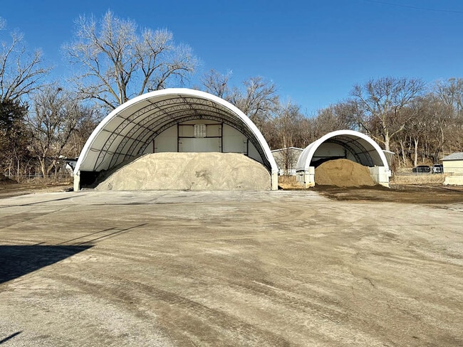
Property Record
3002 Mechanic Dr, Bellevue, NE 68005

Property Detail
3002 Mechanic Dr
Omaha/Council Bluffs
TAX LOTS K2, K1B & PART K1A & PT OF CB & Q RR LYING W OF K1B & K2 1-13-13
Omaha, NE-IA
SARPY
010628762
Nebraska
Stateproperty
k2
0
6.07 AC
2025
Southeast Omaha
010106
NEARBY LISTINGS FOR SALE OR LEASE
DEMOGRAPHICS near 3002 Mechanic Dr
1 mile
3 mile
5 mile
2025 Total Population
4,999
25,723
66,194
2030 Population
5,314
27,295
70,350
Pop Growth 2025-2030
+ 6.30%
+ 6.11%
+ 6.28%
Average Age
38
39
37
2025 Total Households
2,103
10,596
25,376
HH Growth 2025-2030
+ 6.56%
+ 6.46%
+ 6.56%
Median Household Inc
$63,324
$73,719
$90,190
Avg Household Size
2.30
2.30
2.50
2025 Avg HH Vehicles
2.00
2.00
2.00
Median Home Value
$146,714
$235,226
$276,225
Median Year Built
1959
1974
1987
Nearby Places
Map Layers
Map Styles
 Street
 Aerial
Layers
 Traffic
 Biking
Places
Listings with unknown addresses are not visible on the map
- Restaurants
- Banks
- Shops
- Fitness
- Groceries
PUBLIC TRANSPORTATION
AIRPORT
Eppley Airfield
Drive
Walk
Distance
Eppley Airfield
27 min
15.8 mi
Freight Ports
Tulsa Port Of Catoosa
Drive
Walk
Distance
Tulsa Port Of Catoosa
450 min
407.1 mi
Nearby Properties
Address
Land Use
TOTAL SIZE
Lot Size
Zoning
Address
Land Use
TOTAL SIZE
Lot Size
Zoning
24,969 SF
3.79 AC
RG20
Address
Land Use
TOTAL SIZE
Lot Size
Zoning
10,052 SF
9.38 AC
Address
Land Use
TOTAL SIZE
Lot Size
Zoning
160,000 SF
22.48 AC
Address
Land Use
TOTAL SIZE
Lot Size
Zoning
254,734 SF
18.90 AC
Address
Land Use
TOTAL SIZE
Lot Size
Zoning
2,440 SF
18.88 AC
RG28
Address
Land Use
TOTAL SIZE
Lot Size
Zoning
18,825 SF
15.18 AC
Address
Land Use
TOTAL SIZE
Lot Size
Zoning
119,396 SF
13.46 AC
Address
Land Use
TOTAL SIZE
Lot Size
Zoning
3.95 AC
Address
Land Use
TOTAL SIZE
Lot Size
Zoning
121,660 SF
9.23 AC
RG28
Address
Land Use
TOTAL SIZE
Lot Size
Zoning
2,032 SF
8.67 AC
Address
Land Use
TOTAL SIZE
Lot Size
Zoning
212,990 SF
8.75 AC
MH
Address
Land Use
TOTAL SIZE
Lot Size
Zoning
1,103 SF
9.27 AC
Address
Land Use
TOTAL SIZE
Lot Size
Zoning
63,669 SF
6.58 AC
Address
Land Use
TOTAL SIZE
Lot Size
Zoning
18,752 SF
7.06 AC
Address
Land Use
TOTAL SIZE
Lot Size
Zoning
2,328 SF
6.18 AC
Address
Land Use
TOTAL SIZE
Lot Size
Zoning
131,549 SF
6.13 AC
Address
Land Use
TOTAL SIZE
Lot Size
Zoning
Address
Land Use
TOTAL SIZE
Lot Size
Zoning
48,199 SF
2.73 AC
Address
Land Use
TOTAL SIZE
Lot Size
Zoning
24,599 SF
4.36 AC
Address
Land Use
TOTAL SIZE
Lot Size
Zoning
67,107 SF
7.59 AC
Address
Land Use
TOTAL SIZE
Lot Size
Zoning
37,466 SF
3.60 AC
Address
Land Use
TOTAL SIZE
Lot Size
Zoning
79,895 SF
4.81 AC
Address
Land Use
TOTAL SIZE
Lot Size
Zoning
7,778 SF
3.31 AC
Address
Land Use
TOTAL SIZE
Lot Size
Zoning
4,864 SF
7.19 AC
Address
Land Use
TOTAL SIZE
Lot Size
Zoning
45,412 SF
3 AC
Address
Land Use
TOTAL SIZE
Lot Size
Zoning
70,800 SF
3.49 AC
Address
Land Use
TOTAL SIZE
Lot Size
Zoning
14,034 SF
3.19 AC
Address
Land Use
TOTAL SIZE
Lot Size
Zoning
101,606 SF
5.01 AC
RG20
Address
Land Use
TOTAL SIZE
Lot Size
Zoning
1,150 SF
5.77 AC
The World's #1 Commercial Real Estate Marketplace
Connect with us
© 2026 CoStar Group
The information above has been obtained from sources believed reliable. While we do not doubt its accuracy we have not verified it and make no guarantee, warranty or representation about it. It is your responsibility to independently confirm its accuracy and completeness. Any projections, opinions, assumptions, or estimates used are for example only and do not represent the current or future performance of the property. The value of this transaction to you depends on tax and other factors which should be evaluated by your tax, financial, and legal advisors. You and your advisors should conduct a careful, independent investigation of the property to determine to your satisfaction the suitability of the property for your needs.