Property Record
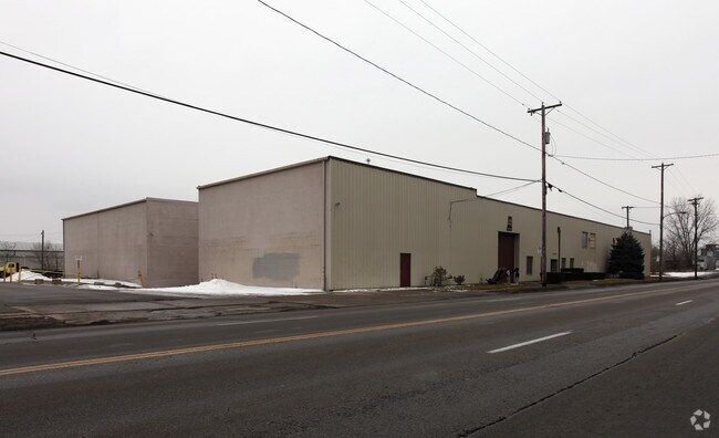
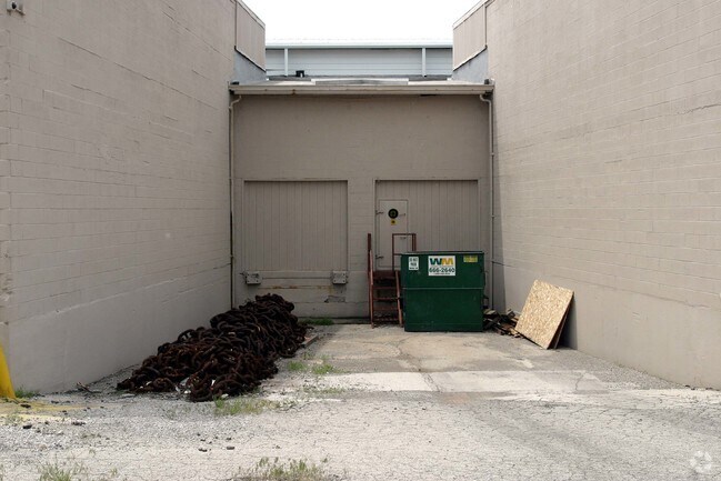
3002 N Summit St, Toledo, OH 43611
Property Detail
3002 N Summit St
11-09877
NORTH TOLEDO BLK 32 SW I00 FT NW 184.5FT & 1/2 NEW YORK AV
Warehouse
LUCAS
10-IL
Ohio
B and X Area of moderate flood hazard, usually the area between the limits of the 100-year and 500-year floods.
0.97 AC
0
North Toledo
2025
Toledo
005503
Toledo, OH
44,145 SF
NEARBY LISTINGS FOR SALE OR LEASE
DEMOGRAPHICS near 3002 N Summit St
1 mile
3 mile
5 mile
2025 Total Population
5,276
60,145
150,962
2030 Population
5,302
60,722
152,153
Pop Growth 2025-2030
+ 0.49%
+ 0.96%
+ 0.79%
Average Age
37
39
39
2025 Total Households
1,767
24,787
62,968
HH Growth 2025-2030
+ 0.96%
+ 0.83%
+ 0.71%
Median Household Inc
$36,015
$39,687
$43,897
Avg Household Size
2.40
2.20
2.30
2025 Avg HH Vehicles
1.00
1.00
1.00
Median Home Value
$71,723
$89,124
$90,367
Median Year Built
1950
1950
1949
Nearby Places
Map Layers
Map Styles
 Street
 Aerial
Layers
 Traffic
 Biking
Places
Listings with unknown addresses are not visible on the map
- Restaurants
- Banks
- Shops
- Fitness
- Groceries
PUBLIC TRANSPORTATION
COMMUTER RAIL
Drive
Walk
Distance
8 min
4.2 mi
AIRPORT
Eugene F Kranz Toledo Express
Drive
Walk
Distance
Eugene F Kranz Toledo Express
41 min
23.3 mi
Freight Ports
Drive
Walk
Distance
14 min
5.4 mi
Nearby Properties
Address
Land Use
TOTAL SIZE
Lot Size
Zoning
Address
Land Use
TOTAL SIZE
Lot Size
Zoning
1,046,727 SF
0.41 AC
10-IC
Address
Land Use
TOTAL SIZE
Lot Size
Zoning
569,999 SF
45.25 AC
10-MX
Address
Land Use
TOTAL SIZE
Lot Size
Zoning
286,525 SF
105.33 AC
10-RS6
Address
Land Use
TOTAL SIZE
Lot Size
Zoning
277,862 SF
3 AC
10-CD
Address
Land Use
TOTAL SIZE
Lot Size
Zoning
169.42 AC
10-IG
Address
Land Use
TOTAL SIZE
Lot Size
Zoning
314,826 SF
10.28 AC
10-CM
Address
Land Use
TOTAL SIZE
Lot Size
Zoning
625,485 SF
2 AC
10-MX
Address
Land Use
TOTAL SIZE
Lot Size
Zoning
171,946 SF
0.17 AC
10-IC
Address
Land Use
TOTAL SIZE
Lot Size
Zoning
Address
Land Use
TOTAL SIZE
Lot Size
Zoning
243,165 SF
3.63 AC
10-CD
Address
Land Use
TOTAL SIZE
Lot Size
Zoning
225,407 SF
128.05 AC
10-MX
Address
Land Use
TOTAL SIZE
Lot Size
Zoning
169.42 AC
10-IG
Address
Land Use
TOTAL SIZE
Lot Size
Zoning
375,323 SF
10-IC
Address
Land Use
TOTAL SIZE
Lot Size
Zoning
182,983 SF
2 AC
10-CD
Address
Land Use
TOTAL SIZE
Lot Size
Zoning
14,824 SF
54.18 AC
10-MX
Address
Land Use
TOTAL SIZE
Lot Size
Zoning
172,044 SF
12.78 AC
10-MX
Address
Land Use
TOTAL SIZE
Lot Size
Zoning
390,272 SF
5 AC
10-CD
Address
Land Use
TOTAL SIZE
Lot Size
Zoning
202,118 SF
1.50 AC
10-CD
Address
Land Use
TOTAL SIZE
Lot Size
Zoning
232,758 SF
2 AC
10-CO
Address
Land Use
TOTAL SIZE
Lot Size
Zoning
132,690 SF
5 AC
10-CO
Address
Land Use
TOTAL SIZE
Lot Size
Zoning
28.51 AC
10-IG
Address
Land Use
TOTAL SIZE
Lot Size
Zoning
158,288 SF
1.22 AC
10-CO
Address
Land Use
TOTAL SIZE
Lot Size
Zoning
334,732 SF
516.10 AC
40-M2
Address
Land Use
TOTAL SIZE
Lot Size
Zoning
370,650 SF
13.65 AC
10-MX
Address
Land Use
TOTAL SIZE
Lot Size
Zoning
158,473 SF
1 AC
10-CD
Address
Land Use
TOTAL SIZE
Lot Size
Zoning
34.13 AC
10-IG
Address
Land Use
TOTAL SIZE
Lot Size
Zoning
273,871 SF
0.66 AC
10-CD
Address
Land Use
TOTAL SIZE
Lot Size
Zoning
3.22 AC
10-CD
Address
Land Use
TOTAL SIZE
Lot Size
Zoning
90,113 SF
8.12 AC
21-PO
Address
Land Use
TOTAL SIZE
Lot Size
Zoning
The World's #1 Commercial Real Estate Marketplace
Connect with us
© 2026 CoStar Group
The information above has been obtained from sources believed reliable. While we do not doubt its accuracy we have not verified it and make no guarantee, warranty or representation about it. It is your responsibility to independently confirm its accuracy and completeness. Any projections, opinions, assumptions, or estimates used are for example only and do not represent the current or future performance of the property. The value of this transaction to you depends on tax and other factors which should be evaluated by your tax, financial, and legal advisors. You and your advisors should conduct a careful, independent investigation of the property to determine to your satisfaction the suitability of the property for your needs.