Property Record
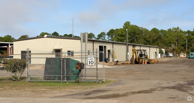
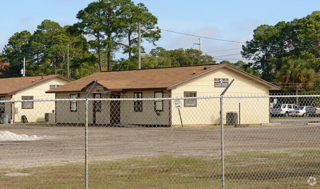
3002 W 19Th St, Panama City, FL 32405

Property Detail
3002 W 19Th St
28471-000-000
36 3S 15W -1- 48A N1/2 LESS NE1/4 & E1/2 OF E1/2 OFE1/2 OF NW1/4 & LESS TO BAY COUNTY SCHOOL BOARD & LESS TO CHAPMAN LAND CO & SR R/W. DB 82 P 29
Municipalproperty
BAY
PC14
Florida
A Areas with a 1% annual chance of flooding and a 26% chance of flooding over the life of a 30-year mortgage.
33
0
14.40 AC
2025
Panama City
001502
Other Market Areas
44,799 SF
Panama City-Panama City Beach, FL
NEARBY LISTINGS FOR SALE OR LEASE
DEMOGRAPHICS near 3002 W 19Th St
1 mile
3 mile
5 mile
2025 Total Population
8,065
26,022
74,494
2030 Population
8,777
28,690
82,868
Pop Growth 2025-2030
+ 8.83%
+ 10.25%
+ 11.24%
Average Age
39
41
41
2025 Total Households
3,249
10,743
31,033
HH Growth 2025-2030
+ 9.14%
+ 10.62%
+ 11.77%
Median Household Inc
$57,499
$66,642
$70,695
Avg Household Size
2.30
2.30
2.30
2025 Avg HH Vehicles
2.00
2.00
2.00
Median Home Value
$220,430
$318,098
$331,683
Median Year Built
1971
1981
1988
Nearby Places
Map Layers
Map Styles
 Street
 Aerial
Layers
 Traffic
 Biking
Places
Listings with unknown addresses are not visible on the map
- Restaurants
- Banks
- Shops
- Fitness
- Groceries
PUBLIC TRANSPORTATION
AIRPORT
Northwest Florida Beaches International
Drive
Walk
Distance
Northwest Florida Beaches International
39 min
24.3 mi
Freight Ports
Port of Panama City
Drive
Walk
Distance
Port of Panama City
5 min
2.4 mi
Nearby Properties
Address
Land Use
TOTAL SIZE
Lot Size
Zoning
Address
Land Use
TOTAL SIZE
Lot Size
Zoning
477,423 SF
21.91 AC
PC09
Address
Land Use
TOTAL SIZE
Lot Size
Zoning
455,239 SF
11.87 AC
PC11
Address
Land Use
TOTAL SIZE
Lot Size
Zoning
648,279 SF
73.10 AC
PC14
Address
Land Use
TOTAL SIZE
Lot Size
Zoning
503,491 SF
79.46 AC
PC12
Address
Land Use
TOTAL SIZE
Lot Size
Zoning
354,592 SF
24 AC
UND
Address
Land Use
TOTAL SIZE
Lot Size
Zoning
214,953 SF
14.58 AC
PC09
Address
Land Use
TOTAL SIZE
Lot Size
Zoning
33,305 SF
15 AC
PC09
Address
Land Use
TOTAL SIZE
Lot Size
Zoning
140,899 SF
15.48 AC
PC09
Address
Land Use
TOTAL SIZE
Lot Size
Zoning
194,474 SF
16.03 AC
PC09
Address
Land Use
TOTAL SIZE
Lot Size
Zoning
115,056 SF
21 AC
PC09
Address
Land Use
TOTAL SIZE
Lot Size
Zoning
30,349 SF
15.70 AC
PC11
Address
Land Use
TOTAL SIZE
Lot Size
Zoning
142,051 SF
13.43 AC
PC09
Address
Land Use
TOTAL SIZE
Lot Size
Zoning
28,314 SF
6.34 AC
PC05
Address
Land Use
TOTAL SIZE
Lot Size
Zoning
122,813 SF
9.58 AC
PC09
Address
Land Use
TOTAL SIZE
Lot Size
Zoning
68,418 SF
417.69 AC
PC11
Address
Land Use
TOTAL SIZE
Lot Size
Zoning
208,296 SF
24.72 AC
PC05
Address
Land Use
TOTAL SIZE
Lot Size
Zoning
165,098 SF
9.67 AC
PC04
Address
Land Use
TOTAL SIZE
Lot Size
Zoning
164,923 SF
23.60 AC
PC09
Address
Land Use
TOTAL SIZE
Lot Size
Zoning
42,718 SF
7.77 AC
PC09
Address
Land Use
TOTAL SIZE
Lot Size
Zoning
207,286 SF
3.48 AC
PC10
Address
Land Use
TOTAL SIZE
Lot Size
Zoning
81,774 SF
17.46 AC
PC05
Address
Land Use
TOTAL SIZE
Lot Size
Zoning
98,827 SF
11.95 AC
PC09
Address
Land Use
TOTAL SIZE
Lot Size
Zoning
88,106 SF
12.22 AC
PC11
Address
Land Use
TOTAL SIZE
Lot Size
Zoning
256,570 SF
7 AC
PC14
Address
Land Use
TOTAL SIZE
Lot Size
Zoning
102,730 SF
11.12 AC
PC09
Address
Land Use
TOTAL SIZE
Lot Size
Zoning
49.47 AC
BC14
Address
Land Use
TOTAL SIZE
Lot Size
Zoning
36,866 SF
12 AC
PC14
Address
Land Use
TOTAL SIZE
Lot Size
Zoning
119,027 SF
10.43 AC
PC05
Address
Land Use
TOTAL SIZE
Lot Size
Zoning
92,299 SF
4.67 AC
Address
Land Use
TOTAL SIZE
Lot Size
Zoning
94,449 SF
2.28 AC
PC09
The World's #1 Commercial Real Estate Marketplace
Connect with us
© 2026 CoStar Group
The information above has been obtained from sources believed reliable. While we do not doubt its accuracy we have not verified it and make no guarantee, warranty or representation about it. It is your responsibility to independently confirm its accuracy and completeness. Any projections, opinions, assumptions, or estimates used are for example only and do not represent the current or future performance of the property. The value of this transaction to you depends on tax and other factors which should be evaluated by your tax, financial, and legal advisors. You and your advisors should conduct a careful, independent investigation of the property to determine to your satisfaction the suitability of the property for your needs.