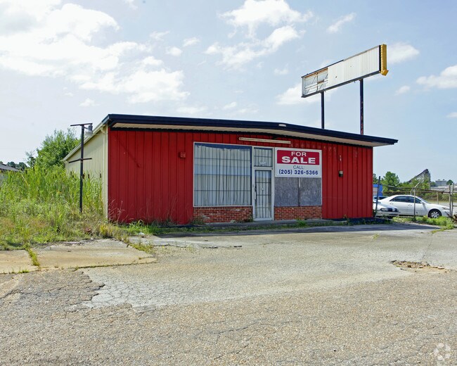
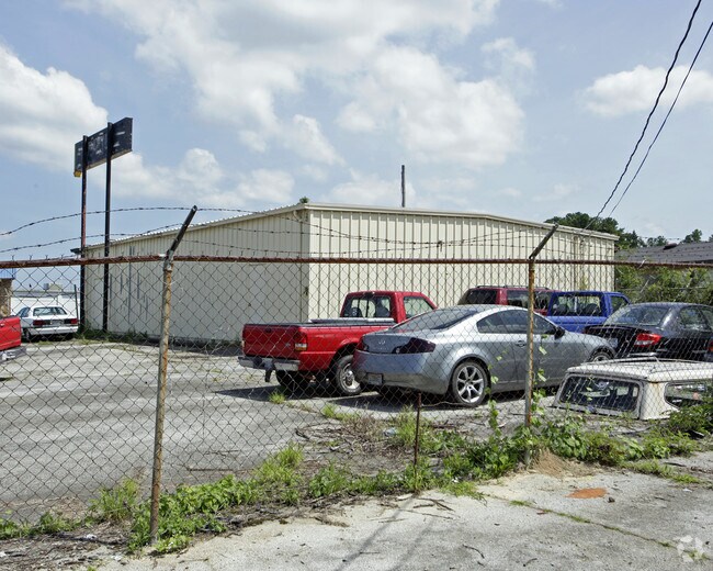
Property Record
3004 Mcclellan Blvd, Anniston, AL 36201

Save to a Folder
{{folder.Name}}
{{folder.ListingIds.length}} Properties
{{folder.ListingIds.length}} Property
Create a New Folder
Property Detail
3004 Mcclellan Blvd
18-09-32-2-002-009.004
SEC 32 TSP 15S R 8E BEG 240 N & 382.59 E OF SW COR NE1/4 NW1/4 TH N 249.58 E 175.92 S 262 W 96 T0 POB ANNISTON AL AL
Storebuilding
Calhoun
B and X Area of moderate flood hazard, usually the area between the limits of the 100-year and 500-year floods.
Alabama
2025
0.71 AC
2025
Gadsden/Anniston Area
000300
Other Market Areas
2,542 SF
Anniston-Oxford, AL
NEARBY LISTINGS FOR SALE OR LEASE
DEMOGRAPHICS near 3004 Mcclellan Blvd
1 mile
3 mile
5 mile
2025 Total Population
3,841
22,999
43,303
2030 Population
3,991
23,411
43,707
Pop Growth 2025-2030
+ 3.91%
+ 1.79%
+ 0.93%
Average Age
40
42
42
2025 Total Households
1,655
9,645
18,169
HH Growth 2025-2030
+ 3.99%
+ 1.85%
+ 0.99%
Median Household Inc
$29,983
$36,500
$44,505
Avg Household Size
2.20
2.20
2.20
2025 Avg HH Vehicles
1.00
2.00
2.00
Median Home Value
$57,890
$92,518
$132,427
Median Year Built
1955
1966
1972
Nearby Places
Map Layers
Map Styles
 Street
 Aerial
Layers
 Traffic
 Biking
Places
Listings with unknown addresses are not visible on the map
- Restaurants
- Banks
- Shops
- Fitness
- Groceries
PUBLIC TRANSPORTATION
COMMUTER RAIL
Anniston Amtrak Station (Crescent - Amtrak)
Drive
Walk
Distance
Anniston Amtrak Station (Crescent - Amtrak)
6 min
2.9 mi
Freight Ports
Port of Panama City
Drive
Walk
Distance
Port of Panama City
367 min
294.6 mi
Nearby Properties
Address
Land Use
TOTAL SIZE
Lot Size
Zoning
Address
Land Use
TOTAL SIZE
Lot Size
Zoning
319,650 SF
10.69 AC
Address
Land Use
TOTAL SIZE
Lot Size
Zoning
12,496 SF
7.39 AC
Address
Land Use
TOTAL SIZE
Lot Size
Zoning
4,520 SF
8.20 AC
Address
Land Use
TOTAL SIZE
Lot Size
Zoning
73,027 SF
1.60 AC
Address
Land Use
TOTAL SIZE
Lot Size
Zoning
21,766 SF
3.06 AC
Address
Land Use
TOTAL SIZE
Lot Size
Zoning
18.55 AC
Address
Land Use
TOTAL SIZE
Lot Size
Zoning
17,254 SF
22 AC
Address
Land Use
TOTAL SIZE
Lot Size
Zoning
16,541 SF
19.44 AC
Address
Land Use
TOTAL SIZE
Lot Size
Zoning
138,119 SF
13.55 AC
Address
Land Use
TOTAL SIZE
Lot Size
Zoning
31,832 SF
16 AC
Address
Land Use
TOTAL SIZE
Lot Size
Zoning
203,573 SF
17.16 AC
Address
Land Use
TOTAL SIZE
Lot Size
Zoning
14,082 SF
3.85 AC
Address
Land Use
TOTAL SIZE
Lot Size
Zoning
5,581 SF
1.01 AC
Address
Land Use
TOTAL SIZE
Lot Size
Zoning
42,158 SF
5.20 AC
Address
Land Use
TOTAL SIZE
Lot Size
Zoning
3.67 AC
Address
Land Use
TOTAL SIZE
Lot Size
Zoning
71,060 SF
2.20 AC
Address
Land Use
TOTAL SIZE
Lot Size
Zoning
103,550 SF
9.15 AC
Address
Land Use
TOTAL SIZE
Lot Size
Zoning
6.94 AC
Address
Land Use
TOTAL SIZE
Lot Size
Zoning
6,912 SF
12.68 AC
Address
Land Use
TOTAL SIZE
Lot Size
Zoning
34,564 SF
1.60 AC
Address
Land Use
TOTAL SIZE
Lot Size
Zoning
42,128 SF
Address
Land Use
TOTAL SIZE
Lot Size
Zoning
Address
Land Use
TOTAL SIZE
Lot Size
Zoning
13,568 SF
1.60 AC
Address
Land Use
TOTAL SIZE
Lot Size
Zoning
11,880 SF
23.44 AC
Address
Land Use
TOTAL SIZE
Lot Size
Zoning
40,520 SF
4.01 AC
Address
Land Use
TOTAL SIZE
Lot Size
Zoning
51,145 SF
2.49 AC
Address
Land Use
TOTAL SIZE
Lot Size
Zoning
25,325 SF
2.29 AC
Address
Land Use
TOTAL SIZE
Lot Size
Zoning
47,164 SF
1.37 AC
Address
Land Use
TOTAL SIZE
Lot Size
Zoning
Address
Land Use
TOTAL SIZE
Lot Size
Zoning
65,545 SF
0.80 AC
The World's #1 Commercial Real Estate Marketplace
Connect with us
© 2026 CoStar Group
The information above has been obtained from sources believed reliable. While we do not doubt its accuracy we have not verified it and make no guarantee, warranty or representation about it. It is your responsibility to independently confirm its accuracy and completeness. Any projections, opinions, assumptions, or estimates used are for example only and do not represent the current or future performance of the property. The value of this transaction to you depends on tax and other factors which should be evaluated by your tax, financial, and legal advisors. You and your advisors should conduct a careful, independent investigation of the property to determine to your satisfaction the suitability of the property for your needs.