Property Record
3005 Rhodes Rd, Reno, NV 89521
Property Detail
3005 Rhodes Rd
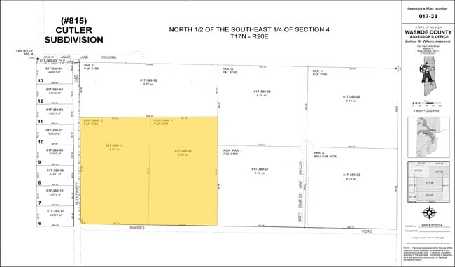
017-380-19
PM 3194 LOT E LESS STREET
Resorthotel
Washoe
LDR
Nevada
B and X Area of moderate flood hazard, usually the area between the limits of the 100-year and 500-year floods.
e
2025
9.86 AC
2026
South Reno
003205
Reno/Sparks
20,800 SF
Reno, NV
NEARBY LISTINGS FOR SALE OR LEASE
DEMOGRAPHICS near 3005 Rhodes Rd
1 mile
3 mile
5 mile
2025 Total Population
655
14,458
47,750
2030 Population
679
15,335
49,741
Pop Growth 2025-2030
+ 3.66%
+ 6.07%
+ 4.17%
Average Age
45
42
44
2025 Total Households
233
5,482
19,033
HH Growth 2025-2030
+ 3.86%
+ 6.26%
+ 4.16%
Median Household Inc
$98,845
$94,989
$121,691
Avg Household Size
2.70
2.60
2.50
2025 Avg HH Vehicles
3.00
2.00
2.00
Median Home Value
$644,860
$713,982
$770,908
Median Year Built
1985
2001
2005
Nearby Places
Map Layers
Map Styles
 Street
 Aerial
Transit
 Traffic
 Biking
Places
Listings with unknown addresses are not visible on the map
- Restaurants
- Banks
- Shops
- Fitness
- Groceries
PUBLIC TRANSPORTATION
AIRPORT
Reno/Tahoe International
Drive
Walk
Distance
Reno/Tahoe International
23 min
12.4 mi
Nearby Properties
Address
Land Use
TOTAL SIZE
Lot Size
Zoning
Address
Land Use
TOTAL SIZE
Lot Size
Zoning
430,526 SF
14.79 AC
MS
Address
Land Use
TOTAL SIZE
Lot Size
Zoning
410,834 SF
11.58 AC
MS
Address
Land Use
TOTAL SIZE
Lot Size
Zoning
379,347 SF
18.42 AC
MS
Address
Land Use
TOTAL SIZE
Lot Size
Zoning
257,652 SF
23.36 AC
MS
Address
Land Use
TOTAL SIZE
Lot Size
Zoning
110,100 SF
22.88 AC
MS
Address
Land Use
TOTAL SIZE
Lot Size
Zoning
167,612 SF
7.88 AC
PD
Address
Land Use
TOTAL SIZE
Lot Size
Zoning
225,634 SF
66.85 AC
PSP
Address
Land Use
TOTAL SIZE
Lot Size
Zoning
25.52 AC
MS
Address
Land Use
TOTAL SIZE
Lot Size
Zoning
47,743 SF
7.27 AC
MS
Address
Land Use
TOTAL SIZE
Lot Size
Zoning
60,947 SF
47.04 AC
MS
Address
Land Use
TOTAL SIZE
Lot Size
Zoning
79,736 SF
1.57 AC
MS
Address
Land Use
TOTAL SIZE
Lot Size
Zoning
55,197 SF
5.50 AC
MDS 79% /
Address
Land Use
TOTAL SIZE
Lot Size
Zoning
98,588 SF
5.60 AC
GC
Address
Land Use
TOTAL SIZE
Lot Size
Zoning
497.01 AC
OS
Address
Land Use
TOTAL SIZE
Lot Size
Zoning
61,554 SF
7.74 AC
GC
Address
Land Use
TOTAL SIZE
Lot Size
Zoning
196,560 SF
10.58 AC
MS
Address
Land Use
TOTAL SIZE
Lot Size
Zoning
190,063 SF
11.94 AC
MS
Address
Land Use
TOTAL SIZE
Lot Size
Zoning
145,600 SF
14.06 AC
MS
Address
Land Use
TOTAL SIZE
Lot Size
Zoning
32.24 AC
MS
Address
Land Use
TOTAL SIZE
Lot Size
Zoning
275.82 AC
OS
Address
Land Use
TOTAL SIZE
Lot Size
Zoning
94,594 SF
8.30 AC
MS
Address
Land Use
TOTAL SIZE
Lot Size
Zoning
28.61 AC
PD
Address
Land Use
TOTAL SIZE
Lot Size
Zoning
51,425 SF
10.04 AC
PSP
Address
Land Use
TOTAL SIZE
Lot Size
Zoning
26.94 AC
PD
Address
Land Use
TOTAL SIZE
Lot Size
Zoning
21,911 SF
4.51 AC
MDS
Address
Land Use
TOTAL SIZE
Lot Size
Zoning
19,969 SF
0.65 AC
MS
Address
Land Use
TOTAL SIZE
Lot Size
Zoning
26,869 SF
4.29 AC
MS
Address
Land Use
TOTAL SIZE
Lot Size
Zoning
14.48 AC
MS
Address
Land Use
TOTAL SIZE
Lot Size
Zoning
11.66 AC
MS
Address
Land Use
TOTAL SIZE
Lot Size
Zoning
19.67 AC
MS
The World's #1 Commercial Real Estate Marketplace
Connect with us
© 2026 CoStar Group
The information above has been obtained from sources believed reliable. While we do not doubt its accuracy we have not verified it and make no guarantee, warranty or representation about it. It is your responsibility to independently confirm its accuracy and completeness. Any projections, opinions, assumptions, or estimates used are for example only and do not represent the current or future performance of the property. The value of this transaction to you depends on tax and other factors which should be evaluated by your tax, financial, and legal advisors. You and your advisors should conduct a careful, independent investigation of the property to determine to your satisfaction the suitability of the property for your needs.