Property Record
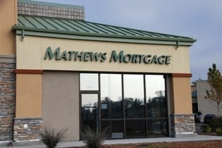
3006 State Highway 49, Cool, CA 95614


Property Detail
3006 State Highway 49
071-080-006-000
SEC 18 12 9
Storebuilding
EL DORADO
C
California
B and X Area of moderate flood hazard, usually the area between the limits of the 100-year and 500-year floods.
1.35 AC
2024
Outer El Dorado Cnty
2025
Sacramento
030601
Sacramento-Roseville-Folsom, CA
10,019 SF
NEARBY LISTINGS FOR SALE OR LEASE
DEMOGRAPHICS near 3006 State Highway 49
1 mile
3 mile
5 mile
2025 Total Population
265
5,304
27,355
2030 Population
255
5,362
28,236
Pop Growth 2025-2030
(3.77%)
+ 1.09%
+ 3.22%
Average Age
49
46
46
2025 Total Households
109
2,306
11,738
HH Growth 2025-2030
(3.67%)
+ 1.34%
+ 3.32%
Median Household Inc
$128,125
$102,083
$85,159
Avg Household Size
2.40
2.30
2.30
2025 Avg HH Vehicles
2.00
2.00
2.00
Median Home Value
$537,234
$634,114
$648,634
Median Year Built
1987
1983
1980
Nearby Places
Map Layers
Map Styles
 Street
 Aerial
Layers
 Traffic
 Biking
Places
Listings with unknown addresses are not visible on the map
- Restaurants
- Banks
- Shops
- Fitness
- Groceries
PUBLIC TRANSPORTATION
COMMUTER RAIL
Auburn-Conheim (Capitol Corridor - Capitol Corridor Joint Powers Authority)
Drive
Walk
Distance
Auburn-Conheim (Capitol Corridor - Capitol Corridor Joint Powers Authority)
16 min
6.9 mi
Auburn Amtrak (Capitol Corridor - Amtrak)
Drive
Walk
Distance
Auburn Amtrak (Capitol Corridor - Amtrak)
16 min
7.0 mi
Freight Ports
Port of Stockton
Drive
Walk
Distance
Port of Stockton
107 min
86.9 mi
SALE & LEASE HISTORY
LISTING DATE
SALE/LEASE

Nov 19, 2024
For Lease
Nearby Properties
Address
Land Use
TOTAL SIZE
Lot Size
Zoning
Address
Land Use
TOTAL SIZE
Lot Size
Zoning
8,856 SF
0.52 AC
Address
Land Use
TOTAL SIZE
Lot Size
Zoning
25,644 SF
2.61 AC
CG
Address
Land Use
TOTAL SIZE
Lot Size
Zoning
17,424 SF
0.66 AC
Address
Land Use
TOTAL SIZE
Lot Size
Zoning
9,100 SF
1.69 AC
CG
Address
Land Use
TOTAL SIZE
Lot Size
Zoning
12,084 SF
0.59 AC
Address
Land Use
TOTAL SIZE
Lot Size
Zoning
9,192 SF
0.65 AC
Address
Land Use
TOTAL SIZE
Lot Size
Zoning
37,117 SF
2 AC
Address
Land Use
TOTAL SIZE
Lot Size
Zoning
38,835 SF
0.53 AC
Address
Land Use
TOTAL SIZE
Lot Size
Zoning
12,103 SF
3.72 AC
C
Address
Land Use
TOTAL SIZE
Lot Size
Zoning
6,841 SF
1 AC
Address
Land Use
TOTAL SIZE
Lot Size
Zoning
8,462 SF
0.43 AC
Address
Land Use
TOTAL SIZE
Lot Size
Zoning
2,807 SF
4.50 AC
R2A
Address
Land Use
TOTAL SIZE
Lot Size
Zoning
4,400 SF
0.73 AC
CG
Address
Land Use
TOTAL SIZE
Lot Size
Zoning
2,176 SF
0.78 AC
Address
Land Use
TOTAL SIZE
Lot Size
Zoning
11,394 SF
1.10 AC
Address
Land Use
TOTAL SIZE
Lot Size
Zoning
5,688 SF
0.35 AC
Address
Land Use
TOTAL SIZE
Lot Size
Zoning
8,658 SF
0.66 AC
Address
Land Use
TOTAL SIZE
Lot Size
Zoning
4,682 SF
0.11 AC
Address
Land Use
TOTAL SIZE
Lot Size
Zoning
10,244 SF
0.46 AC
Address
Land Use
TOTAL SIZE
Lot Size
Zoning
244.45 AC
RE
Address
Land Use
TOTAL SIZE
Lot Size
Zoning
6,574 SF
1.86 AC
CG
Address
Land Use
TOTAL SIZE
Lot Size
Zoning
13,875 SF
0.57 AC
Address
Land Use
TOTAL SIZE
Lot Size
Zoning
1,260 SF
0.44 AC
Address
Land Use
TOTAL SIZE
Lot Size
Zoning
8,480 SF
0.56 AC
Address
Land Use
TOTAL SIZE
Lot Size
Zoning
7,000 SF
2.01 AC
C
Address
Land Use
TOTAL SIZE
Lot Size
Zoning
5,640 SF
0.46 AC
Address
Land Use
TOTAL SIZE
Lot Size
Zoning
6,836 SF
0.43 AC
Address
Land Use
TOTAL SIZE
Lot Size
Zoning
6,000 SF
0.15 AC
Address
Land Use
TOTAL SIZE
Lot Size
Zoning
15,783 SF
2.15 AC
The World's #1 Commercial Real Estate Marketplace
Connect with us
© 2026 CoStar Group
The information above has been obtained from sources believed reliable. While we do not doubt its accuracy we have not verified it and make no guarantee, warranty or representation about it. It is your responsibility to independently confirm its accuracy and completeness. Any projections, opinions, assumptions, or estimates used are for example only and do not represent the current or future performance of the property. The value of this transaction to you depends on tax and other factors which should be evaluated by your tax, financial, and legal advisors. You and your advisors should conduct a careful, independent investigation of the property to determine to your satisfaction the suitability of the property for your needs.