Property Record
3008 6Th St, Riverside, CA 92507
Property Detail
3008 6Th St
Riverside-San Bernardino-Ontario, CA
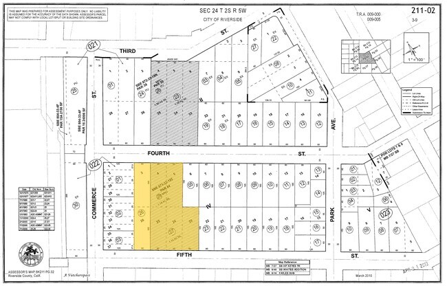
.22 ACRES M/L IN POR LOTS 3 & 26 BLK 8 MB 006/048 E P BURNHAMS SUB
211-072-021
RIVERSIDE
Commercialacreage
California
B and X Area of moderate flood hazard, usually the area between the limits of the 100-year and 500-year floods.
3,26
2024
1.46 AC
2025
Riverside
030400
Inland Empire (California)
NEARBY LISTINGS FOR SALE OR LEASE
DEMOGRAPHICS near 3008 6Th St
1 mile
3 mile
5 mile
2025 Total Population
22,802
114,957
234,723
2030 Population
23,533
117,516
240,022
Pop Growth 2025-2030
+ 3.21%
+ 2.23%
+ 2.26%
Average Age
35
35
36
2025 Total Households
6,832
35,136
71,159
HH Growth 2025-2030
+ 3.04%
+ 1.81%
+ 1.89%
Median Household Inc
$65,408
$80,045
$89,586
Avg Household Size
2.90
2.90
3.00
2025 Avg HH Vehicles
2.00
2.00
2.00
Median Home Value
$535,253
$613,222
$618,511
Median Year Built
1958
1970
1974
Nearby Places
Map Layers
Map Styles
 Street
 Aerial
Layers
 Traffic
 Biking
Places
Listings with unknown addresses are not visible on the map
- Restaurants
- Banks
- Shops
- Fitness
- Groceries
PUBLIC TRANSPORTATION
COMMUTER RAIL
Riverside-Downtown (91 Line - Southern California Regional Rail Authority (Metrolink), Inland Empire-Orange County Line - Southern California Regional Rail Authority (Metrolink), Riverside Line - Southern California Regional Rail Authority (Metrolink))
Drive
Walk
Distance
Riverside-Downtown (91 Line - Southern California Regional Rail Authority (Metrolink), Inland Empire-Orange County Line - Southern California Regional Rail Authority (Metrolink), Riverside Line - Southern California Regional Rail Authority (Metrolink))
3 min
9 min
0.5 mi
Riverside-Hunter Park/Ucr (Metrolink 91-Perris Valley Line - Metrolink Trains)
Drive
Walk
Distance
Riverside-Hunter Park/Ucr (Metrolink 91-Perris Valley Line - Metrolink Trains)
5 min
3.2 mi
AIRPORT
Ontario International
Drive
Walk
Distance
Ontario International
24 min
17.8 mi
Freight Ports
Port of Long Beach
Drive
Walk
Distance
Port of Long Beach
73 min
56.8 mi
Nearby Properties
Address
Land Use
TOTAL SIZE
Lot Size
Zoning
Address
Land Use
TOTAL SIZE
Lot Size
Zoning
412,950 SF
23.16 AC
C2
Address
Land Use
TOTAL SIZE
Lot Size
Zoning
247,416 SF
10.17 AC
Address
Land Use
TOTAL SIZE
Lot Size
Zoning
494,575 SF
25.33 AC
MP
Address
Land Use
TOTAL SIZE
Lot Size
Zoning
350,278 SF
1.21 AC
Address
Land Use
TOTAL SIZE
Lot Size
Zoning
126,036 SF
30.90 AC
Address
Land Use
TOTAL SIZE
Lot Size
Zoning
26,879 SF
16.27 AC
R3
Address
Land Use
TOTAL SIZE
Lot Size
Zoning
217,036 SF
1.66 AC
C2
Address
Land Use
TOTAL SIZE
Lot Size
Zoning
156,241 SF
2.55 AC
Address
Land Use
TOTAL SIZE
Lot Size
Zoning
209,734 SF
10.87 AC
R3
Address
Land Use
TOTAL SIZE
Lot Size
Zoning
139,454 SF
0.97 AC
DSP
Address
Land Use
TOTAL SIZE
Lot Size
Zoning
37,729 SF
3.23 AC
Address
Land Use
TOTAL SIZE
Lot Size
Zoning
36,010 SF
11.76 AC
R3
Address
Land Use
TOTAL SIZE
Lot Size
Zoning
87,600 SF
0.39 AC
Address
Land Use
TOTAL SIZE
Lot Size
Zoning
244,495 SF
17.53 AC
MH
Address
Land Use
TOTAL SIZE
Lot Size
Zoning
134,944 SF
2.52 AC
Address
Land Use
TOTAL SIZE
Lot Size
Zoning
415,990 SF
5.16 AC
Address
Land Use
TOTAL SIZE
Lot Size
Zoning
307,163 SF
16.65 AC
Address
Land Use
TOTAL SIZE
Lot Size
Zoning
122,023 SF
6.83 AC
Address
Land Use
TOTAL SIZE
Lot Size
Zoning
230,063 SF
11.06 AC
Address
Land Use
TOTAL SIZE
Lot Size
Zoning
26.48 AC
R3
Address
Land Use
TOTAL SIZE
Lot Size
Zoning
272,472 SF
24.49 AC
N2
Address
Land Use
TOTAL SIZE
Lot Size
Zoning
304,560 SF
16.79 AC
IP
Address
Land Use
TOTAL SIZE
Lot Size
Zoning
69,660 SF
0.62 AC
C3
Address
Land Use
TOTAL SIZE
Lot Size
Zoning
108,930 SF
4.89 AC
Address
Land Use
TOTAL SIZE
Lot Size
Zoning
446,832 SF
5.03 AC
Address
Land Use
TOTAL SIZE
Lot Size
Zoning
The World's #1 Commercial Real Estate Marketplace
Connect with us
© 2026 CoStar Group
The information above has been obtained from sources believed reliable. While we do not doubt its accuracy we have not verified it and make no guarantee, warranty or representation about it. It is your responsibility to independently confirm its accuracy and completeness. Any projections, opinions, assumptions, or estimates used are for example only and do not represent the current or future performance of the property. The value of this transaction to you depends on tax and other factors which should be evaluated by your tax, financial, and legal advisors. You and your advisors should conduct a careful, independent investigation of the property to determine to your satisfaction the suitability of the property for your needs.