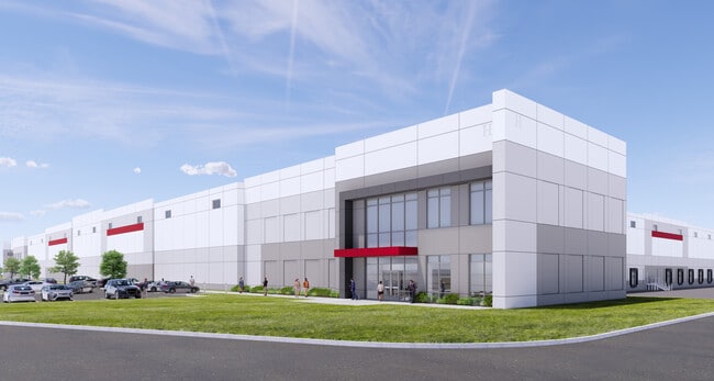
Property Record
3009 E 500 N, Whiteland, IN 46184
Current Lease Availabilities
NEARBY LISTINGS FOR SALE OR LEASE
Property Detail
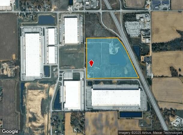
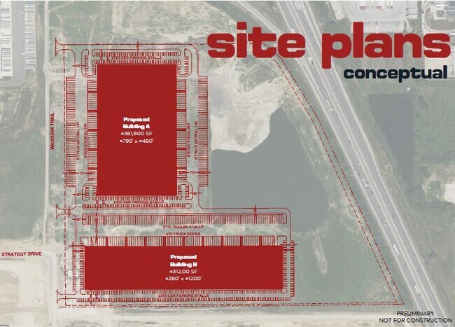
3009 E 500 N
Indianapolis
Whiteland 95
Indianapolis-Carmel-Anderson, IN
Johnson
41-05-25-022-004.000-059
Indiana
Ruralagriculturalresidence
64.43 AC
3,594 SF
Johnson County
DEMOGRAPHICS near 3009 E 500 N
1 Mile
3 Mile
5 Mile
2024 Total Population
197
13,295
66,070
2029 Population
220
14,988
74,124
Pop Growth 2024-2029
+ 11.68%
+ 12.73%
+ 12.19%
Average Age
36
38
38
2024 Total Households
66
4,722
24,090
HH Growth 2024-2029
+ 12.12%
+ 13.09%
+ 12.57%
Median Household Inc
$83,593
$76,944
$78,441
Avg Household Size
3.00
2.80
2.70
2024 Avg HH Vehicles
2.00
2.00
2.00
Median Home Value
$226,000
$173,671
$194,541
Median Year Built
2000
1995
1996
Nearby Places
- Restaurants
- Banks
- Shops
- Fitness
- Groceries
PUBLIC TRANSPORTATION
AIRPORT
Indianapolis International
DRIVE
WALK
Distance
Indianapolis International
46 min
29.2 mi
Freight Ports
Port of Toledo
DRIVE
WALK
Distance
Port of Toledo
291 min
241.1 mi
Nearby Properties
Address
Land Use
TOTAL SIZE
Lot Size
Zoning
Address
Land Use
TOTAL SIZE
Lot Size
Zoning
1,057,350 SF
60.62 AC
Address
Land Use
TOTAL SIZE
Lot Size
Zoning
984,410 SF
73.31 AC
Address
Land Use
TOTAL SIZE
Lot Size
Zoning
845,880 SF
45.31 AC
Address
Land Use
TOTAL SIZE
Lot Size
Zoning
1,103,760 SF
84.07 AC
Address
Land Use
TOTAL SIZE
Lot Size
Zoning
997,650 SF
67.25 AC
Address
Land Use
TOTAL SIZE
Lot Size
Zoning
826,800 SF
62.89 AC
Address
Land Use
TOTAL SIZE
Lot Size
Zoning
34.59 AC
Address
Land Use
TOTAL SIZE
Lot Size
Zoning
588,200 SF
44.31 AC
Address
Land Use
TOTAL SIZE
Lot Size
Zoning
530,400 SF
29.63 AC
Address
Land Use
TOTAL SIZE
Lot Size
Zoning
32.60 AC
Address
Land Use
TOTAL SIZE
Lot Size
Zoning
1,792 SF
66.50 AC
Address
Land Use
TOTAL SIZE
Lot Size
Zoning
232,709 SF
51.30 AC
Address
Land Use
TOTAL SIZE
Lot Size
Zoning
136,760 SF
31.47 AC
Address
Land Use
TOTAL SIZE
Lot Size
Zoning
178,880 SF
9.03 AC
Address
Land Use
TOTAL SIZE
Lot Size
Zoning
168,480 SF
8.42 AC
Address
Land Use
TOTAL SIZE
Lot Size
Zoning
130,440 SF
10.05 AC
Address
Land Use
TOTAL SIZE
Lot Size
Zoning
114,852 SF
8.50 AC
Address
Land Use
TOTAL SIZE
Lot Size
Zoning
20.19 AC
Address
Land Use
TOTAL SIZE
Lot Size
Zoning
7.19 AC
Address
Land Use
TOTAL SIZE
Lot Size
Zoning
119,416 SF
11.51 AC
Address
Land Use
TOTAL SIZE
Lot Size
Zoning
160,700 SF
25.56 AC
Address
Land Use
TOTAL SIZE
Lot Size
Zoning
140,328 SF
20 AC
Address
Land Use
TOTAL SIZE
Lot Size
Zoning
290,449 SF
22.82 AC
Address
Land Use
TOTAL SIZE
Lot Size
Zoning
68,423 SF
41.73 AC
Address
Land Use
TOTAL SIZE
Lot Size
Zoning
100,672 SF
25.32 AC
Address
Land Use
TOTAL SIZE
Lot Size
Zoning
17,021 SF
30.20 AC
B2
Address
Land Use
TOTAL SIZE
Lot Size
Zoning
92,842 SF
27.26 AC
Address
Land Use
TOTAL SIZE
Lot Size
Zoning
63,776 SF
24.53 AC
Address
Land Use
TOTAL SIZE
Lot Size
Zoning
50,400 SF
13.11 AC
Address
Land Use
TOTAL SIZE
Lot Size
Zoning
10,456 SF
9.29 AC
B2
The World's #1 Commercial Real Estate Marketplace
Connect with us
© 2025 CoStar Group
The information above has been obtained from sources believed reliable. While we do not doubt its accuracy we have not verified it and make no guarantee, warranty or representation about it. It is your responsibility to independently confirm its accuracy and completeness. Any projections, opinions, assumptions, or estimates used are for example only and do not represent the current or future performance of the property. The value of this transaction to you depends on tax and other factors which should be evaluated by your tax, financial, and legal advisors. You and your advisors should conduct a careful, independent investigation of the property to determine to your satisfaction the suitability of the property for your needs.