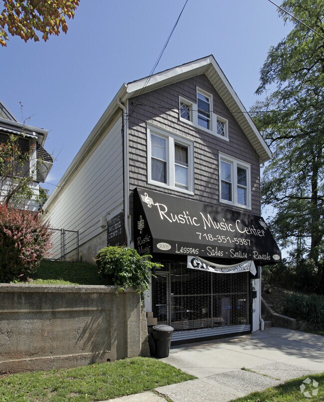
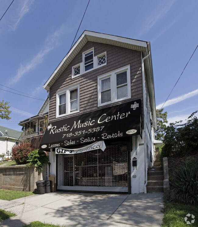
Property Record
3009 Richmond Rd, Staten Island, NY 10306
NEARBY LISTINGS FOR SALE OR LEASE
Property Detail
3009 Richmond Rd
00947-0012
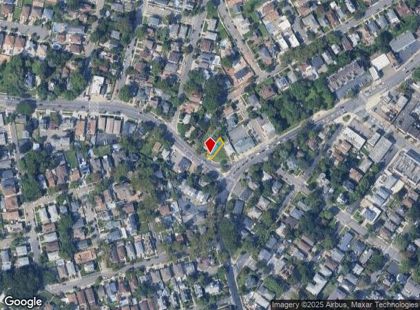
Map Of Crown Park New Dorp Middletown St
Commercialofficeresidentialmixeduse
Staten Island
X
New York
3604970328F
12
2024
0.06 AC
2025
Staten Island
018100
Long Island (New York)
1,814 SF
New York-Jersey City-White Plains, NY-NJ
DEMOGRAPHICS near 3009 Richmond Rd
1 Mile
3 Mile
5 Mile
2024 Total Population
25,788
196,990
434,780
2029 Population
25,527
194,377
428,326
Pop Growth 2024-2029
(1.01%)
(1.33%)
(1.48%)
Average Age
44
42
41
2024 Total Households
9,381
69,955
151,025
HH Growth 2024-2029
(1.10%)
(1.37%)
(1.51%)
Median Household Inc
$95,517
$93,684
$87,701
Avg Household Size
2.70
2.70
2.80
2024 Avg HH Vehicles
2.00
2.00
2.00
Median Home Value
$703,477
$676,820
$647,199
Median Year Built
1963
1972
1972
Nearby Places
Map Layers
Map Styles
 Street
 Aerial
- Restaurants
- Banks
- Shops
- Fitness
- Groceries
PUBLIC TRANSPORTATION
TRANSIT/SUBWAY
New Dorp (Staten Island Railway - New York MTA Subway (The Subway))
DRIVE
WALK
Distance
New Dorp (Staten Island Railway - New York MTA Subway (The Subway))
2 min
6 min
0.3 mi
Grant City (Staten Island Railway - New York MTA Subway (The Subway))
DRIVE
WALK
Distance
Grant City (Staten Island Railway - New York MTA Subway (The Subway))
3 min
17 min
0.9 mi
Oakwood Heights (Staten Island Railway - New York MTA Subway (The Subway))
DRIVE
WALK
Distance
Oakwood Heights (Staten Island Railway - New York MTA Subway (The Subway))
3 min
19 min
0.9 mi
COMMUTER RAIL
New Dorp (Staten Island Railway - New York MTA Subway (The Subway))
DRIVE
WALK
Distance
New Dorp (Staten Island Railway - New York MTA Subway (The Subway))
1 min
7 min
0.3 mi
Grant City (Staten Island Railway - New York MTA Subway (The Subway))
DRIVE
WALK
Distance
Grant City (Staten Island Railway - New York MTA Subway (The Subway))
3 min
17 min
0.9 mi
AIRPORT
Newark Liberty International
DRIVE
WALK
Distance
Newark Liberty International
28 min
16.0 mi
LaGuardia
DRIVE
WALK
Distance
LaGuardia
44 min
23.3 mi
John F Kennedy International
DRIVE
WALK
Distance
John F Kennedy International
47 min
25.8 mi
Freight Ports
New York Container Terminal
DRIVE
WALK
Distance
New York Container Terminal
15 min
6.8 mi
Nearby Properties
Address
Land Use
TOTAL SIZE
Lot Size
Zoning
Address
Land Use
TOTAL SIZE
Lot Size
Zoning
3,600 SF
731.18 AC
PARK
Address
Land Use
TOTAL SIZE
Lot Size
Zoning
633,280 SF
202.90 AC
R3-2
Address
Land Use
TOTAL SIZE
Lot Size
Zoning
686,130 SF
189.62 AC
R3-2
Address
Land Use
TOTAL SIZE
Lot Size
Zoning
1,258,042 SF
14.47 AC
C4-1
Address
Land Use
TOTAL SIZE
Lot Size
Zoning
640,077 SF
19.34 AC
R3-1
Address
Land Use
TOTAL SIZE
Lot Size
Zoning
146 AC
PARK
Address
Land Use
TOTAL SIZE
Lot Size
Zoning
566,000 SF
103.31 AC
R3-2
Address
Land Use
TOTAL SIZE
Lot Size
Zoning
135,000 SF
117.71 AC
PARK
Address
Land Use
TOTAL SIZE
Lot Size
Zoning
310,560 SF
15.90 AC
C4-1
Address
Land Use
TOTAL SIZE
Lot Size
Zoning
494,840 SF
34.77 AC
R3-2
Address
Land Use
TOTAL SIZE
Lot Size
Zoning
195,395 SF
12.04 AC
R3-2
Address
Land Use
TOTAL SIZE
Lot Size
Zoning
418,012 SF
6.74 AC
R3-1
Address
Land Use
TOTAL SIZE
Lot Size
Zoning
421,275 SF
18.95 AC
R3-2
Address
Land Use
TOTAL SIZE
Lot Size
Zoning
111,000 SF
186.03 AC
PARK
Address
Land Use
TOTAL SIZE
Lot Size
Zoning
294,320 SF
15 AC
R3-2
Address
Land Use
TOTAL SIZE
Lot Size
Zoning
505,000 SF
3.79 AC
R3A
Address
Land Use
TOTAL SIZE
Lot Size
Zoning
240 SF
47.41 AC
R3-2
Address
Land Use
TOTAL SIZE
Lot Size
Zoning
476,145 SF
50.97 AC
R3-1
Address
Land Use
TOTAL SIZE
Lot Size
Zoning
48,500 SF
61.98 AC
R3-2
Address
Land Use
TOTAL SIZE
Lot Size
Zoning
74,000 SF
523.69 AC
R3-2
Address
Land Use
TOTAL SIZE
Lot Size
Zoning
377,678 SF
25.40 AC
C4-1
Address
Land Use
TOTAL SIZE
Lot Size
Zoning
77,502 SF
1.29 AC
R3-1
Address
Land Use
TOTAL SIZE
Lot Size
Zoning
900 SF
50 AC
R1-1
Address
Land Use
TOTAL SIZE
Lot Size
Zoning
319,000 SF
18.76 AC
C4-1
Address
Land Use
TOTAL SIZE
Lot Size
Zoning
151,637 SF
7.41 AC
C4-1
Address
Land Use
TOTAL SIZE
Lot Size
Zoning
45,570 SF
206.38 AC
PARKUS
Address
Land Use
TOTAL SIZE
Lot Size
Zoning
26.45 AC
PARK
Address
Land Use
TOTAL SIZE
Lot Size
Zoning
7,410 SF
44.60 AC
R1-1
Address
Land Use
TOTAL SIZE
Lot Size
Zoning
37.30 AC
PARK
Address
Land Use
TOTAL SIZE
Lot Size
Zoning
180,000 SF
2.28 AC
R2
The World's #1 Commercial Real Estate Marketplace
Connect with us
© 2025 CoStar Group
The information above has been obtained from sources believed reliable. While we do not doubt its accuracy we have not verified it and make no guarantee, warranty or representation about it. It is your responsibility to independently confirm its accuracy and completeness. Any projections, opinions, assumptions, or estimates used are for example only and do not represent the current or future performance of the property. The value of this transaction to you depends on tax and other factors which should be evaluated by your tax, financial, and legal advisors. You and your advisors should conduct a careful, independent investigation of the property to determine to your satisfaction the suitability of the property for your needs.