Property Record
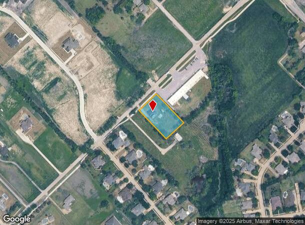
301 Hubbard Dr, Rockwall, TX 75032

NEARBY LISTINGS FOR SALE OR LEASE
Property Detail
301 Hubbard Dr
Dallas-Fort Worth-Arlington, TX
Pierce Hall Addition
10459
Rockwall
Sfr
Texas
X
0.96 AC
48113C0405K
Rockwall
2,158 SF
Dallas/Ft Worth
DEMOGRAPHICS near 301 Hubbard Dr
1 Mile
3 Mile
5 Mile
2024 Total Population
2,033
26,989
73,605
2029 Population
2,819
38,880
98,743
Pop Growth 2024-2029
+ 38.66%
+ 44.06%
+ 34.15%
Average Age
40
36
37
2024 Total Households
702
8,769
25,714
HH Growth 2024-2029
+ 38.89%
+ 43.43%
+ 32.62%
Median Household Inc
$186,238
$117,360
$98,678
Avg Household Size
2.90
3.10
2.80
2024 Avg HH Vehicles
3.00
2.00
2.00
Median Home Value
$463,300
$343,246
$319,941
Median Year Built
2008
2010
2004
Nearby Places
- Restaurants
- Banks
- Shops
- Fitness
- Groceries
PUBLIC TRANSPORTATION
AIRPORT
Dallas Love Field
DRIVE
WALK
Distance
Dallas Love Field
43 min
29.3 mi
Freight Ports
Port of Shreveport
DRIVE
WALK
Distance
Port of Shreveport
198 min
183.4 mi
SALE & LEASE HISTORY
LISTING DATE
SALE/LEASE

Nov 06, 2017
For Sale
May 04, 2017
For Sale
Nearby Properties
Address
Land Use
TOTAL SIZE
Lot Size
Zoning
Address
Land Use
TOTAL SIZE
Lot Size
Zoning
326,408 SF
74.12 AC
Address
Land Use
TOTAL SIZE
Lot Size
Zoning
226,384 SF
36.03 AC
Address
Land Use
TOTAL SIZE
Lot Size
Zoning
101,842 SF
12.13 AC
Address
Land Use
TOTAL SIZE
Lot Size
Zoning
67,511 SF
12.36 AC
Address
Land Use
TOTAL SIZE
Lot Size
Zoning
31,250 SF
2.04 AC
Address
Land Use
TOTAL SIZE
Lot Size
Zoning
54,949 SF
5.62 AC
Address
Land Use
TOTAL SIZE
Lot Size
Zoning
17,180 SF
1.64 AC
Address
Land Use
TOTAL SIZE
Lot Size
Zoning
20,084 SF
3.10 AC
Address
Land Use
TOTAL SIZE
Lot Size
Zoning
5,246 SF
Address
Land Use
TOTAL SIZE
Lot Size
Zoning
12,000 SF
147.17 AC
Address
Land Use
TOTAL SIZE
Lot Size
Zoning
3,000 SF
181.74 AC
Address
Land Use
TOTAL SIZE
Lot Size
Zoning
12,705 SF
3.08 AC
Address
Land Use
TOTAL SIZE
Lot Size
Zoning
7,200 SF
139.90 AC
Address
Land Use
TOTAL SIZE
Lot Size
Zoning
14,225 SF
1.36 AC
Address
Land Use
TOTAL SIZE
Lot Size
Zoning
11,484 SF
1.04 AC
Address
Land Use
TOTAL SIZE
Lot Size
Zoning
57,230 SF
4.73 AC
Address
Land Use
TOTAL SIZE
Lot Size
Zoning
25,907 SF
6 AC
Address
Land Use
TOTAL SIZE
Lot Size
Zoning
17,054 SF
26.69 AC
Address
Land Use
TOTAL SIZE
Lot Size
Zoning
183.55 AC
Address
Land Use
TOTAL SIZE
Lot Size
Zoning
24,762 SF
7.37 AC
Address
Land Use
TOTAL SIZE
Lot Size
Zoning
18,428 SF
3.61 AC
Address
Land Use
TOTAL SIZE
Lot Size
Zoning
2,697 SF
8.05 AC
Address
Land Use
TOTAL SIZE
Lot Size
Zoning
14,587 SF
1.79 AC
Address
Land Use
TOTAL SIZE
Lot Size
Zoning
13,074 SF
25.63 AC
Address
Land Use
TOTAL SIZE
Lot Size
Zoning
8,571 SF
0.70 AC
Address
Land Use
TOTAL SIZE
Lot Size
Zoning
10,537 SF
6 AC
Address
Land Use
TOTAL SIZE
Lot Size
Zoning
6,750 SF
3.80 AC
Address
Land Use
TOTAL SIZE
Lot Size
Zoning
5.12 AC
Address
Land Use
TOTAL SIZE
Lot Size
Zoning
4,710 SF
2.50 AC
Address
Land Use
TOTAL SIZE
Lot Size
Zoning
9,013 SF
14.89 AC
The World's #1 Commercial Real Estate Marketplace
Connect with us
© 2025 CoStar Group
The information above has been obtained from sources believed reliable. While we do not doubt its accuracy we have not verified it and make no guarantee, warranty or representation about it. It is your responsibility to independently confirm its accuracy and completeness. Any projections, opinions, assumptions, or estimates used are for example only and do not represent the current or future performance of the property. The value of this transaction to you depends on tax and other factors which should be evaluated by your tax, financial, and legal advisors. You and your advisors should conduct a careful, independent investigation of the property to determine to your satisfaction the suitability of the property for your needs.