Property Record
301 Alliance Pkwy, Williamston, SC 29697
NEARBY LISTINGS FOR SALE OR LEASE
Property Detail
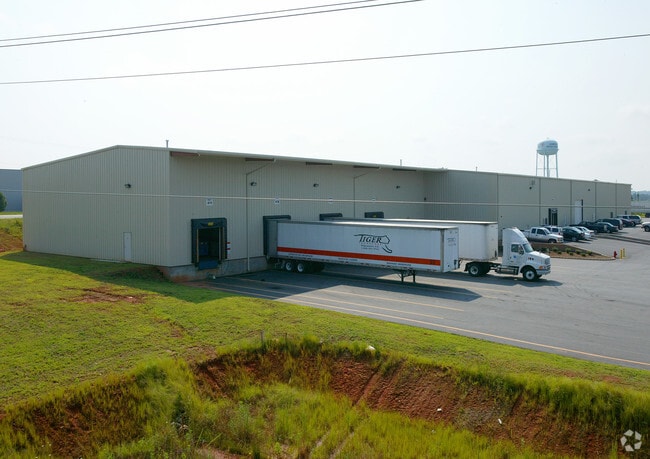
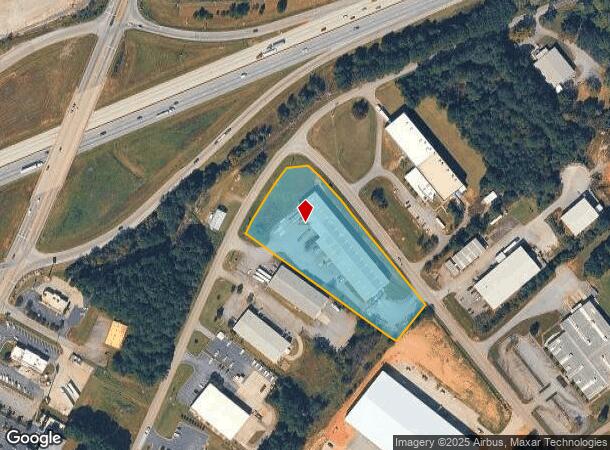
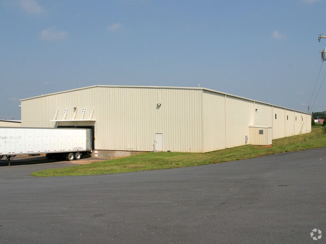
301 Alliance Pkwy
169-00-13-039
CP 114/860 F000 D000 ALLIANCE PKWY 3.28 AC
Warehouse
Anderson
X
South Carolina
45007C0140F
3.28 AC
2025
Outlying Anderson Co
2024
Greenville/Spartanburg
010404
Greenville-Anderson-Greer, SC
33,680 SF
DEMOGRAPHICS near 301 Alliance Pkwy
1 Mile
3 Mile
5 Mile
2024 Total Population
270
5,535
20,306
2029 Population
289
5,924
21,727
Pop Growth 2024-2029
+ 7.04%
+ 7.03%
+ 7.00%
Average Age
40
41
41
2024 Total Households
95
1,984
7,460
HH Growth 2024-2029
+ 7.37%
+ 7.11%
+ 7.09%
Median Household Inc
$71,249
$73,578
$74,058
Avg Household Size
2.80
2.80
2.70
2024 Avg HH Vehicles
2.00
2.00
2.00
Median Home Value
$365,999
$332,738
$258,720
Median Year Built
2004
2004
1997
Nearby Places
Map Layers
Map Styles
 Street
 Aerial
- Restaurants
- Banks
- Shops
- Fitness
- Groceries
PUBLIC TRANSPORTATION
AIRPORT
Greenville Spartanburg International
DRIVE
WALK
Distance
Greenville Spartanburg International
42 min
31.8 mi
Nearby Properties
Address
Land Use
TOTAL SIZE
Lot Size
Zoning
Address
Land Use
TOTAL SIZE
Lot Size
Zoning
109.52 AC
Address
Land Use
TOTAL SIZE
Lot Size
Zoning
41.61 AC
Address
Land Use
TOTAL SIZE
Lot Size
Zoning
89.88 AC
Address
Land Use
TOTAL SIZE
Lot Size
Zoning
59.13 AC
Address
Land Use
TOTAL SIZE
Lot Size
Zoning
29.70 AC
Address
Land Use
TOTAL SIZE
Lot Size
Zoning
6.12 AC
Address
Land Use
TOTAL SIZE
Lot Size
Zoning
4.63 AC
Address
Land Use
TOTAL SIZE
Lot Size
Zoning
33.41 AC
Address
Land Use
TOTAL SIZE
Lot Size
Zoning
46,659 SF
2 AC
Address
Land Use
TOTAL SIZE
Lot Size
Zoning
45,085 SF
6.96 AC
Address
Land Use
TOTAL SIZE
Lot Size
Zoning
16.80 AC
Address
Land Use
TOTAL SIZE
Lot Size
Zoning
34,568 SF
1.85 AC
Address
Land Use
TOTAL SIZE
Lot Size
Zoning
3,835 SF
2.98 AC
Address
Land Use
TOTAL SIZE
Lot Size
Zoning
1,328 SF
11.31 AC
Address
Land Use
TOTAL SIZE
Lot Size
Zoning
41.95 AC
Address
Land Use
TOTAL SIZE
Lot Size
Zoning
7,507 SF
7.73 AC
Address
Land Use
TOTAL SIZE
Lot Size
Zoning
2,420 SF
48.50 AC
Address
Land Use
TOTAL SIZE
Lot Size
Zoning
32,679 SF
15.75 AC
Address
Land Use
TOTAL SIZE
Lot Size
Zoning
1,884 SF
3.87 AC
Address
Land Use
TOTAL SIZE
Lot Size
Zoning
5,248 SF
7.03 AC
Address
Land Use
TOTAL SIZE
Lot Size
Zoning
1,768 SF
7.33 AC
Address
Land Use
TOTAL SIZE
Lot Size
Zoning
12,149 SF
8.91 AC
Address
Land Use
TOTAL SIZE
Lot Size
Zoning
943 SF
0.92 AC
Address
Land Use
TOTAL SIZE
Lot Size
Zoning
4,632 SF
2.43 AC
Address
Land Use
TOTAL SIZE
Lot Size
Zoning
7,200 SF
3.70 AC
Address
Land Use
TOTAL SIZE
Lot Size
Zoning
9,149 SF
1.82 AC
Address
Land Use
TOTAL SIZE
Lot Size
Zoning
9,508 SF
2.57 AC
Address
Land Use
TOTAL SIZE
Lot Size
Zoning
1.79 AC
The World's #1 Commercial Real Estate Marketplace
Connect with us
© 2026 CoStar Group
The information above has been obtained from sources believed reliable. While we do not doubt its accuracy we have not verified it and make no guarantee, warranty or representation about it. It is your responsibility to independently confirm its accuracy and completeness. Any projections, opinions, assumptions, or estimates used are for example only and do not represent the current or future performance of the property. The value of this transaction to you depends on tax and other factors which should be evaluated by your tax, financial, and legal advisors. You and your advisors should conduct a careful, independent investigation of the property to determine to your satisfaction the suitability of the property for your needs.