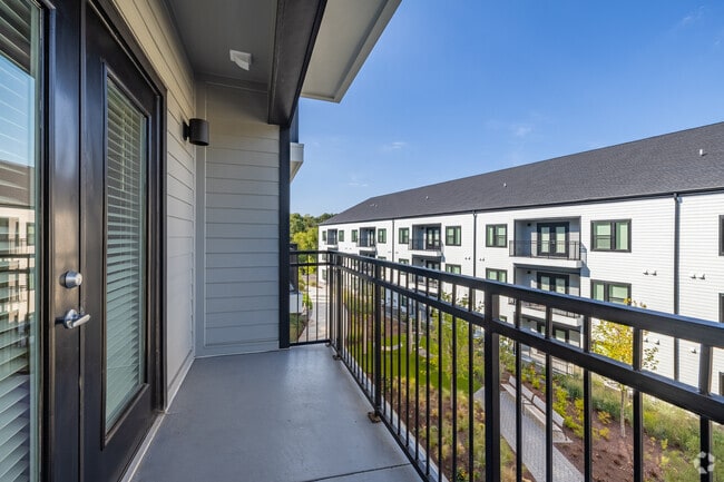
Property Record
301 Ben Allen Rd, Nashville, TN 37207

NEARBY LISTINGS FOR SALE OR LEASE
-
-
No Photo
-
-
-
-
View all Nashville listings for sale on LoopNet.com
Property Detail
301 Ben Allen Rd
061-00-0-017
Maplewood Graymer Acres
Apartment
N SIDE BEN ALLEN RD E OF HILLSIDE RD
X
Davidson
47037C0232H
Tennessee
0
10.71 AC
2025
Talbot's Corner
011001
Nashville
37,730 SF
Nashville-Davidson--Murfreesboro--Franklin, TN
DEMOGRAPHICS near 301 Ben Allen Rd
1 Mile
3 Mile
5 Mile
2024 Total Population
5,815
72,051
168,500
2029 Population
5,792
72,643
169,894
Pop Growth 2024-2029
(0.40%)
+ 0.82%
+ 0.83%
Average Age
38
37
38
2024 Total Households
2,339
29,971
73,500
HH Growth 2024-2029
(0.68%)
+ 0.53%
+ 0.82%
Median Household Inc
$54,520
$58,142
$61,319
Avg Household Size
2.40
2.30
2.20
2024 Avg HH Vehicles
2.00
2.00
2.00
Median Home Value
$307,775
$338,902
$337,480
Median Year Built
1973
1977
1983
Nearby Places
Map Layers
Map Styles
 Street
 Aerial
- Restaurants
- Banks
- Shops
- Fitness
- Groceries
PUBLIC TRANSPORTATION
COMMUTER RAIL
Riverfront (East Corridor Line - Tennessee Regional Transportation Authority Music City Star (Music City Star))
DRIVE
WALK
Distance
Riverfront (East Corridor Line - Tennessee Regional Transportation Authority Music City Star (Music City Star))
11 min
6.2 mi
AIRPORT
Nashville International
DRIVE
WALK
Distance
Nashville International
21 min
13.6 mi
Freight Ports
Port of Mobile
DRIVE
WALK
Distance
Port of Mobile
494 min
451.1 mi
Nearby Properties
Address
Land Use
TOTAL SIZE
Lot Size
Zoning
Address
Land Use
TOTAL SIZE
Lot Size
Zoning
267,538 SF
1.78 AC
MULTI-ZONE
Address
Land Use
TOTAL SIZE
Lot Size
Zoning
43,022 SF
17.02 AC
MULTIZONE
Address
Land Use
TOTAL SIZE
Lot Size
Zoning
25,326 SF
16.89 AC
SP
Address
Land Use
TOTAL SIZE
Lot Size
Zoning
27,585 SF
18.20 AC
SP
Address
Land Use
TOTAL SIZE
Lot Size
Zoning
34,160 SF
9.20 AC
R10
Address
Land Use
TOTAL SIZE
Lot Size
Zoning
363,125 SF
51.28 AC
MULTI-ZONE
Address
Land Use
TOTAL SIZE
Lot Size
Zoning
25,872 SF
13.31 AC
MUL
Address
Land Use
TOTAL SIZE
Lot Size
Zoning
74,132 SF
6.12 AC
SP
Address
Land Use
TOTAL SIZE
Lot Size
Zoning
29,064 SF
15.11 AC
MULTIZONE
Address
Land Use
TOTAL SIZE
Lot Size
Zoning
17,292 SF
12.35 AC
RM20
Address
Land Use
TOTAL SIZE
Lot Size
Zoning
327,884 SF
2.93 AC
SP
Address
Land Use
TOTAL SIZE
Lot Size
Zoning
73,439 SF
3.68 AC
MULTIZONE
Address
Land Use
TOTAL SIZE
Lot Size
Zoning
10,604 SF
17.59 AC
R8
Address
Land Use
TOTAL SIZE
Lot Size
Zoning
125,064 SF
5.13 AC
CS
Address
Land Use
TOTAL SIZE
Lot Size
Zoning
14,024 SF
MULTIZONE
Address
Land Use
TOTAL SIZE
Lot Size
Zoning
127,470 SF
6.13 AC
IR
Address
Land Use
TOTAL SIZE
Lot Size
Zoning
154,143 SF
8.88 AC
OG
Address
Land Use
TOTAL SIZE
Lot Size
Zoning
195,436 SF
33.31 AC
CA
Address
Land Use
TOTAL SIZE
Lot Size
Zoning
20.60 AC
RS10
Address
Land Use
TOTAL SIZE
Lot Size
Zoning
47,203 SF
8.19 AC
MUL-A
Address
Land Use
TOTAL SIZE
Lot Size
Zoning
25,116 SF
6.95 AC
SP
Address
Land Use
TOTAL SIZE
Lot Size
Zoning
337,915 SF
49.18 AC
IWD
Address
Land Use
TOTAL SIZE
Lot Size
Zoning
511,019 SF
38.69 AC
MULTIZONE
Address
Land Use
TOTAL SIZE
Lot Size
Zoning
162,261 SF
6.20 AC
RM40
Address
Land Use
TOTAL SIZE
Lot Size
Zoning
405,415 SF
22.69 AC
IWD
Address
Land Use
TOTAL SIZE
Lot Size
Zoning
22,212 SF
10.21 AC
IWD
Address
Land Use
TOTAL SIZE
Lot Size
Zoning
344,701 SF
5.04 AC
IWD
Address
Land Use
TOTAL SIZE
Lot Size
Zoning
162,500 SF
18.26 AC
IR
Address
Land Use
TOTAL SIZE
Lot Size
Zoning
13,950 SF
17.60 AC
R8
The World's #1 Commercial Real Estate Marketplace
Connect with us
© 2025 CoStar Group
The information above has been obtained from sources believed reliable. While we do not doubt its accuracy we have not verified it and make no guarantee, warranty or representation about it. It is your responsibility to independently confirm its accuracy and completeness. Any projections, opinions, assumptions, or estimates used are for example only and do not represent the current or future performance of the property. The value of this transaction to you depends on tax and other factors which should be evaluated by your tax, financial, and legal advisors. You and your advisors should conduct a careful, independent investigation of the property to determine to your satisfaction the suitability of the property for your needs.