Property Record
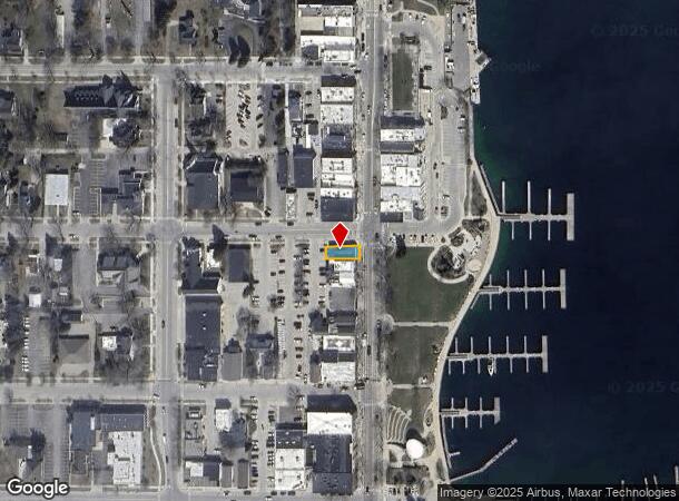
301 Bridge St, Charlevoix, MI 49720


NEARBY LISTINGS FOR SALE OR LEASE
-
-
View all Charlevoix listings for sale on LoopNet.com
Property Detail
301 Bridge St
05234700110
Original Plat City
Commercialnec
301 BRIDGE ST DDA BEG NE COR LOT 1 BLK 7 VIL OF CHX S 30FT3.5 W 73.3 FT N 30FT10 TO S LI OF CLINTON ST E TO POB PT LOTS 1 & 2
X
Charlevoix
26029C0309D
Michigan
2025
1-2
2025
0.10 AC
001500
Michigan North Central Area
1,950 SF
Other Market Areas
DEMOGRAPHICS near 301 Bridge St
1 mile
3 mile
5 mile
2024 Total Population
3,095
5,593
6,621
2029 Population
3,203
5,769
6,815
Pop Growth 2024-2029
+ 3.49%
+ 3.15%
+ 2.93%
Average Age
49
48
48
2024 Total Households
1,579
2,660
3,108
HH Growth 2024-2029
+ 3.48%
+ 3.16%
+ 2.96%
Median Household Inc
$45,676
$58,429
$61,019
Avg Household Size
1.90
2.00
2.10
2024 Avg HH Vehicles
1.00
2.00
2.00
Median Home Value
$239,648
$251,546
$248,060
Median Year Built
1967
1974
1976
Nearby Places
Map Layers
Map Styles
 Street
 Aerial
Transit
 Traffic
 Biking
Places
Listings with unknown addresses are not visible on the map
- Restaurants
- Banks
- Shops
- Fitness
- Groceries
SALE & LEASE HISTORY
LISTING DATE
SALE/LEASE

Sep 24, 2016
For Sale
Oct 17, 2016
For Sale
Nearby Properties
Address
Land Use
TOTAL SIZE
Lot Size
Zoning
Address
Land Use
TOTAL SIZE
Lot Size
Zoning
9,870 SF
34.80 AC
R1
Address
Land Use
TOTAL SIZE
Lot Size
Zoning
14,876 SF
92.50 AC
Address
Land Use
TOTAL SIZE
Lot Size
Zoning
16,513 SF
1.10 AC
R1
Address
Land Use
TOTAL SIZE
Lot Size
Zoning
8,771 SF
10.40 AC
R1
Address
Land Use
TOTAL SIZE
Lot Size
Zoning
Address
Land Use
TOTAL SIZE
Lot Size
Zoning
Address
Land Use
TOTAL SIZE
Lot Size
Zoning
8,546 SF
0.94 AC
Address
Land Use
TOTAL SIZE
Lot Size
Zoning
7,116 SF
9.80 AC
R1
Address
Land Use
TOTAL SIZE
Lot Size
Zoning
Address
Land Use
TOTAL SIZE
Lot Size
Zoning
76,668 SF
6.57 AC
Address
Land Use
TOTAL SIZE
Lot Size
Zoning
39,933 SF
3.42 AC
Address
Land Use
TOTAL SIZE
Lot Size
Zoning
11,090 SF
1.80 AC
Address
Land Use
TOTAL SIZE
Lot Size
Zoning
4,293 SF
2.59 AC
Address
Land Use
TOTAL SIZE
Lot Size
Zoning
9,062 SF
2.70 AC
R1
Address
Land Use
TOTAL SIZE
Lot Size
Zoning
5,616 SF
1.03 AC
R1
Address
Land Use
TOTAL SIZE
Lot Size
Zoning
Address
Land Use
TOTAL SIZE
Lot Size
Zoning
4,476 SF
0.55 AC
Address
Land Use
TOTAL SIZE
Lot Size
Zoning
4.50 AC
Address
Land Use
TOTAL SIZE
Lot Size
Zoning
5,238 SF
55.90 AC
R1
Address
Land Use
TOTAL SIZE
Lot Size
Zoning
7,497 SF
5.40 AC
R1
Address
Land Use
TOTAL SIZE
Lot Size
Zoning
7,788 SF
2.50 AC
R1
Address
Land Use
TOTAL SIZE
Lot Size
Zoning
6,002 SF
2.26 AC
R1
Address
Land Use
TOTAL SIZE
Lot Size
Zoning
35,406 SF
21 AC
R1
Address
Land Use
TOTAL SIZE
Lot Size
Zoning
4,492 SF
4.80 AC
R1
Address
Land Use
TOTAL SIZE
Lot Size
Zoning
8,418 SF
1.78 AC
R1
Address
Land Use
TOTAL SIZE
Lot Size
Zoning
2,629 SF
0.63 AC
R1
Address
Land Use
TOTAL SIZE
Lot Size
Zoning
2.10 AC
Address
Land Use
TOTAL SIZE
Lot Size
Zoning
7,263 SF
1.90 AC
R1
Address
Land Use
TOTAL SIZE
Lot Size
Zoning
7,256 SF
2.30 AC
Address
Land Use
TOTAL SIZE
Lot Size
Zoning
4,309 SF
1.30 AC
The World's #1 Commercial Real Estate Marketplace
Connect with us
© 2026 CoStar Group
The information above has been obtained from sources believed reliable. While we do not doubt its accuracy we have not verified it and make no guarantee, warranty or representation about it. It is your responsibility to independently confirm its accuracy and completeness. Any projections, opinions, assumptions, or estimates used are for example only and do not represent the current or future performance of the property. The value of this transaction to you depends on tax and other factors which should be evaluated by your tax, financial, and legal advisors. You and your advisors should conduct a careful, independent investigation of the property to determine to your satisfaction the suitability of the property for your needs.