Property Record
301 Curtis Corner Rd, Wakefield, RI 02879
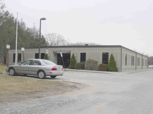

Property Detail
301 Curtis Corner Rd
SKIN-003903-000000-000020
WASHINGTON
Governmentalpublicusegeneral
Rhode Island
GI
20
C and X Area of minimal flood hazard, usually depicted on FIRMs as above the 500-year flood level.
50.78 AC
0
Washington County
2025
Providence
051306
Providence-Warwick, RI-MA
NEARBY LISTINGS FOR SALE OR LEASE
DEMOGRAPHICS near 301 Curtis Corner Rd
1 mile
3 mile
5 mile
2025 Total Population
4,475
22,300
41,641
2030 Population
4,370
21,891
41,417
Pop Growth 2025-2030
(2.35%)
(1.83%)
(0.54%)
Average Age
43
38
42
2025 Total Households
1,728
6,858
15,098
HH Growth 2025-2030
(2.89%)
(2.65%)
(0.66%)
Median Household Inc
$108,552
$104,937
$108,217
Avg Household Size
2.40
2.30
2.30
2025 Avg HH Vehicles
2.00
2.00
2.00
Median Home Value
$538,640
$568,273
$638,866
Median Year Built
1981
1977
1977
Nearby Places
Map Layers
Map Styles
 Street
 Aerial
Layers
 Traffic
 Biking
Places
Listings with unknown addresses are not visible on the map
- Restaurants
- Banks
- Shops
- Fitness
- Groceries
PUBLIC TRANSPORTATION
COMMUTER RAIL
Kingston Amtrak Station (Northeast Regional - Amtrak)
Drive
Walk
Distance
Kingston Amtrak Station (Northeast Regional - Amtrak)
11 min
4.3 mi
AIRPORT
Rhode Island Tf Green International
Drive
Walk
Distance
Rhode Island Tf Green International
43 min
26.3 mi
Freight Ports
Port of Davisville, RI
Drive
Walk
Distance
Port of Davisville, RI
33 min
16.1 mi
Nearby Properties
Address
Land Use
TOTAL SIZE
Lot Size
Zoning
Address
Land Use
TOTAL SIZE
Lot Size
Zoning
8.03 AC
GI
Address
Land Use
TOTAL SIZE
Lot Size
Zoning
17.06 AC
GI
Address
Land Use
TOTAL SIZE
Lot Size
Zoning
16.50 AC
GI
Address
Land Use
TOTAL SIZE
Lot Size
Zoning
245,692 SF
11.12 AC
GI
Address
Land Use
TOTAL SIZE
Lot Size
Zoning
35.38 AC
B-B
Address
Land Use
TOTAL SIZE
Lot Size
Zoning
151,375 SF
12.17 AC
SMD
Address
Land Use
TOTAL SIZE
Lot Size
Zoning
10 AC
SMD
Address
Land Use
TOTAL SIZE
Lot Size
Zoning
25.32 AC
GI
Address
Land Use
TOTAL SIZE
Lot Size
Zoning
74,782 SF
6.16 AC
MU
Address
Land Use
TOTAL SIZE
Lot Size
Zoning
6.50 AC
SMD
Address
Land Use
TOTAL SIZE
Lot Size
Zoning
150.79 AC
GI
Address
Land Use
TOTAL SIZE
Lot Size
Zoning
24.81 AC
GI
Address
Land Use
TOTAL SIZE
Lot Size
Zoning
15.20 AC
SMD
Address
Land Use
TOTAL SIZE
Lot Size
Zoning
91,020 SF
6.95 AC
RM
Address
Land Use
TOTAL SIZE
Lot Size
Zoning
85,477 SF
6.23 AC
GI
Address
Land Use
TOTAL SIZE
Lot Size
Zoning
340.80 AC
GI
Address
Land Use
TOTAL SIZE
Lot Size
Zoning
13.34 AC
CH
Address
Land Use
TOTAL SIZE
Lot Size
Zoning
41.50 AC
GI
Address
Land Use
TOTAL SIZE
Lot Size
Zoning
6.22 AC
RM
Address
Land Use
TOTAL SIZE
Lot Size
Zoning
4.81 AC
GI
Address
Land Use
TOTAL SIZE
Lot Size
Zoning
6.09 AC
GI
Address
Land Use
TOTAL SIZE
Lot Size
Zoning
5.03 AC
CH
Address
Land Use
TOTAL SIZE
Lot Size
Zoning
63,563 SF
13.25 AC
R80
Address
Land Use
TOTAL SIZE
Lot Size
Zoning
4.45 AC
GI
Address
Land Use
TOTAL SIZE
Lot Size
Zoning
57,663 SF
1.45 AC
GI
Address
Land Use
TOTAL SIZE
Lot Size
Zoning
10.03 AC
GI
Address
Land Use
TOTAL SIZE
Lot Size
Zoning
86,735 SF
25 AC
RM
Address
Land Use
TOTAL SIZE
Lot Size
Zoning
4.47 AC
B-B
Address
Land Use
TOTAL SIZE
Lot Size
Zoning
4.40 AC
CN
The World's #1 Commercial Real Estate Marketplace
Connect with us
© 2026 CoStar Group
The information above has been obtained from sources believed reliable. While we do not doubt its accuracy we have not verified it and make no guarantee, warranty or representation about it. It is your responsibility to independently confirm its accuracy and completeness. Any projections, opinions, assumptions, or estimates used are for example only and do not represent the current or future performance of the property. The value of this transaction to you depends on tax and other factors which should be evaluated by your tax, financial, and legal advisors. You and your advisors should conduct a careful, independent investigation of the property to determine to your satisfaction the suitability of the property for your needs.