Property Record
301 E Main St, Patchogue, NY 11772


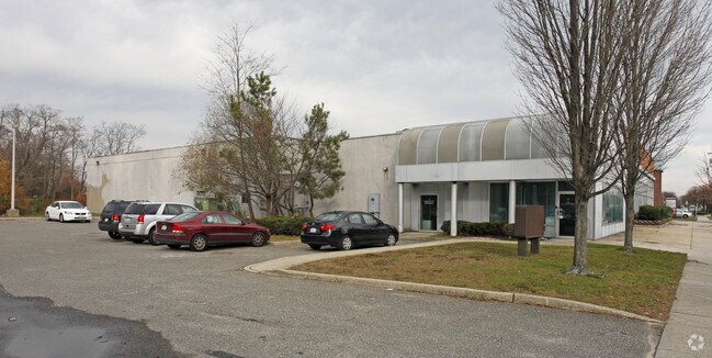
Property Detail
301 E Main St
Nassau County-Suffolk County, NY
SUFFOLK
0500-394-00-01-00-008-004
New York
Hospitalpublic
100
B and X Area of moderate flood hazard, usually the area between the limits of the 100-year and 500-year floods.
18.89 AC
0
Southwestern Suffolk
2025
Long Island (New York)
159109
NEARBY LISTINGS FOR SALE OR LEASE
DEMOGRAPHICS near 301 E Main St
1 mile
3 mile
5 mile
2025 Total Population
13,811
88,600
221,785
2030 Population
13,683
86,889
217,105
Pop Growth 2025-2030
(0.93%)
(1.93%)
(2.11%)
Average Age
39
40
40
2025 Total Households
5,008
27,680
66,485
HH Growth 2025-2030
(0.80%)
(1.91%)
(2.14%)
Median Household Inc
$80,635
$121,879
$124,871
Avg Household Size
2.60
3.00
3.10
2025 Avg HH Vehicles
2.00
2.00
2.00
Median Home Value
$492,015
$562,823
$545,625
Median Year Built
1966
1962
1963
Nearby Places
Map Layers
Map Styles
 Street
 Aerial
Layers
 Traffic
 Biking
Places
Listings with unknown addresses are not visible on the map
- Restaurants
- Banks
- Shops
- Fitness
- Groceries
PUBLIC TRANSPORTATION
COMMUTER RAIL
Bay Shore Station (Montauk Branch - Long Island Rail Road)
Drive
Walk
Distance
Bay Shore Station (Montauk Branch - Long Island Rail Road)
2 min
20 min
0.8 mi
Islip Station (Montauk Branch - Long Island Rail Road)
Drive
Walk
Distance
Islip Station (Montauk Branch - Long Island Rail Road)
5 min
2.2 mi
AIRPORT
Long Island MacArthur
Drive
Walk
Distance
Long Island MacArthur
20 min
11.4 mi
John F Kennedy International
Drive
Walk
Distance
John F Kennedy International
46 min
33.2 mi
Freight Ports
NY - Red Hook Container Terminal
Drive
Walk
Distance
NY - Red Hook Container Terminal
67 min
44.6 mi
Nearby Properties
Address
Land Use
TOTAL SIZE
Lot Size
Zoning
Address
Land Use
TOTAL SIZE
Lot Size
Zoning
86.63 AC
Address
Land Use
TOTAL SIZE
Lot Size
Zoning
57.30 AC
IND1
Address
Land Use
TOTAL SIZE
Lot Size
Zoning
1,400 SF
10.27 AC
BD
Address
Land Use
TOTAL SIZE
Lot Size
Zoning
28.40 AC
A
Address
Land Use
TOTAL SIZE
Lot Size
Zoning
15 AC
B
Address
Land Use
TOTAL SIZE
Lot Size
Zoning
12 AC
A
Address
Land Use
TOTAL SIZE
Lot Size
Zoning
19.56 AC
BUS3
Address
Land Use
TOTAL SIZE
Lot Size
Zoning
15.60 AC
BUS3
Address
Land Use
TOTAL SIZE
Lot Size
Zoning
31.64 AC
Address
Land Use
TOTAL SIZE
Lot Size
Zoning
231.30 AC
AAA
Address
Land Use
TOTAL SIZE
Lot Size
Zoning
16.52 AC
AA
Address
Land Use
TOTAL SIZE
Lot Size
Zoning
19.60 AC
BUS3
Address
Land Use
TOTAL SIZE
Lot Size
Zoning
10.90 AC
B
Address
Land Use
TOTAL SIZE
Lot Size
Zoning
19.04 AC
BUS1
Address
Land Use
TOTAL SIZE
Lot Size
Zoning
10.44 AC
BUS3
Address
Land Use
TOTAL SIZE
Lot Size
Zoning
13.50 AC
AA
Address
Land Use
TOTAL SIZE
Lot Size
Zoning
66 AC
AAA
Address
Land Use
TOTAL SIZE
Lot Size
Zoning
9.70 AC
B
Address
Land Use
TOTAL SIZE
Lot Size
Zoning
46.60 AC
A
Address
Land Use
TOTAL SIZE
Lot Size
Zoning
7.70 AC
A
Address
Land Use
TOTAL SIZE
Lot Size
Zoning
19.70 AC
B
Address
Land Use
TOTAL SIZE
Lot Size
Zoning
1.80 AC
Address
Land Use
TOTAL SIZE
Lot Size
Zoning
9.80 AC
AA
Address
Land Use
TOTAL SIZE
Lot Size
Zoning
2.33 AC
DDD278
Address
Land Use
TOTAL SIZE
Lot Size
Zoning
10.22 AC
IBD
Address
Land Use
TOTAL SIZE
Lot Size
Zoning
10.90 AC
IND1
Address
Land Use
TOTAL SIZE
Lot Size
Zoning
3,898 SF
0.47 AC
R4
Address
Land Use
TOTAL SIZE
Lot Size
Zoning
Address
Land Use
TOTAL SIZE
Lot Size
Zoning
10.25 AC
AAA
The World's #1 Commercial Real Estate Marketplace
Connect with us
© 2026 CoStar Group
The information above has been obtained from sources believed reliable. While we do not doubt its accuracy we have not verified it and make no guarantee, warranty or representation about it. It is your responsibility to independently confirm its accuracy and completeness. Any projections, opinions, assumptions, or estimates used are for example only and do not represent the current or future performance of the property. The value of this transaction to you depends on tax and other factors which should be evaluated by your tax, financial, and legal advisors. You and your advisors should conduct a careful, independent investigation of the property to determine to your satisfaction the suitability of the property for your needs.