Property Record
301 E W, Green Valley, AZ 85614


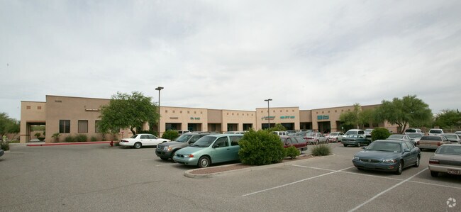
Property Detail
301 E W
304-57-992A
PTN S213.09 SE4 SE4 EXC RDS 1.72 AC SEC 3-18-13
Commercialnec
PIMA
RH
Arizona
B and X Area of moderate flood hazard, usually the area between the limits of the 100-year and 500-year floods.
12
0
1.72 AC
2026
Green Valley/South Tucson
004307
Tucson
9,436 SF
Tucson, AZ
NEARBY LISTINGS FOR SALE OR LEASE
DEMOGRAPHICS near 301 E W
1 mile
3 mile
5 mile
2025 Total Population
8,665
29,058
41,595
2030 Population
9,018
30,298
43,635
Pop Growth 2025-2030
+ 4.07%
+ 4.27%
+ 4.90%
Average Age
70
58
61
2025 Total Households
5,106
14,873
21,569
HH Growth 2025-2030
+ 4.19%
+ 4.57%
+ 5.08%
Median Household Inc
$53,561
$64,881
$69,942
Avg Household Size
1.60
1.90
1.90
2025 Avg HH Vehicles
2.00
2.00
2.00
Median Home Value
$282,250
$309,428
$337,359
Median Year Built
1987
1991
1994
Nearby Places
Map Layers
Map Styles
 Street
 Aerial
Layers
 Traffic
 Biking
Places
Listings with unknown addresses are not visible on the map
- Restaurants
- Banks
- Shops
- Fitness
- Groceries
PUBLIC TRANSPORTATION
AIRPORT
Tucson International
Drive
Walk
Distance
Tucson International
33 min
21.5 mi
Nearby Properties
Address
Land Use
TOTAL SIZE
Lot Size
Zoning
Address
Land Use
TOTAL SIZE
Lot Size
Zoning
81,624 SF
8.11 AC
CR4
Address
Land Use
TOTAL SIZE
Lot Size
Zoning
508,423 SF
48.71 AC
CR5
Address
Land Use
TOTAL SIZE
Lot Size
Zoning
321,679 SF
27.25 AC
CB2
Address
Land Use
TOTAL SIZE
Lot Size
Zoning
183,470 SF
18.20 AC
CB2
Address
Land Use
TOTAL SIZE
Lot Size
Zoning
20,400 SF
2.25 AC
CB2
Address
Land Use
TOTAL SIZE
Lot Size
Zoning
151,585 SF
14.56 AC
CB1
Address
Land Use
TOTAL SIZE
Lot Size
Zoning
89,760 SF
9.42 AC
Address
Land Use
TOTAL SIZE
Lot Size
Zoning
81,011 SF
5.57 AC
TR
Address
Land Use
TOTAL SIZE
Lot Size
Zoning
92,411 SF
8.88 AC
CB1
Address
Land Use
TOTAL SIZE
Lot Size
Zoning
78,750 SF
1.63 AC
CB2
Address
Land Use
TOTAL SIZE
Lot Size
Zoning
54,921 SF
6.75 AC
CB2
Address
Land Use
TOTAL SIZE
Lot Size
Zoning
56,544 SF
3.20 AC
CB2
Address
Land Use
TOTAL SIZE
Lot Size
Zoning
10,000 SF
633.39 AC
Address
Land Use
TOTAL SIZE
Lot Size
Zoning
2.49 AC
CB2
Address
Land Use
TOTAL SIZE
Lot Size
Zoning
15,365 SF
1.79 AC
Address
Land Use
TOTAL SIZE
Lot Size
Zoning
62,175 SF
7.60 AC
Address
Land Use
TOTAL SIZE
Lot Size
Zoning
25,211 SF
17.20 AC
RH
Address
Land Use
TOTAL SIZE
Lot Size
Zoning
94,916 SF
5.33 AC
CR4
Address
Land Use
TOTAL SIZE
Lot Size
Zoning
73,181 SF
10.10 AC
RH
Address
Land Use
TOTAL SIZE
Lot Size
Zoning
23,844 SF
5.22 AC
Address
Land Use
TOTAL SIZE
Lot Size
Zoning
48,145 SF
9.40 AC
Address
Land Use
TOTAL SIZE
Lot Size
Zoning
79,128 SF
3.49 AC
CB2
Address
Land Use
TOTAL SIZE
Lot Size
Zoning
71,082 SF
8.21 AC
Address
Land Use
TOTAL SIZE
Lot Size
Zoning
73,616 SF
13.80 AC
CB2
Address
Land Use
TOTAL SIZE
Lot Size
Zoning
24,435 SF
2.53 AC
TR
Address
Land Use
TOTAL SIZE
Lot Size
Zoning
26,749 SF
7.53 AC
RH
Address
Land Use
TOTAL SIZE
Lot Size
Zoning
7,000 SF
1.39 AC
CR4
Address
Land Use
TOTAL SIZE
Lot Size
Zoning
23,915 SF
2.96 AC
RH
Address
Land Use
TOTAL SIZE
Lot Size
Zoning
96,288 SF
8.44 AC
GR1
Address
Land Use
TOTAL SIZE
Lot Size
Zoning
21,734 SF
4.08 AC
The World's #1 Commercial Real Estate Marketplace
Connect with us
© 2026 CoStar Group
The information above has been obtained from sources believed reliable. While we do not doubt its accuracy we have not verified it and make no guarantee, warranty or representation about it. It is your responsibility to independently confirm its accuracy and completeness. Any projections, opinions, assumptions, or estimates used are for example only and do not represent the current or future performance of the property. The value of this transaction to you depends on tax and other factors which should be evaluated by your tax, financial, and legal advisors. You and your advisors should conduct a careful, independent investigation of the property to determine to your satisfaction the suitability of the property for your needs.