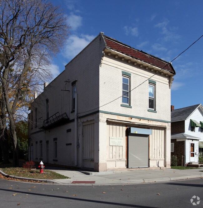
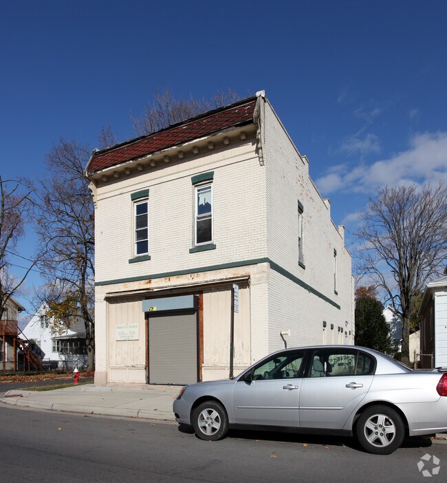
Property Record
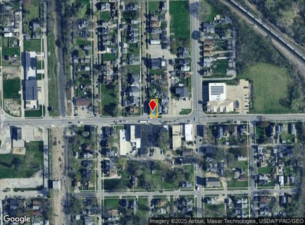
301 Fassett St, Toledo, OH 43605
NEARBY LISTINGS FOR SALE OR LEASE
Property Detail
301 Fassett St
Toledo, OH
Prentices Addition
12-29101
PRENTICES ADDITION 132 & S 33 FT 133... W 331/3 FT
Storebuilding
Lucas
X
Ohio
39095C0095F
132
2024
0.08 AC
2024
East Toledo/Oregon
005102
Toledo
3,100 SF
DEMOGRAPHICS near 301 Fassett St
1 Mile
3 Mile
5 Mile
2024 Total Population
13,230
77,479
161,556
2029 Population
13,257
78,261
162,258
Pop Growth 2024-2029
+ 0.20%
+ 1.01%
+ 0.43%
Average Age
35
38
38
2024 Total Households
5,083
32,543
68,036
HH Growth 2024-2029
+ 0.02%
+ 0.93%
+ 0.38%
Median Household Inc
$36,698
$34,424
$38,896
Avg Household Size
2.40
2.20
2.20
2024 Avg HH Vehicles
1.00
1.00
1.00
Median Home Value
$59,966
$82,663
$90,244
Median Year Built
1946
1948
1950
Nearby Places
Map Layers
Map Styles
 Street
 Aerial
- Restaurants
- Banks
- Shops
- Fitness
- Groceries
PUBLIC TRANSPORTATION
COMMUTER RAIL
Toledo (Capitol Limited - Amtrak, Lake Shore Limited - Amtrak)
DRIVE
WALK
Distance
Toledo (Capitol Limited - Amtrak, Lake Shore Limited - Amtrak)
6 min
2.6 mi
AIRPORT
Eugene F Kranz Toledo Express
DRIVE
WALK
Distance
Eugene F Kranz Toledo Express
37 min
20.7 mi
Freight Ports
Port of Toledo
DRIVE
WALK
Distance
Port of Toledo
15 min
6.1 mi
Nearby Properties
Address
Land Use
TOTAL SIZE
Lot Size
Zoning
Address
Land Use
TOTAL SIZE
Lot Size
Zoning
1,243,593 SF
42.25 AC
10-MX
Address
Land Use
TOTAL SIZE
Lot Size
Zoning
1,046,727 SF
0.41 AC
10-IC
Address
Land Use
TOTAL SIZE
Lot Size
Zoning
605,609 SF
9.66 AC
40-C4
Address
Land Use
TOTAL SIZE
Lot Size
Zoning
277,862 SF
3 AC
10-CD
Address
Land Use
TOTAL SIZE
Lot Size
Zoning
504,154 SF
111.51 AC
Address
Land Use
TOTAL SIZE
Lot Size
Zoning
314,826 SF
10.28 AC
10-CM
Address
Land Use
TOTAL SIZE
Lot Size
Zoning
313,004 SF
44.54 AC
40-C2
Address
Land Use
TOTAL SIZE
Lot Size
Zoning
625,485 SF
2 AC
10-MX
Address
Land Use
TOTAL SIZE
Lot Size
Zoning
111,471 SF
6.17 AC
10-CD
Address
Land Use
TOTAL SIZE
Lot Size
Zoning
171,946 SF
0.17 AC
10-IC
Address
Land Use
TOTAL SIZE
Lot Size
Zoning
328,568 SF
16.37 AC
10-CO
Address
Land Use
TOTAL SIZE
Lot Size
Zoning
496,062 SF
50.37 AC
Address
Land Use
TOTAL SIZE
Lot Size
Zoning
1.74 AC
10-CD
Address
Land Use
TOTAL SIZE
Lot Size
Zoning
296,348 SF
1 AC
10-CO
Address
Land Use
TOTAL SIZE
Lot Size
Zoning
243,165 SF
3.63 AC
10-CD
Address
Land Use
TOTAL SIZE
Lot Size
Zoning
219,265 SF
32.11 AC
Address
Land Use
TOTAL SIZE
Lot Size
Zoning
375,323 SF
10-IC
Address
Land Use
TOTAL SIZE
Lot Size
Zoning
940,263 SF
0.52 AC
10-MX
Address
Land Use
TOTAL SIZE
Lot Size
Zoning
174,496 SF
7.30 AC
Address
Land Use
TOTAL SIZE
Lot Size
Zoning
182,983 SF
2 AC
10-CD
Address
Land Use
TOTAL SIZE
Lot Size
Zoning
14,824 SF
54.18 AC
10-MX
Address
Land Use
TOTAL SIZE
Lot Size
Zoning
136,090 SF
4 AC
Address
Land Use
TOTAL SIZE
Lot Size
Zoning
68,517 SF
1.56 AC
10-RM36
Address
Land Use
TOTAL SIZE
Lot Size
Zoning
390,272 SF
5 AC
10-CD
Address
Land Use
TOTAL SIZE
Lot Size
Zoning
127,658 SF
9.01 AC
40-C4
Address
Land Use
TOTAL SIZE
Lot Size
Zoning
202,118 SF
1.50 AC
10-CD
Address
Land Use
TOTAL SIZE
Lot Size
Zoning
232,758 SF
2 AC
10-CO
Address
Land Use
TOTAL SIZE
Lot Size
Zoning
486,615 SF
45.39 AC
Address
Land Use
TOTAL SIZE
Lot Size
Zoning
297,666 SF
4 AC
10-CO
Address
Land Use
TOTAL SIZE
Lot Size
Zoning
132,690 SF
5 AC
10-CO
The World's #1 Commercial Real Estate Marketplace
Connect with us
© 2025 CoStar Group
The information above has been obtained from sources believed reliable. While we do not doubt its accuracy we have not verified it and make no guarantee, warranty or representation about it. It is your responsibility to independently confirm its accuracy and completeness. Any projections, opinions, assumptions, or estimates used are for example only and do not represent the current or future performance of the property. The value of this transaction to you depends on tax and other factors which should be evaluated by your tax, financial, and legal advisors. You and your advisors should conduct a careful, independent investigation of the property to determine to your satisfaction the suitability of the property for your needs.