Property Record
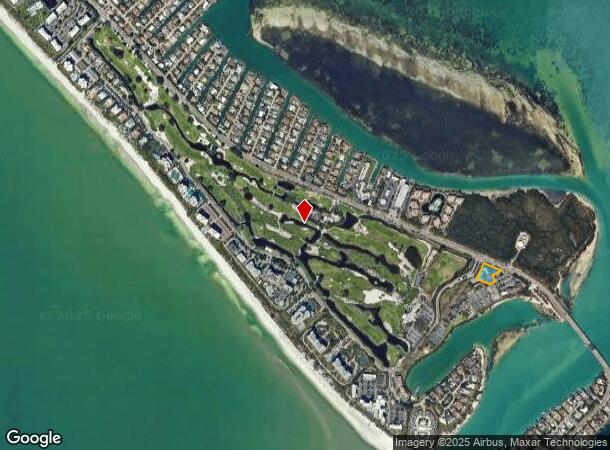
301 Gulf Of Mexico Dr, Longboat Key, FL 34228


NEARBY LISTINGS FOR SALE OR LEASE
Property Detail
301 Gulf Of Mexico Dr
North Port-Sarasota-Bradenton, FL
Longboat Key Club Unit 7
0012-11-0008
A PORTIION OF LOT B, LONGBOAT KEY CLUB UNIT 7, PB 52 PG 95, PREVIOUSLY KNOWN AS PARCEL C-1 IN LONGBOAT KEY CLUB UNIT 4, PB 30 PG 50
Parkinglot
Sarasota
AE
Florida
12115C0128G
b
2024
1.16 AC
2025
Sarasota
000801
Tampa/St Petersburg
3,959 SF
DEMOGRAPHICS near 301 Gulf Of Mexico Dr
1 Mile
3 Mile
5 Mile
2024 Total Population
1,907
22,125
78,417
2029 Population
2,332
26,353
91,236
Pop Growth 2024-2029
+ 22.29%
+ 19.11%
+ 16.35%
Average Age
69
62
50
2024 Total Households
1,053
12,444
36,758
HH Growth 2024-2029
+ 22.41%
+ 19.26%
+ 16.71%
Median Household Inc
$141,634
$105,262
$74,694
Avg Household Size
1.80
1.70
2.00
2024 Avg HH Vehicles
2.00
1.00
2.00
Median Home Value
$1,060,877
$840,545
$571,414
Median Year Built
1984
1986
1977
Nearby Places
Map Layers
Map Styles
 Street
 Aerial
- Restaurants
- Banks
- Shops
- Fitness
- Groceries
PUBLIC TRANSPORTATION
AIRPORT
Sarasota/Bradenton International
DRIVE
WALK
Distance
Sarasota/Bradenton International
19 min
8.9 mi
Freight Ports
Port Manatee
DRIVE
WALK
Distance
Port Manatee
50 min
28.8 mi
Nearby Properties
Address
Land Use
TOTAL SIZE
Lot Size
Zoning
Address
Land Use
TOTAL SIZE
Lot Size
Zoning
337,721 SF
3.93 AC
T6
Address
Land Use
TOTAL SIZE
Lot Size
Zoning
124,840 SF
29.18 AC
G
Address
Land Use
TOTAL SIZE
Lot Size
Zoning
516,332 SF
7.62 AC
DTB
Address
Land Use
TOTAL SIZE
Lot Size
Zoning
595,734 SF
1.63 AC
DTB
Address
Land Use
TOTAL SIZE
Lot Size
Zoning
595,368 SF
13.76 AC
MCI
Address
Land Use
TOTAL SIZE
Lot Size
Zoning
253,844 SF
4.09 AC
WFR
Address
Land Use
TOTAL SIZE
Lot Size
Zoning
60.62 AC
G
Address
Land Use
TOTAL SIZE
Lot Size
Zoning
1.70 AC
DTB
Address
Land Use
TOTAL SIZE
Lot Size
Zoning
321,015 SF
1.11 AC
DTB
Address
Land Use
TOTAL SIZE
Lot Size
Zoning
2,900 SF
152 AC
G
Address
Land Use
TOTAL SIZE
Lot Size
Zoning
133,389 SF
6.14 AC
WFR
Address
Land Use
TOTAL SIZE
Lot Size
Zoning
252,254 SF
0.98 AC
DTB
Address
Land Use
TOTAL SIZE
Lot Size
Zoning
26,202 SF
1.21 AC
G
Address
Land Use
TOTAL SIZE
Lot Size
Zoning
17,718 SF
3.91 AC
WFR
Address
Land Use
TOTAL SIZE
Lot Size
Zoning
257,614 SF
0.36 AC
DTB
Address
Land Use
TOTAL SIZE
Lot Size
Zoning
262,739 SF
3.56 AC
DTB
Address
Land Use
TOTAL SIZE
Lot Size
Zoning
72,201 SF
11.29 AC
PD
Address
Land Use
TOTAL SIZE
Lot Size
Zoning
66,008 SF
3.98 AC
G
Address
Land Use
TOTAL SIZE
Lot Size
Zoning
169,017 SF
1.86 AC
G
Address
Land Use
TOTAL SIZE
Lot Size
Zoning
123,449 SF
4.10 AC
DTB
Address
Land Use
TOTAL SIZE
Lot Size
Zoning
364 SF
25.10 AC
G
Address
Land Use
TOTAL SIZE
Lot Size
Zoning
45,680 SF
3.13 AC
G
Address
Land Use
TOTAL SIZE
Lot Size
Zoning
81,337 SF
1.70 AC
RMF5
Address
Land Use
TOTAL SIZE
Lot Size
Zoning
73,810 SF
3.98 AC
WFR
Address
Land Use
TOTAL SIZE
Lot Size
Zoning
63,903 SF
3.78 AC
ORD
Address
Land Use
TOTAL SIZE
Lot Size
Zoning
23,964 SF
0.54 AC
CT
Address
Land Use
TOTAL SIZE
Lot Size
Zoning
60,162 SF
269.72 AC
PD
Address
Land Use
TOTAL SIZE
Lot Size
Zoning
0.98 AC
DTB
Address
Land Use
TOTAL SIZE
Lot Size
Zoning
22,767 SF
4.99 AC
RSF1
Address
Land Use
TOTAL SIZE
Lot Size
Zoning
18,171 SF
3.05 AC
DTB
The World's #1 Commercial Real Estate Marketplace
Connect with us
© 2025 CoStar Group
The information above has been obtained from sources believed reliable. While we do not doubt its accuracy we have not verified it and make no guarantee, warranty or representation about it. It is your responsibility to independently confirm its accuracy and completeness. Any projections, opinions, assumptions, or estimates used are for example only and do not represent the current or future performance of the property. The value of this transaction to you depends on tax and other factors which should be evaluated by your tax, financial, and legal advisors. You and your advisors should conduct a careful, independent investigation of the property to determine to your satisfaction the suitability of the property for your needs.