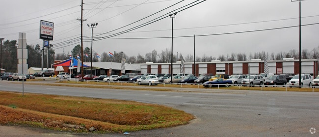
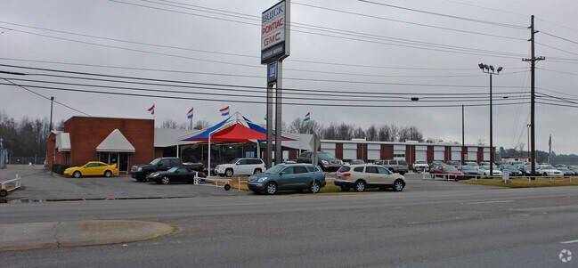
Property Record
301 High St, Orangeburg, SC 29115

Property Detail
301 High St
0182-17-02-002.000
HWY 301 SUPERIOR-MOTORS 50 00361602
Commercialnec
ORANGEBURG
AE The base floodplain where base flood elevations are provided. AE Zones are now used on new format FIRMs instead of A1-A30 Zones.
South Carolina
2024
15.50 AC
2024
Orangeburg/Sumter
011500
Other Market Areas
18,200 SF
Orangeburg, SC
NEARBY LISTINGS FOR SALE OR LEASE
DEMOGRAPHICS near 301 High St
1 mile
3 mile
5 mile
2025 Total Population
3,744
22,864
32,855
2030 Population
3,902
23,188
33,001
Pop Growth 2025-2030
+ 4.22%
+ 1.42%
+ 0.44%
Average Age
39
38
39
2025 Total Households
1,414
8,296
12,455
HH Growth 2025-2030
+ 4.60%
+ 1.39%
+ 0.31%
Median Household Inc
$35,205
$34,853
$45,457
Avg Household Size
2.40
2.20
2.30
2025 Avg HH Vehicles
1.00
1.00
2.00
Median Home Value
$87,557
$134,798
$143,566
Median Year Built
1976
1974
1976
Nearby Places
Map Layers
Map Styles
 Street
 Aerial
Layers
 Traffic
 Biking
Places
Listings with unknown addresses are not visible on the map
- Restaurants
- Banks
- Shops
- Fitness
- Groceries
Nearby Properties
Address
Land Use
TOTAL SIZE
Lot Size
Zoning
Address
Land Use
TOTAL SIZE
Lot Size
Zoning
534,738 SF
53.78 AC
Address
Land Use
TOTAL SIZE
Lot Size
Zoning
24,351 SF
1.23 AC
Address
Land Use
TOTAL SIZE
Lot Size
Zoning
20,838 SF
7.70 AC
Address
Land Use
TOTAL SIZE
Lot Size
Zoning
41,412 SF
7.40 AC
Address
Land Use
TOTAL SIZE
Lot Size
Zoning
7,634 SF
0.72 AC
Address
Land Use
TOTAL SIZE
Lot Size
Zoning
206,224 SF
42.20 AC
Address
Land Use
TOTAL SIZE
Lot Size
Zoning
320,700 SF
35.10 AC
Address
Land Use
TOTAL SIZE
Lot Size
Zoning
100,693 SF
6.61 AC
Address
Land Use
TOTAL SIZE
Lot Size
Zoning
20,160 SF
3.35 AC
Address
Land Use
TOTAL SIZE
Lot Size
Zoning
5,059 SF
3.60 AC
Address
Land Use
TOTAL SIZE
Lot Size
Zoning
29,977 SF
9.57 AC
Address
Land Use
TOTAL SIZE
Lot Size
Zoning
4,794 SF
5 AC
Address
Land Use
TOTAL SIZE
Lot Size
Zoning
179,500 SF
83 AC
Address
Land Use
TOTAL SIZE
Lot Size
Zoning
102,557 SF
10.30 AC
Address
Land Use
TOTAL SIZE
Lot Size
Zoning
205,299 SF
44.40 AC
Address
Land Use
TOTAL SIZE
Lot Size
Zoning
2,500 SF
14.76 AC
Address
Land Use
TOTAL SIZE
Lot Size
Zoning
29,275 SF
8.50 AC
Address
Land Use
TOTAL SIZE
Lot Size
Zoning
14,606 SF
1.80 AC
Address
Land Use
TOTAL SIZE
Lot Size
Zoning
41,838 SF
2.40 AC
Address
Land Use
TOTAL SIZE
Lot Size
Zoning
159,852 SF
27 AC
Address
Land Use
TOTAL SIZE
Lot Size
Zoning
9,358 SF
2.20 AC
Address
Land Use
TOTAL SIZE
Lot Size
Zoning
3,876 SF
5 AC
Address
Land Use
TOTAL SIZE
Lot Size
Zoning
63,120 SF
3.55 AC
Address
Land Use
TOTAL SIZE
Lot Size
Zoning
100,000 SF
8.62 AC
Address
Land Use
TOTAL SIZE
Lot Size
Zoning
16,182 SF
4.02 AC
Address
Land Use
TOTAL SIZE
Lot Size
Zoning
66,220 SF
25 AC
Address
Land Use
TOTAL SIZE
Lot Size
Zoning
86,292 SF
7.60 AC
Address
Land Use
TOTAL SIZE
Lot Size
Zoning
3,228 SF
19.40 AC
Address
Land Use
TOTAL SIZE
Lot Size
Zoning
12,280 SF
10 AC
Address
Land Use
TOTAL SIZE
Lot Size
Zoning
7,500 SF
6 AC
The World's #1 Commercial Real Estate Marketplace
Connect with us
© 2026 CoStar Group
The information above has been obtained from sources believed reliable. While we do not doubt its accuracy we have not verified it and make no guarantee, warranty or representation about it. It is your responsibility to independently confirm its accuracy and completeness. Any projections, opinions, assumptions, or estimates used are for example only and do not represent the current or future performance of the property. The value of this transaction to you depends on tax and other factors which should be evaluated by your tax, financial, and legal advisors. You and your advisors should conduct a careful, independent investigation of the property to determine to your satisfaction the suitability of the property for your needs.