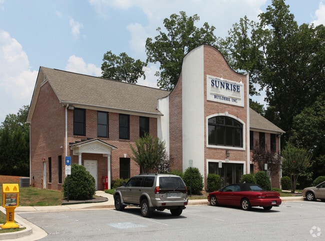
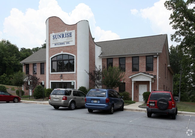
Property Record
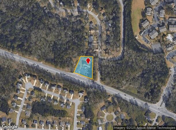
301 Highway 138 W, Jonesboro, GA 30238
NEARBY LISTINGS FOR SALE OR LEASE
Property Detail
301 Highway 138 W
13-0212B-00A-004
Valley Hill Twnhms
Officebuilding
Clayton
X
Georgia
13063C0067F
149
2025
1.38 AC
2025
South Clayton/Henry Cnty
040533
Atlanta
3,642 SF
Atlanta-Sandy Springs-Roswell, GA
DEMOGRAPHICS near 301 Highway 138 W
1 Mile
3 Mile
5 Mile
2024 Total Population
11,446
87,289
178,823
2029 Population
11,345
86,904
178,584
Pop Growth 2024-2029
(0.88%)
(0.44%)
(0.13%)
Average Age
35
35
36
2024 Total Households
4,020
31,394
64,687
HH Growth 2024-2029
(0.92%)
(0.46%)
(0.09%)
Median Household Inc
$50,903
$49,136
$50,847
Avg Household Size
2.70
2.70
2.70
2024 Avg HH Vehicles
2.00
2.00
2.00
Median Home Value
$153,325
$157,795
$173,130
Median Year Built
1983
1984
1984
Nearby Places
Map Layers
Map Styles
 Street
 Aerial
- Restaurants
- Banks
- Shops
- Fitness
- Groceries
PUBLIC TRANSPORTATION
AIRPORT
Hartsfield - Jackson Atlanta International
DRIVE
WALK
Distance
Hartsfield - Jackson Atlanta International
18 min
10.1 mi
Freight Ports
Georgia Ports - Savannah
DRIVE
WALK
Distance
Georgia Ports - Savannah
266 min
236.7 mi
Nearby Properties
Address
Land Use
TOTAL SIZE
Lot Size
Zoning
Address
Land Use
TOTAL SIZE
Lot Size
Zoning
231,046 SF
97.58 AC
C
Address
Land Use
TOTAL SIZE
Lot Size
Zoning
518,648 SF
31.03 AC
MCD
Address
Land Use
TOTAL SIZE
Lot Size
Zoning
40,472 SF
116.70 AC
HI
Address
Land Use
TOTAL SIZE
Lot Size
Zoning
194,682 SF
27.80 AC
OI
Address
Land Use
TOTAL SIZE
Lot Size
Zoning
324 SF
49.49 AC
RM
Address
Land Use
TOTAL SIZE
Lot Size
Zoning
11.31 AC
RM
Address
Land Use
TOTAL SIZE
Lot Size
Zoning
250 SF
31.25 AC
RM
Address
Land Use
TOTAL SIZE
Lot Size
Zoning
123,000 SF
48 AC
RS110
Address
Land Use
TOTAL SIZE
Lot Size
Zoning
424 SF
54.79 AC
RM
Address
Land Use
TOTAL SIZE
Lot Size
Zoning
270 SF
28.02 AC
RM
Address
Land Use
TOTAL SIZE
Lot Size
Zoning
230 SF
27.09 AC
RM
Address
Land Use
TOTAL SIZE
Lot Size
Zoning
278 SF
18.53 AC
PUD
Address
Land Use
TOTAL SIZE
Lot Size
Zoning
351,207 SF
20 AC
HI
Address
Land Use
TOTAL SIZE
Lot Size
Zoning
316 SF
34.30 AC
RG75
Address
Land Use
TOTAL SIZE
Lot Size
Zoning
224 SF
25 AC
C
Address
Land Use
TOTAL SIZE
Lot Size
Zoning
256 SF
25 AC
PUD
Address
Land Use
TOTAL SIZE
Lot Size
Zoning
252 SF
27.14 AC
RM
Address
Land Use
TOTAL SIZE
Lot Size
Zoning
190 SF
21.66 AC
RM
Address
Land Use
TOTAL SIZE
Lot Size
Zoning
410 SF
35 AC
RM
Address
Land Use
TOTAL SIZE
Lot Size
Zoning
14,230 AC
C
Address
Land Use
TOTAL SIZE
Lot Size
Zoning
220 SF
26.84 AC
RM
Address
Land Use
TOTAL SIZE
Lot Size
Zoning
252 SF
23.62 AC
RM
Address
Land Use
TOTAL SIZE
Lot Size
Zoning
65,798 SF
7.41 AC
C
Address
Land Use
TOTAL SIZE
Lot Size
Zoning
57.05 AC
GB
Address
Land Use
TOTAL SIZE
Lot Size
Zoning
160 SF
19.95 AC
RM
Address
Land Use
TOTAL SIZE
Lot Size
Zoning
250,048 SF
31.80 AC
HI
Address
Land Use
TOTAL SIZE
Lot Size
Zoning
208 SF
19.26 AC
RM
Address
Land Use
TOTAL SIZE
Lot Size
Zoning
203,067 SF
18 AC
C
Address
Land Use
TOTAL SIZE
Lot Size
Zoning
176 SF
17.67 AC
RM
Address
Land Use
TOTAL SIZE
Lot Size
Zoning
108,738 SF
28.31 AC
C
The World's #1 Commercial Real Estate Marketplace
Connect with us
© 2025 CoStar Group
The information above has been obtained from sources believed reliable. While we do not doubt its accuracy we have not verified it and make no guarantee, warranty or representation about it. It is your responsibility to independently confirm its accuracy and completeness. Any projections, opinions, assumptions, or estimates used are for example only and do not represent the current or future performance of the property. The value of this transaction to you depends on tax and other factors which should be evaluated by your tax, financial, and legal advisors. You and your advisors should conduct a careful, independent investigation of the property to determine to your satisfaction the suitability of the property for your needs.