Property Record
301 Highway 35 N, Rockport, TX 78382
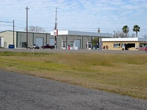

Property Detail
301 Highway 35 N
Corpus Christi, TX
SMITH AND WOOD, BLOCK 31, LOT 1-R
R32565
ARANSAS
Commercialnec
Texas
C and X Area of minimal flood hazard, usually depicted on FIRMs as above the 500-year flood level.
1-r
2025
1.50 AC
2025
Rockport/N Aransas
950301
Corpus Christi
23,065 SF
NEARBY LISTINGS FOR SALE OR LEASE
DEMOGRAPHICS near 301 Highway 35 N
1 mile
3 mile
5 mile
2025 Total Population
4,083
15,987
19,930
2030 Population
4,350
16,874
20,973
Pop Growth 2025-2030
+ 6.54%
+ 5.55%
+ 5.23%
Average Age
45
47
48
2025 Total Households
1,654
6,863
8,629
HH Growth 2025-2030
+ 6.89%
+ 6.15%
+ 5.74%
Median Household Inc
$44,306
$58,902
$62,950
Avg Household Size
2.30
2.20
2.20
2025 Avg HH Vehicles
2.00
2.00
2.00
Median Home Value
$223,559
$274,368
$277,579
Median Year Built
1984
1992
1992
Nearby Places
Map Layers
Map Styles
 Street
 Aerial
Transit
 Traffic
 Biking
Places
Listings with unknown addresses are not visible on the map
- Restaurants
- Banks
- Shops
- Fitness
- Groceries
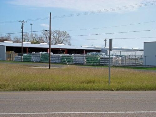
Nearby Properties
Address
Land Use
TOTAL SIZE
Lot Size
Zoning
Address
Land Use
TOTAL SIZE
Lot Size
Zoning
395,335 SF
57.39 AC
Address
Land Use
TOTAL SIZE
Lot Size
Zoning
7,385 SF
44.08 AC
Address
Land Use
TOTAL SIZE
Lot Size
Zoning
100,891 SF
7.78 AC
Address
Land Use
TOTAL SIZE
Lot Size
Zoning
32,302 SF
14.42 AC
Address
Land Use
TOTAL SIZE
Lot Size
Zoning
163,293 SF
13.66 AC
Address
Land Use
TOTAL SIZE
Lot Size
Zoning
125,197 SF
14.61 AC
Address
Land Use
TOTAL SIZE
Lot Size
Zoning
75,772 SF
13.74 AC
Address
Land Use
TOTAL SIZE
Lot Size
Zoning
126,886 AC
Address
Land Use
TOTAL SIZE
Lot Size
Zoning
65,191 SF
Address
Land Use
TOTAL SIZE
Lot Size
Zoning
288 SF
129.13 AC
Address
Land Use
TOTAL SIZE
Lot Size
Zoning
33,524 SF
2.06 AC
Address
Land Use
TOTAL SIZE
Lot Size
Zoning
155,264 SF
21.60 AC
Address
Land Use
TOTAL SIZE
Lot Size
Zoning
18,998 SF
20 AC
Address
Land Use
TOTAL SIZE
Lot Size
Zoning
59,220 AC
Address
Land Use
TOTAL SIZE
Lot Size
Zoning
43,584 SF
0.48 AC
Address
Land Use
TOTAL SIZE
Lot Size
Zoning
59,600 SF
6.15 AC
Address
Land Use
TOTAL SIZE
Lot Size
Zoning
43,816 SF
3.46 AC
Address
Land Use
TOTAL SIZE
Lot Size
Zoning
41,075 SF
11.93 AC
Address
Land Use
TOTAL SIZE
Lot Size
Zoning
30,880 SF
16.53 AC
Address
Land Use
TOTAL SIZE
Lot Size
Zoning
152.58 AC
Address
Land Use
TOTAL SIZE
Lot Size
Zoning
91,025 SF
8.22 AC
Address
Land Use
TOTAL SIZE
Lot Size
Zoning
16,791 SF
2.65 AC
Address
Land Use
TOTAL SIZE
Lot Size
Zoning
30,927 SF
9.08 AC
Address
Land Use
TOTAL SIZE
Lot Size
Zoning
14,925 SF
1.66 AC
Address
Land Use
TOTAL SIZE
Lot Size
Zoning
31,795 SF
1.50 AC
Address
Land Use
TOTAL SIZE
Lot Size
Zoning
31,494 SF
1.84 AC
Address
Land Use
TOTAL SIZE
Lot Size
Zoning
24,890 SF
16.22 AC
Address
Land Use
TOTAL SIZE
Lot Size
Zoning
68,265 SF
8.15 AC
Address
Land Use
TOTAL SIZE
Lot Size
Zoning
5.02 AC
Address
Land Use
TOTAL SIZE
Lot Size
Zoning
15,147 SF
21.52 AC
The World's #1 Commercial Real Estate Marketplace
Connect with us
© 2026 CoStar Group
The information above has been obtained from sources believed reliable. While we do not doubt its accuracy we have not verified it and make no guarantee, warranty or representation about it. It is your responsibility to independently confirm its accuracy and completeness. Any projections, opinions, assumptions, or estimates used are for example only and do not represent the current or future performance of the property. The value of this transaction to you depends on tax and other factors which should be evaluated by your tax, financial, and legal advisors. You and your advisors should conduct a careful, independent investigation of the property to determine to your satisfaction the suitability of the property for your needs.