Property Record
301 Lakehurst Rd, Toms River, NJ 08755


Save to a Folder
{{folder.Name}}
{{folder.ListingIds.length}} Properties
{{folder.ListingIds.length}} Property
Create a New Folder
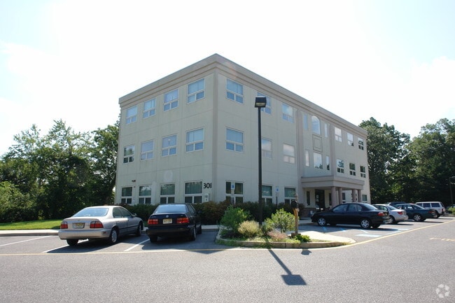
Property Detail
301 Lakehurst Rd
08-00538-0000-00018
3.6AC
Commercialnec
Ocean
VO
New Jersey
AE The base floodplain where base flood elevations are provided. AE Zones are now used on new format FIRMs instead of A1-A30 Zones.
18
2025
3.60 AC
2026
Ocean County
723000
Northern New Jersey
3,600 SF
Lakewood-New Brunswick, NJ
NEARBY LISTINGS FOR SALE OR LEASE
DEMOGRAPHICS near 301 Lakehurst Rd
1 mile
3 mile
5 mile
2025 Total Population
6,709
60,108
132,281
2030 Population
6,809
60,955
134,544
Pop Growth 2025-2030
+ 1.49%
+ 1.41%
+ 1.71%
Average Age
39
44
44
2025 Total Households
2,689
23,917
51,867
HH Growth 2025-2030
+ 0.86%
+ 0.91%
+ 1.14%
Median Household Inc
$74,831
$80,521
$83,452
Avg Household Size
2.30
2.40
2.40
2025 Avg HH Vehicles
2.00
2.00
2.00
Median Home Value
$334,263
$335,779
$348,193
Median Year Built
1973
1975
1977
Nearby Places
Map Layers
Map Styles
 Street
 Aerial
Layers
 Traffic
 Biking
Places
Listings with unknown addresses are not visible on the map
- Restaurants
- Banks
- Shops
- Fitness
- Groceries
PUBLIC TRANSPORTATION
AIRPORT
Trenton Mercer
Drive
Walk
Distance
Trenton Mercer
71 min
46.9 mi
Atlantic City International
Drive
Walk
Distance
Atlantic City International
78 min
47.2 mi
Freight Ports
South Jersey Port
Drive
Walk
Distance
South Jersey Port
71 min
54.6 mi
SALE & LEASE HISTORY
LISTING DATE
SALE/LEASE

Nov 25, 2019
For Lease
Nov 25, 2019
For Lease
Apr 29, 2025
For Lease
Apr 04, 2019
For Sale
Nearby Properties
Address
Land Use
TOTAL SIZE
Lot Size
Zoning
Address
Land Use
TOTAL SIZE
Lot Size
Zoning
70.33 AC
RC
Address
Land Use
TOTAL SIZE
Lot Size
Zoning
14,748 SF
56.53 AC
MF8
Address
Land Use
TOTAL SIZE
Lot Size
Zoning
38.17 AC
HMS
Address
Land Use
TOTAL SIZE
Lot Size
Zoning
83.07 AC
R400
Address
Land Use
TOTAL SIZE
Lot Size
Zoning
15.67 AC
RC
Address
Land Use
TOTAL SIZE
Lot Size
Zoning
14,136 SF
11.85 AC
VO
Address
Land Use
TOTAL SIZE
Lot Size
Zoning
260 SF
326.26 AC
SPLT
Address
Land Use
TOTAL SIZE
Lot Size
Zoning
165,024 SF
22.43 AC
HB
Address
Land Use
TOTAL SIZE
Lot Size
Zoning
8.21 AC
VO
Address
Land Use
TOTAL SIZE
Lot Size
Zoning
1,414 SF
35.40 AC
RHB
Address
Land Use
TOTAL SIZE
Lot Size
Zoning
1,332 SF
13.76 AC
EM18
Address
Land Use
TOTAL SIZE
Lot Size
Zoning
18,890 SF
24.59 AC
SPLT
Address
Land Use
TOTAL SIZE
Lot Size
Zoning
11,304 SF
25.56 AC
MF8
Address
Land Use
TOTAL SIZE
Lot Size
Zoning
57,008 SF
8.85 AC
SPLT
Address
Land Use
TOTAL SIZE
Lot Size
Zoning
19,836 SF
13.03 AC
EM18
Address
Land Use
TOTAL SIZE
Lot Size
Zoning
90,240 SF
8.66 AC
RHB
Address
Land Use
TOTAL SIZE
Lot Size
Zoning
7,436 SF
22.36 AC
MF8
Address
Land Use
TOTAL SIZE
Lot Size
Zoning
2,176 SF
22.96 AC
MF8
Address
Land Use
TOTAL SIZE
Lot Size
Zoning
15.68 AC
MF8
Address
Land Use
TOTAL SIZE
Lot Size
Zoning
8,512 SF
25.67 AC
RC
Address
Land Use
TOTAL SIZE
Lot Size
Zoning
2,549 SF
16.02 AC
RC
Address
Land Use
TOTAL SIZE
Lot Size
Zoning
26,832 SF
11.09 AC
RC
Address
Land Use
TOTAL SIZE
Lot Size
Zoning
129,411 SF
24.53 AC
RHB
Address
Land Use
TOTAL SIZE
Lot Size
Zoning
4,264 SF
189.71 AC
R400
Address
Land Use
TOTAL SIZE
Lot Size
Zoning
44.86 AC
SPLT
Address
Land Use
TOTAL SIZE
Lot Size
Zoning
41,100 SF
14.63 AC
RC
Address
Land Use
TOTAL SIZE
Lot Size
Zoning
6,098 SF
7.66 AC
EM18
Address
Land Use
TOTAL SIZE
Lot Size
Zoning
4,275 SF
5.47 AC
HMS
Address
Land Use
TOTAL SIZE
Lot Size
Zoning
115,528 SF
17.59 AC
SPLT
Address
Land Use
TOTAL SIZE
Lot Size
Zoning
14,432 SF
15.69 AC
RHB
The World's #1 Commercial Real Estate Marketplace
Connect with us
© 2026 CoStar Group
The information above has been obtained from sources believed reliable. While we do not doubt its accuracy we have not verified it and make no guarantee, warranty or representation about it. It is your responsibility to independently confirm its accuracy and completeness. Any projections, opinions, assumptions, or estimates used are for example only and do not represent the current or future performance of the property. The value of this transaction to you depends on tax and other factors which should be evaluated by your tax, financial, and legal advisors. You and your advisors should conduct a careful, independent investigation of the property to determine to your satisfaction the suitability of the property for your needs.