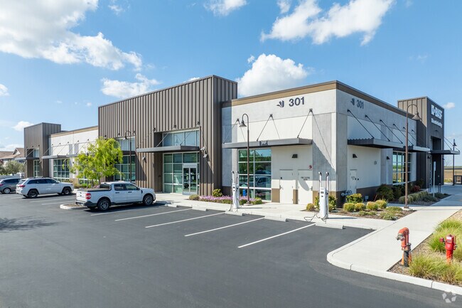
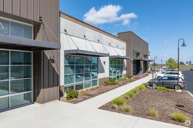
Property Record
301 Mace Blvd, Davis, CA 95618

Property Detail
301 Mace Blvd
071-100-065-000
PM 5144 PCL 2 2019 M 59-61
Officebuilding
Yolo
C
California
B and X Area of moderate flood hazard, usually the area between the limits of the 100-year and 500-year floods.
1.52 AC
2024
Davis/Woodland
2025
Sacramento
010605
Sacramento-Roseville-Folsom, CA
16,200 SF
NEARBY LISTINGS FOR SALE OR LEASE
DEMOGRAPHICS near 301 Mace Blvd
1 mile
3 mile
5 mile
2025 Total Population
7,537
43,647
81,774
2030 Population
7,671
44,628
84,042
Pop Growth 2025-2030
+ 1.78%
+ 2.25%
+ 2.77%
Average Age
37
36
34
2025 Total Households
2,819
16,716
28,205
HH Growth 2025-2030
+ 2.13%
+ 2.39%
+ 2.77%
Median Household Inc
$120,512
$96,781
$88,505
Avg Household Size
2.60
2.50
2.50
2025 Avg HH Vehicles
2.00
2.00
2.00
Median Home Value
$868,742
$824,255
$835,291
Median Year Built
1991
1984
1984
Nearby Places
Map Layers
Map Styles
 Street
 Aerial
Transit
 Traffic
 Biking
Places
Listings with unknown addresses are not visible on the map
- Restaurants
- Banks
- Shops
- Fitness
- Groceries
PUBLIC TRANSPORTATION
COMMUTER RAIL
Davis (Capitol Corridor - Capitol Corridor Joint Powers Authority)
Drive
Walk
Distance
Davis (Capitol Corridor - Capitol Corridor Joint Powers Authority)
6 min
3.5 mi
AIRPORT
Sacramento International
Drive
Walk
Distance
Sacramento International
28 min
20.3 mi
Freight Ports
Port of Stockton
Drive
Walk
Distance
Port of Stockton
66 min
56.3 mi
SALE & LEASE HISTORY
LISTING DATE
SALE/LEASE

Apr 26, 2019
For Lease
Nearby Properties
Address
Land Use
TOTAL SIZE
Lot Size
Zoning
Address
Land Use
TOTAL SIZE
Lot Size
Zoning
5.92 AC
P-D
Address
Land Use
TOTAL SIZE
Lot Size
Zoning
29,376 SF
0.14 AC
PD
Address
Land Use
TOTAL SIZE
Lot Size
Zoning
225,000 SF
7.43 AC
PD
Address
Land Use
TOTAL SIZE
Lot Size
Zoning
0.20 AC
I
Address
Land Use
TOTAL SIZE
Lot Size
Zoning
209,988 SF
0.11 AC
PD
Address
Land Use
TOTAL SIZE
Lot Size
Zoning
168,279 SF
0.09 AC
R-M
Address
Land Use
TOTAL SIZE
Lot Size
Zoning
110,839 SF
0.26 AC
R3M
Address
Land Use
TOTAL SIZE
Lot Size
Zoning
134,214 SF
5.99 AC
PD
Address
Land Use
TOTAL SIZE
Lot Size
Zoning
174,228 SF
0.16 AC
PD
Address
Land Use
TOTAL SIZE
Lot Size
Zoning
126,842 SF
13.56 AC
PD
Address
Land Use
TOTAL SIZE
Lot Size
Zoning
148,848 SF
0.13 AC
I
Address
Land Use
TOTAL SIZE
Lot Size
Zoning
107,817 SF
6.44 AC
PD
Address
Land Use
TOTAL SIZE
Lot Size
Zoning
1.37 AC
PD
Address
Land Use
TOTAL SIZE
Lot Size
Zoning
2.52 AC
I
Address
Land Use
TOTAL SIZE
Lot Size
Zoning
99,399 SF
5.83 AC
I
Address
Land Use
TOTAL SIZE
Lot Size
Zoning
152,916 SF
0.17 AC
PD
Address
Land Use
TOTAL SIZE
Lot Size
Zoning
1.74 AC
CH
Address
Land Use
TOTAL SIZE
Lot Size
Zoning
68,428 SF
0.29 AC
PD
Address
Land Use
TOTAL SIZE
Lot Size
Zoning
213,692 SF
8.07 AC
03
Address
Land Use
TOTAL SIZE
Lot Size
Zoning
102,400 SF
5.78 AC
PD
Address
Land Use
TOTAL SIZE
Lot Size
Zoning
90,752 SF
0.21 AC
R3
Address
Land Use
TOTAL SIZE
Lot Size
Zoning
1.93 AC
PD
Address
Land Use
TOTAL SIZE
Lot Size
Zoning
78,953 SF
2.69 AC
I
Address
Land Use
TOTAL SIZE
Lot Size
Zoning
61,829 SF
1.31 AC
CC
Address
Land Use
TOTAL SIZE
Lot Size
Zoning
12,361 SF
0.59 AC
PD
Address
Land Use
TOTAL SIZE
Lot Size
Zoning
70,954 SF
3.73 AC
PD
Address
Land Use
TOTAL SIZE
Lot Size
Zoning
79,719 SF
3.50 AC
PD
Address
Land Use
TOTAL SIZE
Lot Size
Zoning
99,968 SF
0.19 AC
R3M
Address
Land Use
TOTAL SIZE
Lot Size
Zoning
59,200 SF
2.34 AC
R3M
Address
Land Use
TOTAL SIZE
Lot Size
Zoning
2.03 AC
I-R
The World's #1 Commercial Real Estate Marketplace
Connect with us
© 2026 CoStar Group
The information above has been obtained from sources believed reliable. While we do not doubt its accuracy we have not verified it and make no guarantee, warranty or representation about it. It is your responsibility to independently confirm its accuracy and completeness. Any projections, opinions, assumptions, or estimates used are for example only and do not represent the current or future performance of the property. The value of this transaction to you depends on tax and other factors which should be evaluated by your tax, financial, and legal advisors. You and your advisors should conduct a careful, independent investigation of the property to determine to your satisfaction the suitability of the property for your needs.