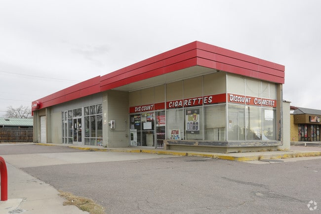
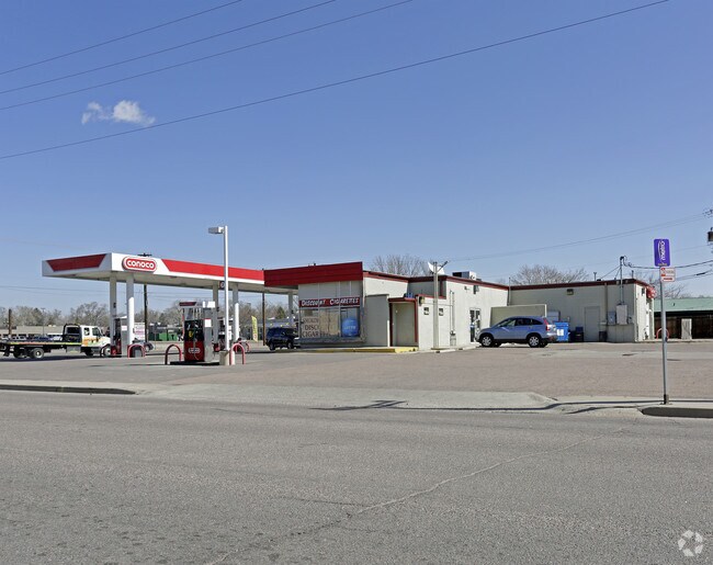
Property Record
301 Main St, Colorado Springs, CO 80911
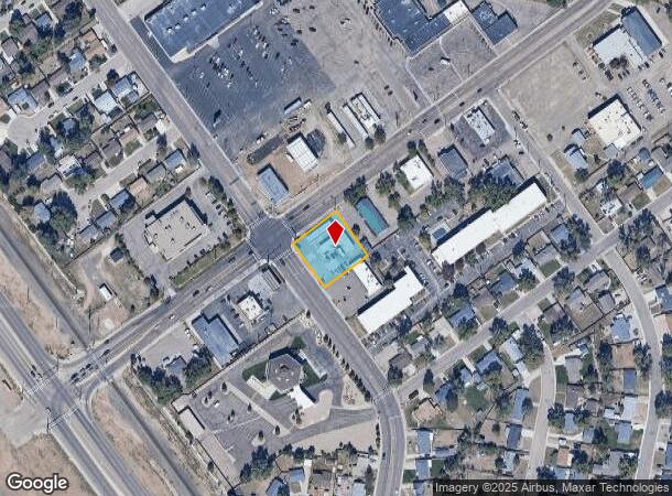

NEARBY LISTINGS FOR SALE OR LEASE
Property Detail
301 Main St
65114-16-030
Security Add No 06
Commercialbuilding
PART OF BLK 12 SECURITY COLO ADD 6 AS FOLS, BEG AT MOST WLY COR OF SD BLK, TH NE ALG N BDRY LN OF BLK 150 FT, SE AT R/W 150 FT, SW AT R/A 150 FT, TH NW ALG WLY BDRY LN 150.0 FT TO POB
AE
El Paso
08041C0763G
Colorado
2024
0.52 AC
2025
Southeast
004200
Colorado Springs
1,980 SF
Colorado Springs, CO
DEMOGRAPHICS near 301 Main St
1 Mile
3 Mile
5 Mile
2024 Total Population
10,105
52,728
156,661
2029 Population
10,447
54,573
163,488
Pop Growth 2024-2029
+ 3.38%
+ 3.50%
+ 4.36%
Average Age
38
35
34
2024 Total Households
3,719
16,603
53,101
HH Growth 2024-2029
+ 3.60%
+ 3.81%
+ 4.71%
Median Household Inc
$69,360
$68,457
$66,468
Avg Household Size
2.70
2.80
2.70
2024 Avg HH Vehicles
2.00
2.00
2.00
Median Home Value
$287,102
$298,873
$316,686
Median Year Built
1966
1982
1987
Nearby Places
Map Layers
Map Styles
 Street
 Aerial
- Restaurants
- Banks
- Shops
- Fitness
- Groceries
PUBLIC TRANSPORTATION
AIRPORT
City of Colorado Springs Municipal
DRIVE
WALK
Distance
City of Colorado Springs Municipal
18 min
8.8 mi
Freight Ports
Tulsa Port Of Catoosa
DRIVE
WALK
Distance
Tulsa Port Of Catoosa
744 min
695.3 mi
SALE & LEASE HISTORY
LISTING DATE
SALE/LEASE

Jun 14, 2018
For Lease
Jun 14, 2018
For Sale
Jan 12, 2018
For Sale
Nearby Properties
Address
Land Use
TOTAL SIZE
Lot Size
Zoning
Address
Land Use
TOTAL SIZE
Lot Size
Zoning
241,806 SF
937.06 AC
A-5 CAD-O
Address
Land Use
TOTAL SIZE
Lot Size
Zoning
3,486,127 SF
69.25 AC
APD APZ1 A
Address
Land Use
TOTAL SIZE
Lot Size
Zoning
89,487 SF
Address
Land Use
TOTAL SIZE
Lot Size
Zoning
78,815 SF
Address
Land Use
TOTAL SIZE
Lot Size
Zoning
48,255 SF
17.35 AC
A-5 CAD-O
Address
Land Use
TOTAL SIZE
Lot Size
Zoning
278,331 SF
324.19 AC
Address
Land Use
TOTAL SIZE
Lot Size
Zoning
34,984 SF
14.31 AC
A-5
Address
Land Use
TOTAL SIZE
Lot Size
Zoning
92.06 AC
APD APZ1 A
Address
Land Use
TOTAL SIZE
Lot Size
Zoning
130,569 SF
3.23 AC
Address
Land Use
TOTAL SIZE
Lot Size
Zoning
22,596 SF
3.93 AC
R-5 UV AO
Address
Land Use
TOTAL SIZE
Lot Size
Zoning
50,992 SF
10.27 AC
PDZ AO
Address
Land Use
TOTAL SIZE
Lot Size
Zoning
131,040 SF
8.50 AC
BP/CR AO
Address
Land Use
TOTAL SIZE
Lot Size
Zoning
92,000 SF
9.56 AC
MX-M UV AO
Address
Land Use
TOTAL SIZE
Lot Size
Zoning
66,640 SF
6.87 AC
MX-M CU AO
Address
Land Use
TOTAL SIZE
Lot Size
Zoning
322,147 SF
35.10 AC
I-2 CAD-O
Address
Land Use
TOTAL SIZE
Lot Size
Zoning
43,914 SF
9.36 AC
A-5 CAD-O
Address
Land Use
TOTAL SIZE
Lot Size
Zoning
207,858 SF
18.08 AC
C-2 R-2
Address
Land Use
TOTAL SIZE
Lot Size
Zoning
168.20 AC
APD APZ1 A
Address
Land Use
TOTAL SIZE
Lot Size
Zoning
2.09 AC
MX-M CU AO
Address
Land Use
TOTAL SIZE
Lot Size
Zoning
19,308 SF
2.69 AC
RM-30 CAD-
Address
Land Use
TOTAL SIZE
Lot Size
Zoning
9,448 SF
212.16 AC
A-5
Address
Land Use
TOTAL SIZE
Lot Size
Zoning
131,040 SF
9.68 AC
BP AO
Address
Land Use
TOTAL SIZE
Lot Size
Zoning
163,073 SF
14.57 AC
PUD
Address
Land Use
TOTAL SIZE
Lot Size
Zoning
278,331 SF
6.39 AC
Address
Land Use
TOTAL SIZE
Lot Size
Zoning
99,960 SF
8.21 AC
BP AO
Address
Land Use
TOTAL SIZE
Lot Size
Zoning
8,252 SF
44.09 AC
A-5
Address
Land Use
TOTAL SIZE
Lot Size
Zoning
19,813 SF
16.55 AC
A-5 CAD-O
Address
Land Use
TOTAL SIZE
Lot Size
Zoning
57,430 SF
9.19 AC
R-1 6 DF A
Address
Land Use
TOTAL SIZE
Lot Size
Zoning
Address
Land Use
TOTAL SIZE
Lot Size
Zoning
66,780 SF
18.74 AC
APD APZ2 A
The World's #1 Commercial Real Estate Marketplace
Connect with us
© 2025 CoStar Group
The information above has been obtained from sources believed reliable. While we do not doubt its accuracy we have not verified it and make no guarantee, warranty or representation about it. It is your responsibility to independently confirm its accuracy and completeness. Any projections, opinions, assumptions, or estimates used are for example only and do not represent the current or future performance of the property. The value of this transaction to you depends on tax and other factors which should be evaluated by your tax, financial, and legal advisors. You and your advisors should conduct a careful, independent investigation of the property to determine to your satisfaction the suitability of the property for your needs.