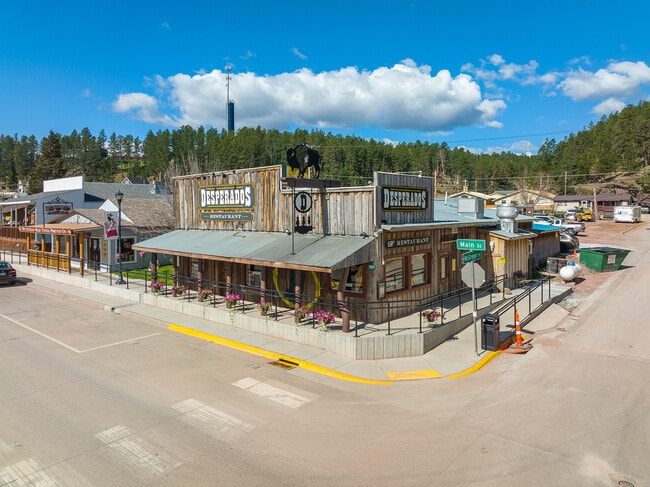
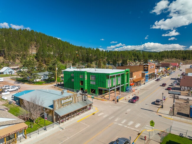
Property Record
301 Main St, Hill City, SD 57745

Property Detail
301 Main St
Rapid City, SD
ORIGINAL TOWN OF HILL CITY, BLOCK 2, LOT 20, LESS LOT H1; LOT 21; LOT E
0048477
Pennington
Restaurantbuilding
South Dakota
B and X Area of moderate flood hazard, usually the area between the limits of the 100-year and 500-year floods.
20e
2025
0.15 AC
2025
Rapid City
011700
Other Market Areas
2,448 SF
NEARBY LISTINGS FOR SALE OR LEASE
-
-
View all Hill City listings for sale on LoopNet.com
DEMOGRAPHICS near 301 Main St
1 mile
3 mile
5 mile
2025 Total Population
896
1,442
1,856
2030 Population
924
1,488
1,920
Pop Growth 2025-2030
+ 3.13%
+ 3.19%
+ 3.45%
Average Age
48
48
48
2025 Total Households
401
644
829
HH Growth 2025-2030
+ 3.24%
+ 3.42%
+ 3.74%
Median Household Inc
$79,167
$79,583
$80,521
Avg Household Size
2.20
2.20
2.20
2025 Avg HH Vehicles
3.00
3.00
3.00
Median Home Value
$493,395
$492,856
$490,540
Median Year Built
1989
1988
1988
Nearby Places
Map Layers
Map Styles
 Street
 Aerial
Layers
 Traffic
 Biking
Places
Listings with unknown addresses are not visible on the map
- Restaurants
- Banks
- Shops
- Fitness
- Groceries
PUBLIC TRANSPORTATION
AIRPORT
Rapid City Regional
Drive
Walk
Distance
Rapid City Regional
50 min
35.4 mi
SALE & LEASE HISTORY
LISTING DATE
SALE/LEASE

Jun 01, 2022
For Sale
Nearby Properties
Address
Land Use
TOTAL SIZE
Lot Size
Zoning
Address
Land Use
TOTAL SIZE
Lot Size
Zoning
14,566 SF
3.35 AC
Address
Land Use
TOTAL SIZE
Lot Size
Zoning
13,709 SF
1.40 AC
Address
Land Use
TOTAL SIZE
Lot Size
Zoning
1,200 SF
30.58 AC
Address
Land Use
TOTAL SIZE
Lot Size
Zoning
11,159 SF
0.94 AC
Address
Land Use
TOTAL SIZE
Lot Size
Zoning
2,982 SF
5.12 AC
Address
Land Use
TOTAL SIZE
Lot Size
Zoning
18,924 SF
4.86 AC
Address
Land Use
TOTAL SIZE
Lot Size
Zoning
5,667 SF
0.47 AC
Address
Land Use
TOTAL SIZE
Lot Size
Zoning
6,674 SF
0.79 AC
Address
Land Use
TOTAL SIZE
Lot Size
Zoning
4,947 SF
0.90 AC
Address
Land Use
TOTAL SIZE
Lot Size
Zoning
13,843 SF
2.19 AC
Address
Land Use
TOTAL SIZE
Lot Size
Zoning
5,000 SF
15.45 AC
Address
Land Use
TOTAL SIZE
Lot Size
Zoning
4,214 SF
0.20 AC
Address
Land Use
TOTAL SIZE
Lot Size
Zoning
2,314 SF
30.72 AC
Address
Land Use
TOTAL SIZE
Lot Size
Zoning
1,152 SF
23.44 AC
Address
Land Use
TOTAL SIZE
Lot Size
Zoning
5,376 SF
0.20 AC
Address
Land Use
TOTAL SIZE
Lot Size
Zoning
9,044 SF
0.99 AC
Address
Land Use
TOTAL SIZE
Lot Size
Zoning
2,376 SF
0.71 AC
Address
Land Use
TOTAL SIZE
Lot Size
Zoning
670 SF
5.44 AC
Address
Land Use
TOTAL SIZE
Lot Size
Zoning
2,274 SF
2.77 AC
Address
Land Use
TOTAL SIZE
Lot Size
Zoning
4,573 SF
0.42 AC
Address
Land Use
TOTAL SIZE
Lot Size
Zoning
4,648 SF
0.48 AC
Address
Land Use
TOTAL SIZE
Lot Size
Zoning
1,288 SF
0.21 AC
Address
Land Use
TOTAL SIZE
Lot Size
Zoning
2,340 SF
0.12 AC
Address
Land Use
TOTAL SIZE
Lot Size
Zoning
2,768 SF
7.68 AC
Address
Land Use
TOTAL SIZE
Lot Size
Zoning
7,392 SF
0.33 AC
Address
Land Use
TOTAL SIZE
Lot Size
Zoning
6,300 SF
26.06 AC
Address
Land Use
TOTAL SIZE
Lot Size
Zoning
2,496 SF
2.62 AC
Address
Land Use
TOTAL SIZE
Lot Size
Zoning
7,990 SF
0.42 AC
Address
Land Use
TOTAL SIZE
Lot Size
Zoning
5,000 SF
0.95 AC
Address
Land Use
TOTAL SIZE
Lot Size
Zoning
3,048 SF
0.29 AC
The World's #1 Commercial Real Estate Marketplace
Connect with us
© 2026 CoStar Group
The information above has been obtained from sources believed reliable. While we do not doubt its accuracy we have not verified it and make no guarantee, warranty or representation about it. It is your responsibility to independently confirm its accuracy and completeness. Any projections, opinions, assumptions, or estimates used are for example only and do not represent the current or future performance of the property. The value of this transaction to you depends on tax and other factors which should be evaluated by your tax, financial, and legal advisors. You and your advisors should conduct a careful, independent investigation of the property to determine to your satisfaction the suitability of the property for your needs.