Property Record
301 N Hamilton Rd, Columbus, OH 43213
NEARBY LISTINGS FOR SALE OR LEASE
Property Detail
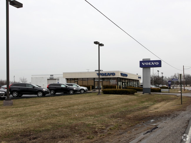
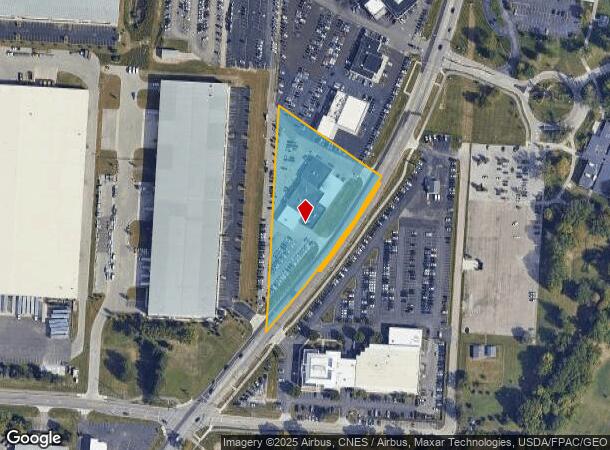
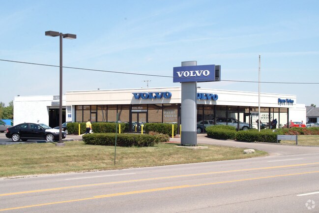
301 N Hamilton Rd
Columbus, OH
United States Military Lands
090-000514
HAMILTON RD 2.7671 ACRES R17 T1 1/4T4
Vehiclerentalsvehiclesales
Franklin
X
Ohio
39045C0025G
1
2024
2.54 AC
2024
East
009251
Columbus
19,533 SF
DEMOGRAPHICS near 301 N Hamilton Rd
1 Mile
3 Mile
5 Mile
2024 Total Population
5,310
78,603
252,243
2029 Population
5,396
78,671
252,512
Pop Growth 2024-2029
+ 1.62%
+ 0.09%
+ 0.11%
Average Age
38
39
38
2024 Total Households
2,575
32,785
101,678
HH Growth 2024-2029
+ 1.13%
+ 0.06%
+ 0.14%
Median Household Inc
$52,394
$52,697
$57,030
Avg Household Size
2.00
2.30
2.40
2024 Avg HH Vehicles
1.00
2.00
2.00
Median Home Value
$201,250
$194,139
$216,800
Median Year Built
1977
1969
1974
Nearby Places
Map Layers
Map Styles
 Street
 Aerial
- Restaurants
- Banks
- Shops
- Fitness
- Groceries
PUBLIC TRANSPORTATION
AIRPORT
John Glenn Columbus International
DRIVE
WALK
Distance
John Glenn Columbus International
7 min
3.1 mi
Rickenbacker International
DRIVE
WALK
Distance
Rickenbacker International
22 min
15.1 mi
Freight Ports
Port of Toledo
DRIVE
WALK
Distance
Port of Toledo
186 min
148.6 mi
Nearby Properties
Address
Land Use
TOTAL SIZE
Lot Size
Zoning
Address
Land Use
TOTAL SIZE
Lot Size
Zoning
316,415 SF
415.78 AC
Address
Land Use
TOTAL SIZE
Lot Size
Zoning
1,256,678 SF
1,292.62 AC
Address
Land Use
TOTAL SIZE
Lot Size
Zoning
Address
Land Use
TOTAL SIZE
Lot Size
Zoning
761,542 SF
21.30 AC
Address
Land Use
TOTAL SIZE
Lot Size
Zoning
180,383 SF
15.54 AC
Address
Land Use
TOTAL SIZE
Lot Size
Zoning
208,472 SF
1.45 AC
Address
Land Use
TOTAL SIZE
Lot Size
Zoning
329,049 SF
38.53 AC
Address
Land Use
TOTAL SIZE
Lot Size
Zoning
164,095 SF
33.71 AC
Address
Land Use
TOTAL SIZE
Lot Size
Zoning
147,649 SF
5.15 AC
Address
Land Use
TOTAL SIZE
Lot Size
Zoning
122,526 SF
27 AC
Address
Land Use
TOTAL SIZE
Lot Size
Zoning
514,341 SF
46.79 AC
Address
Land Use
TOTAL SIZE
Lot Size
Zoning
183,352 SF
55.41 AC
Address
Land Use
TOTAL SIZE
Lot Size
Zoning
282,035 SF
29.29 AC
Address
Land Use
TOTAL SIZE
Lot Size
Zoning
464,796 SF
7.33 AC
Address
Land Use
TOTAL SIZE
Lot Size
Zoning
166,628 SF
9.98 AC
Address
Land Use
TOTAL SIZE
Lot Size
Zoning
706,471 SF
41.34 AC
Address
Land Use
TOTAL SIZE
Lot Size
Zoning
217,088 SF
10.67 AC
Address
Land Use
TOTAL SIZE
Lot Size
Zoning
253,893 SF
12.57 AC
Address
Land Use
TOTAL SIZE
Lot Size
Zoning
171,366 SF
28.27 AC
Address
Land Use
TOTAL SIZE
Lot Size
Zoning
1,264,151 SF
58.42 AC
Address
Land Use
TOTAL SIZE
Lot Size
Zoning
170,209 SF
15.03 AC
Address
Land Use
TOTAL SIZE
Lot Size
Zoning
142,542 SF
6.55 AC
Address
Land Use
TOTAL SIZE
Lot Size
Zoning
188,305 SF
27.46 AC
Address
Land Use
TOTAL SIZE
Lot Size
Zoning
142,542 SF
3.95 AC
Address
Land Use
TOTAL SIZE
Lot Size
Zoning
158,325 SF
34.39 AC
Address
Land Use
TOTAL SIZE
Lot Size
Zoning
187,858 SF
19.50 AC
Address
Land Use
TOTAL SIZE
Lot Size
Zoning
145,592 SF
4.48 AC
Address
Land Use
TOTAL SIZE
Lot Size
Zoning
267,596 SF
5.76 AC
Address
Land Use
TOTAL SIZE
Lot Size
Zoning
471,738 SF
35.43 AC
Address
Land Use
TOTAL SIZE
Lot Size
Zoning
118,706 SF
8.73 AC
The World's #1 Commercial Real Estate Marketplace
Connect with us
© 2025 CoStar Group
The information above has been obtained from sources believed reliable. While we do not doubt its accuracy we have not verified it and make no guarantee, warranty or representation about it. It is your responsibility to independently confirm its accuracy and completeness. Any projections, opinions, assumptions, or estimates used are for example only and do not represent the current or future performance of the property. The value of this transaction to you depends on tax and other factors which should be evaluated by your tax, financial, and legal advisors. You and your advisors should conduct a careful, independent investigation of the property to determine to your satisfaction the suitability of the property for your needs.