Property Record
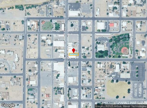
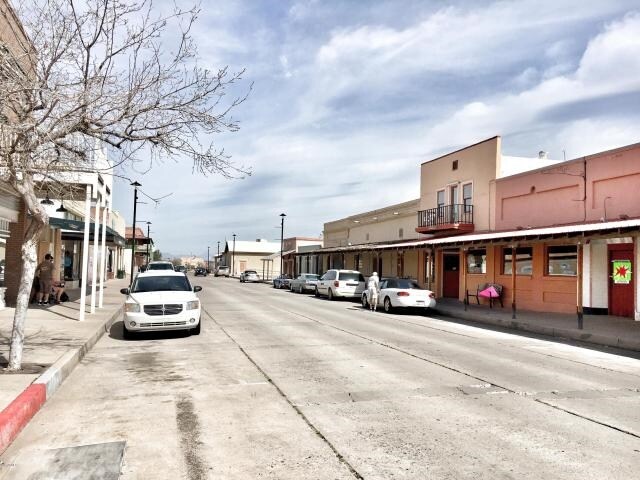
305 N Main St, Eloy, AZ 85131

NEARBY LISTINGS FOR SALE OR LEASE
Property Detail
305 N Main St
200-49-003D
Florence Townsite
Bartavern
N1/2 S1/2 OF BLOCK 124 OF FLORENCE TOWNSITE BK 1 PG 1 SEC 36-4S-9 E .09 AC
X
Pinal
04021C0867E
Arizona
2024
0.09 AC
2025
Outlying Pinal County
002004
Phoenix
2,651 SF
Phoenix-Mesa-Scottsdale, AZ
DEMOGRAPHICS near 305 N Main St
1 Mile
3 Mile
5 Mile
2024 Total Population
4,842
11,267
15,491
2029 Population
5,372
13,250
18,712
Pop Growth 2024-2029
+ 10.95%
+ 17.60%
+ 20.79%
Average Age
41
48
47
2024 Total Households
859
3,203
4,766
HH Growth 2024-2029
+ 21.54%
+ 29.04%
+ 29.06%
Median Household Inc
$58,610
$42,001
$55,221
Avg Household Size
2.60
2.00
2.20
2024 Avg HH Vehicles
2.00
2.00
2.00
Median Home Value
$168,047
$101,824
$181,712
Median Year Built
1980
1992
1998
Nearby Places
Map Layers
Map Styles
 Street
 Aerial
- Restaurants
- Banks
- Shops
- Fitness
- Groceries
SALE & LEASE HISTORY
LISTING DATE
SALE/LEASE

Sep 29, 2017
For Sale
Sep 06, 2018
For Sale
Mar 08, 2017
For Sale
Jan 30, 2017
For Sale
Dec 19, 2019
For Sale
Nearby Properties
Address
Land Use
TOTAL SIZE
Lot Size
Zoning
Address
Land Use
TOTAL SIZE
Lot Size
Zoning
583,508 SF
32.12 AC
UNDESIGNAT
Address
Land Use
TOTAL SIZE
Lot Size
Zoning
388,169 SF
33.33 AC
UNDESIGNAT
Address
Land Use
TOTAL SIZE
Lot Size
Zoning
199,261 SF
19.06 AC
UNDESIGNAT
Address
Land Use
TOTAL SIZE
Lot Size
Zoning
128,660 SF
4.80 AC
UNDESIGNAT
Address
Land Use
TOTAL SIZE
Lot Size
Zoning
303,040 SF
12.34 AC
Address
Land Use
TOTAL SIZE
Lot Size
Zoning
11.58 AC
Address
Land Use
TOTAL SIZE
Lot Size
Zoning
102,629 SF
17.85 AC
UNDESIGNAT
Address
Land Use
TOTAL SIZE
Lot Size
Zoning
51,000 SF
5.71 AC
Address
Land Use
TOTAL SIZE
Lot Size
Zoning
71,889 SF
10.43 AC
Address
Land Use
TOTAL SIZE
Lot Size
Zoning
27,177 SF
125.23 AC
Address
Land Use
TOTAL SIZE
Lot Size
Zoning
89,998 SF
7.92 AC
Address
Land Use
TOTAL SIZE
Lot Size
Zoning
38,044 SF
1.62 AC
UNDESIGNAT
Address
Land Use
TOTAL SIZE
Lot Size
Zoning
19.98 AC
UNDESIGNAT
Address
Land Use
TOTAL SIZE
Lot Size
Zoning
Address
Land Use
TOTAL SIZE
Lot Size
Zoning
56,028 SF
2.44 AC
UNDESIGNAT
Address
Land Use
TOTAL SIZE
Lot Size
Zoning
32.30 AC
Address
Land Use
TOTAL SIZE
Lot Size
Zoning
39,036 SF
4.88 AC
UNDESIGNAT
Address
Land Use
TOTAL SIZE
Lot Size
Zoning
14,990 SF
6.44 AC
UNDESIGNAT
Address
Land Use
TOTAL SIZE
Lot Size
Zoning
12,100 SF
2.40 AC
Address
Land Use
TOTAL SIZE
Lot Size
Zoning
11,100 SF
3.10 AC
UNDESIGNAT
Address
Land Use
TOTAL SIZE
Lot Size
Zoning
Address
Land Use
TOTAL SIZE
Lot Size
Zoning
11.97 AC
UNDESIGNAT
Address
Land Use
TOTAL SIZE
Lot Size
Zoning
17,914 SF
2.23 AC
UNDESIGNAT
Address
Land Use
TOTAL SIZE
Lot Size
Zoning
7,636 SF
3.56 AC
Address
Land Use
TOTAL SIZE
Lot Size
Zoning
210.16 AC
UNDESIGNAT
Address
Land Use
TOTAL SIZE
Lot Size
Zoning
784 SF
3.84 AC
Address
Land Use
TOTAL SIZE
Lot Size
Zoning
8,564 SF
1.53 AC
Address
Land Use
TOTAL SIZE
Lot Size
Zoning
5,305 SF
0.66 AC
UNDESIGNAT
Address
Land Use
TOTAL SIZE
Lot Size
Zoning
5,308 SF
1.51 AC
Address
Land Use
TOTAL SIZE
Lot Size
Zoning
3.96 AC
The World's #1 Commercial Real Estate Marketplace
Connect with us
© 2025 CoStar Group
The information above has been obtained from sources believed reliable. While we do not doubt its accuracy we have not verified it and make no guarantee, warranty or representation about it. It is your responsibility to independently confirm its accuracy and completeness. Any projections, opinions, assumptions, or estimates used are for example only and do not represent the current or future performance of the property. The value of this transaction to you depends on tax and other factors which should be evaluated by your tax, financial, and legal advisors. You and your advisors should conduct a careful, independent investigation of the property to determine to your satisfaction the suitability of the property for your needs.