Property Record
301 N Ridge Rd, Minooka, IL 60447
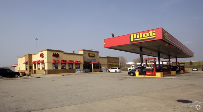
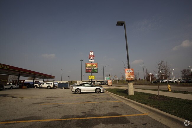
Property Detail
301 N Ridge Rd
03-02-200-016
PT E1/2 NE - BEG 709'S NE COR, S6' W739.6' N577.74' SE20.09' SE111.93' SE154.68' SE192.84' SE57.26' SE32.61' S367.52' E210' T
Commercialnec
Grundy
B and X Area of moderate flood hazard, usually the area between the limits of the 100-year and 500-year floods.
Illinois
2025
1.96 AC
2025
Grundy County
000102
Chicago
8,160 SF
Chicago-Naperville-Elgin, IL-IN
NEARBY LISTINGS FOR SALE OR LEASE
DEMOGRAPHICS near 301 N Ridge Rd
1 mile
3 mile
5 mile
2025 Total Population
1,882
17,455
41,981
2030 Population
1,903
17,873
43,026
Pop Growth 2025-2030
+ 1.12%
+ 2.39%
+ 2.49%
Average Age
39
37
39
2025 Total Households
666
5,822
14,400
HH Growth 2025-2030
+ 1.05%
+ 2.30%
+ 2.44%
Median Household Inc
$91,703
$115,713
$116,773
Avg Household Size
2.80
3.00
2.90
2025 Avg HH Vehicles
2.00
2.00
2.00
Median Home Value
$269,141
$308,116
$325,754
Median Year Built
1978
2001
2001
Nearby Places
Map Layers
Map Styles
 Street
 Aerial
Layers
 Traffic
 Biking
Places
Listings with unknown addresses are not visible on the map
- Restaurants
- Banks
- Shops
- Fitness
- Groceries
Nearby Properties
Address
Land Use
TOTAL SIZE
Lot Size
Zoning
Address
Land Use
TOTAL SIZE
Lot Size
Zoning
73.42 AC
Address
Land Use
TOTAL SIZE
Lot Size
Zoning
1,000,800 SF
24.66 AC
Address
Land Use
TOTAL SIZE
Lot Size
Zoning
872,032 SF
43.10 AC
Address
Land Use
TOTAL SIZE
Lot Size
Zoning
1,034,100 SF
54.99 AC
Address
Land Use
TOTAL SIZE
Lot Size
Zoning
107,428 SF
17.69 AC
Address
Land Use
TOTAL SIZE
Lot Size
Zoning
364 SF
48.93 AC
Address
Land Use
TOTAL SIZE
Lot Size
Zoning
598,380 SF
32.69 AC
Address
Land Use
TOTAL SIZE
Lot Size
Zoning
19.57 AC
Address
Land Use
TOTAL SIZE
Lot Size
Zoning
79.57 AC
Address
Land Use
TOTAL SIZE
Lot Size
Zoning
15,600 SF
7.60 AC
Address
Land Use
TOTAL SIZE
Lot Size
Zoning
306,240 SF
19.99 AC
Address
Land Use
TOTAL SIZE
Lot Size
Zoning
35.52 AC
Address
Land Use
TOTAL SIZE
Lot Size
Zoning
861,000 SF
47.22 AC
Address
Land Use
TOTAL SIZE
Lot Size
Zoning
456,860 SF
35.47 AC
Address
Land Use
TOTAL SIZE
Lot Size
Zoning
17.51 AC
Address
Land Use
TOTAL SIZE
Lot Size
Zoning
24.22 AC
Address
Land Use
TOTAL SIZE
Lot Size
Zoning
47,183 SF
2.52 AC
Address
Land Use
TOTAL SIZE
Lot Size
Zoning
56,214 SF
2.85 AC
Address
Land Use
TOTAL SIZE
Lot Size
Zoning
134,300 SF
18.29 AC
Address
Land Use
TOTAL SIZE
Lot Size
Zoning
4.72 AC
Address
Land Use
TOTAL SIZE
Lot Size
Zoning
9,185 SF
5.86 AC
Address
Land Use
TOTAL SIZE
Lot Size
Zoning
4,532 SF
12.24 AC
Address
Land Use
TOTAL SIZE
Lot Size
Zoning
60,804 SF
7.29 AC
Address
Land Use
TOTAL SIZE
Lot Size
Zoning
16,884 SF
9.93 AC
Address
Land Use
TOTAL SIZE
Lot Size
Zoning
1,187 SF
2.11 AC
Address
Land Use
TOTAL SIZE
Lot Size
Zoning
77,000 SF
7.43 AC
Address
Land Use
TOTAL SIZE
Lot Size
Zoning
3.91 AC
Address
Land Use
TOTAL SIZE
Lot Size
Zoning
2,825 SF
4.22 AC
Address
Land Use
TOTAL SIZE
Lot Size
Zoning
4,653 SF
1.14 AC
The World's #1 Commercial Real Estate Marketplace
Connect with us
© 2026 CoStar Group
The information above has been obtained from sources believed reliable. While we do not doubt its accuracy we have not verified it and make no guarantee, warranty or representation about it. It is your responsibility to independently confirm its accuracy and completeness. Any projections, opinions, assumptions, or estimates used are for example only and do not represent the current or future performance of the property. The value of this transaction to you depends on tax and other factors which should be evaluated by your tax, financial, and legal advisors. You and your advisors should conduct a careful, independent investigation of the property to determine to your satisfaction the suitability of the property for your needs.