Property Record
301 N Walston Bridge Rd, Jasper, AL 35504


NEARBY LISTINGS FOR SALE OR LEASE
Property Detail
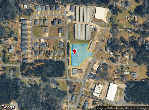
301 N Walston Bridge Rd
17-02-03-4-000-013-0000
PO SWSE 3/14/7 COM @ INT N ROW 2ND ST NE & W ROW WALSTON BRIDGE RD NE ALG W ROW 285.9 TO POB CONT NE 70 NW 105 NE 100 W 265
Commercialofficeresidentialmixeduse
Walker
X
Alabama
01127C0307E
1.70 AC
2025
Walker County
2024
Birmingham
020302
Birmingham-Hoover, AL
16,510 SF
DEMOGRAPHICS near 301 N Walston Bridge Rd
1 Mile
3 Mile
5 Mile
2024 Total Population
2,523
13,945
21,098
2029 Population
2,438
13,634
20,638
Pop Growth 2024-2029
(3.37%)
(2.23%)
(2.18%)
Average Age
42
42
42
2024 Total Households
1,088
5,485
8,306
HH Growth 2024-2029
(3.22%)
(2.19%)
(2.11%)
Median Household Inc
$55,723
$48,765
$51,409
Avg Household Size
2.20
2.40
2.40
2024 Avg HH Vehicles
2.00
2.00
2.00
Median Home Value
$191,148
$179,233
$173,298
Median Year Built
1977
1978
1981
Nearby Places
Map Layers
Map Styles
 Street
 Aerial
- Restaurants
- Banks
- Shops
- Fitness
- Groceries
SALE & LEASE HISTORY
LISTING DATE
SALE/LEASE

Sep 24, 2016
For Sale
Nearby Properties
Address
Land Use
TOTAL SIZE
Lot Size
Zoning
Address
Land Use
TOTAL SIZE
Lot Size
Zoning
258,084 SF
49 AC
O
Address
Land Use
TOTAL SIZE
Lot Size
Zoning
146,360 SF
51 AC
O
Address
Land Use
TOTAL SIZE
Lot Size
Zoning
86,928 SF
19 AC
OT
Address
Land Use
TOTAL SIZE
Lot Size
Zoning
55,188 SF
4.80 AC
OT
Address
Land Use
TOTAL SIZE
Lot Size
Zoning
42,149 SF
2 AC
O
Address
Land Use
TOTAL SIZE
Lot Size
Zoning
8,932 SF
7.50 AC
CO
Address
Land Use
TOTAL SIZE
Lot Size
Zoning
60,200 SF
5.60 AC
OT
Address
Land Use
TOTAL SIZE
Lot Size
Zoning
846 SF
11 AC
SF
Address
Land Use
TOTAL SIZE
Lot Size
Zoning
44,601 SF
3.80 AC
OT
Address
Land Use
TOTAL SIZE
Lot Size
Zoning
38,770 SF
180 AC
CO
Address
Land Use
TOTAL SIZE
Lot Size
Zoning
33,863 SF
2.50 AC
S
Address
Land Use
TOTAL SIZE
Lot Size
Zoning
26,446 SF
43 AC
CO
Address
Land Use
TOTAL SIZE
Lot Size
Zoning
37,813 SF
2 AC
O
Address
Land Use
TOTAL SIZE
Lot Size
Zoning
5,640 SF
19 AC
O
Address
Land Use
TOTAL SIZE
Lot Size
Zoning
4,830 SF
6.10 AC
OT
Address
Land Use
TOTAL SIZE
Lot Size
Zoning
30,981 SF
3.90 AC
S
Address
Land Use
TOTAL SIZE
Lot Size
Zoning
100 SF
20 AC
OT
Address
Land Use
TOTAL SIZE
Lot Size
Zoning
81,668 SF
9.80 AC
O
Address
Land Use
TOTAL SIZE
Lot Size
Zoning
53,413 SF
14 AC
O
The World's #1 Commercial Real Estate Marketplace
Connect with us
© 2025 CoStar Group
The information above has been obtained from sources believed reliable. While we do not doubt its accuracy we have not verified it and make no guarantee, warranty or representation about it. It is your responsibility to independently confirm its accuracy and completeness. Any projections, opinions, assumptions, or estimates used are for example only and do not represent the current or future performance of the property. The value of this transaction to you depends on tax and other factors which should be evaluated by your tax, financial, and legal advisors. You and your advisors should conduct a careful, independent investigation of the property to determine to your satisfaction the suitability of the property for your needs.