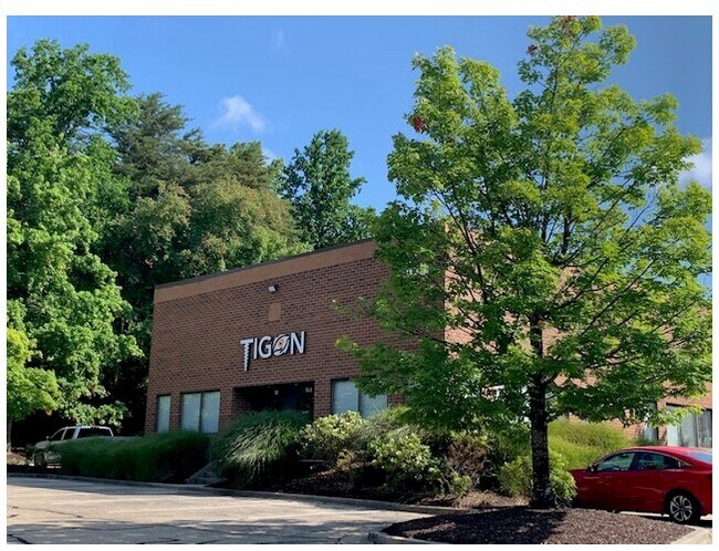
Property Record
303 Najoles Rd, Millersville, MD 21108
NEARBY LISTINGS FOR SALE OR LEASE
Property Detail
303 Najoles Rd
04-159-90066606
The Concourse
Warehouse
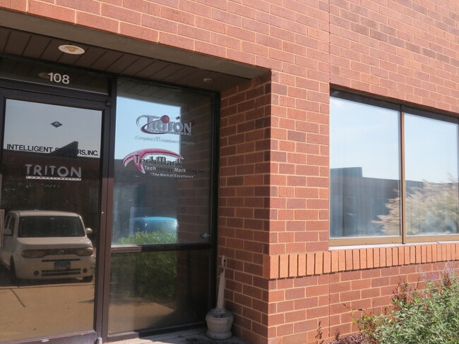
UNIT 101 PH I THE CONCOURSE
X
Anne Arundel
24003C0134E
Maryland
2024
2 AC
2025
I-97/Crain Hwy Corrid
741000
Baltimore
1,217 SF
Baltimore-Columbia-Towson, MD
DEMOGRAPHICS near 303 Najoles Rd
1 Mile
3 Mile
5 Mile
2024 Total Population
2,659
42,042
171,853
2029 Population
2,680
43,034
175,767
Pop Growth 2024-2029
+ 0.79%
+ 2.36%
+ 2.28%
Average Age
41
40
39
2024 Total Households
915
15,091
63,369
HH Growth 2024-2029
+ 0.77%
+ 2.41%
+ 2.37%
Median Household Inc
$155,132
$125,220
$110,399
Avg Household Size
2.90
2.70
2.60
2024 Avg HH Vehicles
2.00
2.00
2.00
Median Home Value
$717,696
$496,991
$423,186
Median Year Built
1979
1979
1984
Nearby Places
Map Layers
Map Styles
 Street
 Aerial
- Restaurants
- Banks
- Shops
- Fitness
- Groceries
PUBLIC TRANSPORTATION
COMMUTER RAIL
Odenton (Penn Line - Maryland Area Regional Commuter Trains (The MARC))
DRIVE
WALK
Distance
Odenton (Penn Line - Maryland Area Regional Commuter Trains (The MARC))
14 min
5.3 mi
AIRPORT
Baltimore/Washington International Thurgood Marshall
DRIVE
WALK
Distance
Baltimore/Washington International Thurgood Marshall
19 min
11.0 mi
Ronald Reagan Washington Ntl
DRIVE
WALK
Distance
Ronald Reagan Washington Ntl
53 min
35.1 mi
Freight Ports
Port of Baltimore
DRIVE
WALK
Distance
Port of Baltimore
25 min
16.3 mi
SALE & LEASE HISTORY
LISTING DATE
SALE/LEASE

Oct 26, 2023
For Lease
May 30, 2024
For Lease
Jan 22, 2019
For Lease
Aug 28, 2020
For Lease
Aug 18, 2020
For Lease
Nearby Properties
Address
Land Use
TOTAL SIZE
Lot Size
Zoning
Address
Land Use
TOTAL SIZE
Lot Size
Zoning
851,355 SF
172.49 AC
R5
Address
Land Use
TOTAL SIZE
Lot Size
Zoning
356,600 SF
21.37 AC
R5
Address
Land Use
TOTAL SIZE
Lot Size
Zoning
11.57 AC
R22
Address
Land Use
TOTAL SIZE
Lot Size
Zoning
277,037 SF
10.45 AC
R5
Address
Land Use
TOTAL SIZE
Lot Size
Zoning
14.53 AC
R22
Address
Land Use
TOTAL SIZE
Lot Size
Zoning
14.58 AC
R22
Address
Land Use
TOTAL SIZE
Lot Size
Zoning
18.93 AC
R15
Address
Land Use
TOTAL SIZE
Lot Size
Zoning
9.45 AC
R22
Address
Land Use
TOTAL SIZE
Lot Size
Zoning
14.70 AC
R15
Address
Land Use
TOTAL SIZE
Lot Size
Zoning
7.64 AC
R15
Address
Land Use
TOTAL SIZE
Lot Size
Zoning
139,230 SF
39.22 AC
R2
Address
Land Use
TOTAL SIZE
Lot Size
Zoning
154,056 SF
19.89 AC
R2
Address
Land Use
TOTAL SIZE
Lot Size
Zoning
128,466 SF
18.70 AC
W1
Address
Land Use
TOTAL SIZE
Lot Size
Zoning
98,109 SF
5.33 AC
C2
Address
Land Use
TOTAL SIZE
Lot Size
Zoning
46,896 SF
3.29 AC
C1B
Address
Land Use
TOTAL SIZE
Lot Size
Zoning
95,311 SF
3.84 AC
C4
Address
Land Use
TOTAL SIZE
Lot Size
Zoning
48,036 SF
15.99 AC
RLD
Address
Land Use
TOTAL SIZE
Lot Size
Zoning
87,878 SF
3.91 AC
C4
Address
Land Use
TOTAL SIZE
Lot Size
Zoning
7.57 AC
R15
Address
Land Use
TOTAL SIZE
Lot Size
Zoning
100,803 SF
8.40 AC
C3
Address
Land Use
TOTAL SIZE
Lot Size
Zoning
49,713 SF
5 AC
R1
Address
Land Use
TOTAL SIZE
Lot Size
Zoning
167,939 SF
24.48 AC
W1
Address
Land Use
TOTAL SIZE
Lot Size
Zoning
55,291 SF
20.77 AC
R2
Address
Land Use
TOTAL SIZE
Lot Size
Zoning
75,540 SF
10.10 AC
W1
Address
Land Use
TOTAL SIZE
Lot Size
Zoning
5,474 SF
3.11 AC
C4
Address
Land Use
TOTAL SIZE
Lot Size
Zoning
123,000 SF
9.92 AC
W1
Address
Land Use
TOTAL SIZE
Lot Size
Zoning
47,358 SF
38.77 AC
R1
Address
Land Use
TOTAL SIZE
Lot Size
Zoning
32,892 SF
18.11 AC
C2
Address
Land Use
TOTAL SIZE
Lot Size
Zoning
45,265 SF
5.04 AC
W1
Address
Land Use
TOTAL SIZE
Lot Size
Zoning
47,311 SF
4.33 AC
W1
The World's #1 Commercial Real Estate Marketplace
Connect with us
© 2026 CoStar Group
The information above has been obtained from sources believed reliable. While we do not doubt its accuracy we have not verified it and make no guarantee, warranty or representation about it. It is your responsibility to independently confirm its accuracy and completeness. Any projections, opinions, assumptions, or estimates used are for example only and do not represent the current or future performance of the property. The value of this transaction to you depends on tax and other factors which should be evaluated by your tax, financial, and legal advisors. You and your advisors should conduct a careful, independent investigation of the property to determine to your satisfaction the suitability of the property for your needs.