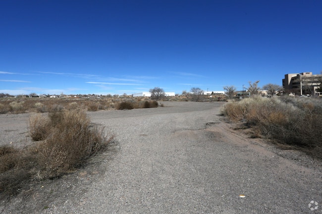
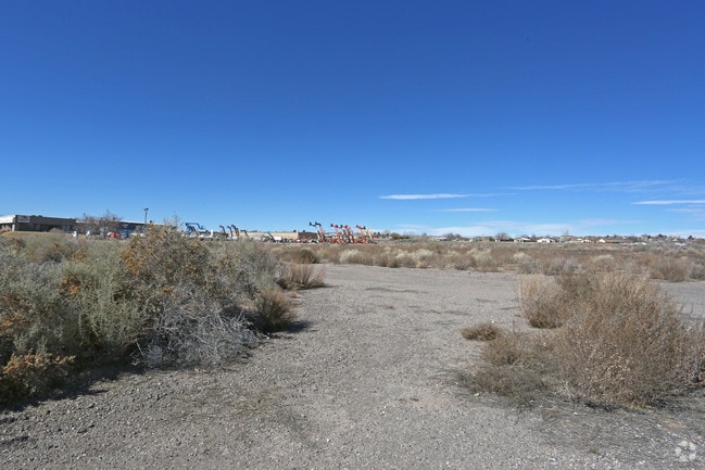
Property Record
301 Nm Highway 528 Ne, Rio Rancho, NM 87124

NEARBY LISTINGS FOR SALE OR LEASE
Property Detail
301 Nm Highway 528 Ne
Albuquerque, NM
Vista Hills 4
1-015-070-065-064
LEGAL: S: 16 T: 12N R: 3E SUBD: VISTA HILLS 4 BLOCK: E LOT: 2B1
Vacantlandnec
Sandoval
X
New Mexico
35043C1894D
2b1
2024
3 AC
2025
Rio Rancho
010729
Albuquerque
117,926 SF
DEMOGRAPHICS near 301 Nm Highway 528 Ne
1 Mile
3 Mile
5 Mile
2024 Total Population
6,487
45,005
109,650
2029 Population
7,016
48,700
116,777
Pop Growth 2024-2029
+ 8.15%
+ 8.21%
+ 6.50%
Average Age
43
45
42
2024 Total Households
2,525
17,859
42,629
HH Growth 2024-2029
+ 8.28%
+ 8.30%
+ 6.37%
Median Household Inc
$64,612
$77,036
$78,987
Avg Household Size
2.50
2.40
2.50
2024 Avg HH Vehicles
2.00
2.00
2.00
Median Home Value
$210,578
$279,810
$272,972
Median Year Built
1987
1992
1995
Nearby Places
Map Layers
Map Styles
 Street
 Aerial
- Restaurants
- Banks
- Shops
- Fitness
- Groceries
PUBLIC TRANSPORTATION
COMMUTER RAIL
Sandia Pueblo (Rail Runner Express - New Mexico Rail Runner Express)
DRIVE
WALK
Distance
Sandia Pueblo (Rail Runner Express - New Mexico Rail Runner Express)
17 min
9.5 mi
Sandia Pueblo Rail Runner Station (NMRX - Rio Metro Regional Transit District)
DRIVE
WALK
Distance
Sandia Pueblo Rail Runner Station (NMRX - Rio Metro Regional Transit District)
18 min
9.6 mi
AIRPORT
Albuquerque International Sunport
DRIVE
WALK
Distance
Albuquerque International Sunport
47 min
22.5 mi
Freight Ports
Tulsa Port Of Catoosa
DRIVE
WALK
Distance
Tulsa Port Of Catoosa
711 min
673.8 mi
SALE & LEASE HISTORY
LISTING DATE
SALE/LEASE

Jan 07, 2019
For Sale
Jan 07, 2019
For Lease
Nearby Properties
Address
Land Use
TOTAL SIZE
Lot Size
Zoning
Address
Land Use
TOTAL SIZE
Lot Size
Zoning
2,095,144 SF
123.59 AC
Address
Land Use
TOTAL SIZE
Lot Size
Zoning
1,087,991 SF
55.76 AC
Address
Land Use
TOTAL SIZE
Lot Size
Zoning
381,500 SF
111.32 AC
Address
Land Use
TOTAL SIZE
Lot Size
Zoning
256,916 SF
12.06 AC
Address
Land Use
TOTAL SIZE
Lot Size
Zoning
67,905 SF
4.25 AC
Address
Land Use
TOTAL SIZE
Lot Size
Zoning
228,746 SF
66.75 AC
Address
Land Use
TOTAL SIZE
Lot Size
Zoning
Address
Land Use
TOTAL SIZE
Lot Size
Zoning
66,000 SF
85.14 AC
Address
Land Use
TOTAL SIZE
Lot Size
Zoning
307,481 SF
17.50 AC
Address
Land Use
TOTAL SIZE
Lot Size
Zoning
137,071 SF
8.30 AC
Address
Land Use
TOTAL SIZE
Lot Size
Zoning
62,881 SF
4.67 AC
Address
Land Use
TOTAL SIZE
Lot Size
Zoning
124,106 SF
30.54 AC
Address
Land Use
TOTAL SIZE
Lot Size
Zoning
68,123 SF
6.81 AC
Address
Land Use
TOTAL SIZE
Lot Size
Zoning
75,911 SF
6.80 AC
Address
Land Use
TOTAL SIZE
Lot Size
Zoning
73,234 SF
16.50 AC
Address
Land Use
TOTAL SIZE
Lot Size
Zoning
94,354 SF
7.96 AC
Address
Land Use
TOTAL SIZE
Lot Size
Zoning
65,668 SF
3.03 AC
Address
Land Use
TOTAL SIZE
Lot Size
Zoning
204,442 SF
9.24 AC
Address
Land Use
TOTAL SIZE
Lot Size
Zoning
64,749 SF
6.21 AC
Address
Land Use
TOTAL SIZE
Lot Size
Zoning
50,213 SF
7.84 AC
Address
Land Use
TOTAL SIZE
Lot Size
Zoning
97,174 SF
8.53 AC
Address
Land Use
TOTAL SIZE
Lot Size
Zoning
143,738 SF
10 AC
Address
Land Use
TOTAL SIZE
Lot Size
Zoning
46,756 SF
10 AC
Address
Land Use
TOTAL SIZE
Lot Size
Zoning
220,626 SF
10.75 AC
Address
Land Use
TOTAL SIZE
Lot Size
Zoning
141,350 SF
14.01 AC
Address
Land Use
TOTAL SIZE
Lot Size
Zoning
76,872 SF
12.65 AC
Address
Land Use
TOTAL SIZE
Lot Size
Zoning
121,674 SF
9.63 AC
Address
Land Use
TOTAL SIZE
Lot Size
Zoning
112,319 SF
21.03 AC
Address
Land Use
TOTAL SIZE
Lot Size
Zoning
The World's #1 Commercial Real Estate Marketplace
Connect with us
© 2025 CoStar Group
The information above has been obtained from sources believed reliable. While we do not doubt its accuracy we have not verified it and make no guarantee, warranty or representation about it. It is your responsibility to independently confirm its accuracy and completeness. Any projections, opinions, assumptions, or estimates used are for example only and do not represent the current or future performance of the property. The value of this transaction to you depends on tax and other factors which should be evaluated by your tax, financial, and legal advisors. You and your advisors should conduct a careful, independent investigation of the property to determine to your satisfaction the suitability of the property for your needs.