Property Record
301 Petfinder Ln, Raleigh, NC 27603


NEARBY LISTINGS FOR SALE OR LEASE
Property Detail
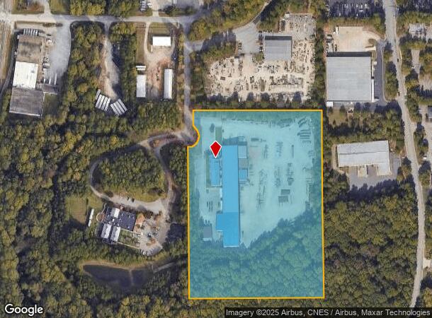
301 Petfinder Ln
Raleigh, NC
S P C A
1702.17-00-9230-000
LO2 SPCA OF WAKE COUNTY BM2003-437
Warehouse
Wake
X
North Carolina
3720170200K
2
0
11.42 AC
2025
Southeast Wake County
053009
Raleigh/Durham
25,864 SF
DEMOGRAPHICS near 301 Petfinder Ln
1 Mile
3 Mile
5 Mile
2024 Total Population
4,755
47,286
172,581
2029 Population
5,144
51,368
187,873
Pop Growth 2024-2029
+ 8.18%
+ 8.63%
+ 8.86%
Average Age
36
37
36
2024 Total Households
1,993
18,489
69,310
HH Growth 2024-2029
+ 8.08%
+ 8.70%
+ 9.36%
Median Household Inc
$66,085
$54,009
$63,875
Avg Household Size
2.30
2.40
2.20
2024 Avg HH Vehicles
2.00
2.00
2.00
Median Home Value
$345,493
$247,019
$314,872
Median Year Built
2001
1989
1990
Nearby Places
Map Layers
Map Styles
 Street
 Aerial
- Restaurants
- Banks
- Shops
- Fitness
- Groceries
PUBLIC TRANSPORTATION
COMMUTER RAIL
Raleigh Union Station (Piedmont - North Carolina by Train (NC Train))
DRIVE
WALK
Distance
Raleigh Union Station (Piedmont - North Carolina by Train (NC Train))
9 min
4.1 mi
AIRPORT
Raleigh-Durham International
DRIVE
WALK
Distance
Raleigh-Durham International
25 min
16.4 mi
Freight Ports
Port of Wilmington
DRIVE
WALK
Distance
Port of Wilmington
152 min
130.2 mi
Nearby Properties
Address
Land Use
TOTAL SIZE
Lot Size
Zoning
Address
Land Use
TOTAL SIZE
Lot Size
Zoning
573,338 SF
19.34 AC
IH
Address
Land Use
TOTAL SIZE
Lot Size
Zoning
982,323 SF
154.02 AC
OX-7
Address
Land Use
TOTAL SIZE
Lot Size
Zoning
127,409 SF
734.31 AC
R-1
Address
Land Use
TOTAL SIZE
Lot Size
Zoning
447,294 SF
5.64 AC
PD
Address
Land Use
TOTAL SIZE
Lot Size
Zoning
327,776 SF
14.48 AC
CX-5
Address
Land Use
TOTAL SIZE
Lot Size
Zoning
235,588 SF
128.17 AC
OX-3
Address
Land Use
TOTAL SIZE
Lot Size
Zoning
2,740 SF
400.73 AC
AP
Address
Land Use
TOTAL SIZE
Lot Size
Zoning
263,138 SF
25 AC
R-10
Address
Land Use
TOTAL SIZE
Lot Size
Zoning
370,651 SF
24.83 AC
IX-3
Address
Land Use
TOTAL SIZE
Lot Size
Zoning
280,473 SF
28.12 AC
R-10
Address
Land Use
TOTAL SIZE
Lot Size
Zoning
275,019 SF
17.04 AC
MF-A
Address
Land Use
TOTAL SIZE
Lot Size
Zoning
228,260 SF
15.92 AC
R-10
Address
Land Use
TOTAL SIZE
Lot Size
Zoning
212,330 SF
8.75 AC
R-10
Address
Land Use
TOTAL SIZE
Lot Size
Zoning
292,610 SF
7.33 AC
PD
Address
Land Use
TOTAL SIZE
Lot Size
Zoning
292,992 SF
25.32 AC
R-10
Address
Land Use
TOTAL SIZE
Lot Size
Zoning
5,882 SF
287.18 AC
AP
Address
Land Use
TOTAL SIZE
Lot Size
Zoning
188,454 SF
13.13 AC
RX-3
Address
Land Use
TOTAL SIZE
Lot Size
Zoning
213,098 SF
24.60 AC
R-10
Address
Land Use
TOTAL SIZE
Lot Size
Zoning
124,876 SF
CMP
Address
Land Use
TOTAL SIZE
Lot Size
Zoning
340,994 SF
27.24 AC
MF-B
Address
Land Use
TOTAL SIZE
Lot Size
Zoning
260,355 SF
18.48 AC
MF-A
Address
Land Use
TOTAL SIZE
Lot Size
Zoning
278,725 SF
CMP
Address
Land Use
TOTAL SIZE
Lot Size
Zoning
487,635 SF
27.81 AC
IX-3
Address
Land Use
TOTAL SIZE
Lot Size
Zoning
112,278 SF
6.97 AC
R-10
Address
Land Use
TOTAL SIZE
Lot Size
Zoning
227,910 SF
20.77 AC
MF-A
Address
Land Use
TOTAL SIZE
Lot Size
Zoning
116,391 SF
CMP
Address
Land Use
TOTAL SIZE
Lot Size
Zoning
74,356 SF
6.02 AC
IH
Address
Land Use
TOTAL SIZE
Lot Size
Zoning
419,154 SF
1.17 AC
CX-20
Address
Land Use
TOTAL SIZE
Lot Size
Zoning
77.64 AC
CX-20
Address
Land Use
TOTAL SIZE
Lot Size
Zoning
85.61 AC
IX-3
The World's #1 Commercial Real Estate Marketplace
Connect with us
© 2025 CoStar Group
The information above has been obtained from sources believed reliable. While we do not doubt its accuracy we have not verified it and make no guarantee, warranty or representation about it. It is your responsibility to independently confirm its accuracy and completeness. Any projections, opinions, assumptions, or estimates used are for example only and do not represent the current or future performance of the property. The value of this transaction to you depends on tax and other factors which should be evaluated by your tax, financial, and legal advisors. You and your advisors should conduct a careful, independent investigation of the property to determine to your satisfaction the suitability of the property for your needs.