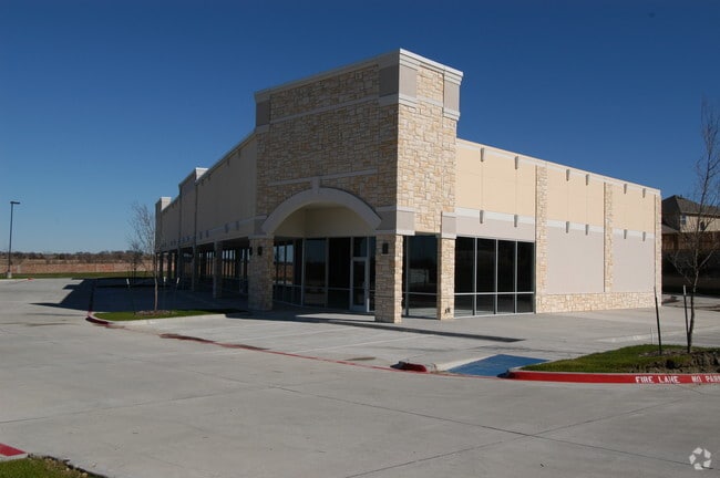
Property Record
301 Rivercrest Blvd, Allen, TX 75002

Property Detail
301 Rivercrest Blvd
Dallas-Fort Worth-Arlington, TX
ALLEN EDUCATIONAL PARK, BLK A, LOT 2R1; REPLAT
R-3862-00A-02R1-1
COLLIN
Publicschool
Texas
B and X Area of moderate flood hazard, usually the area between the limits of the 100-year and 500-year floods.
2
0
72.67 AC
2025
Allen
031508
Dallas/Ft Worth
414,198 SF
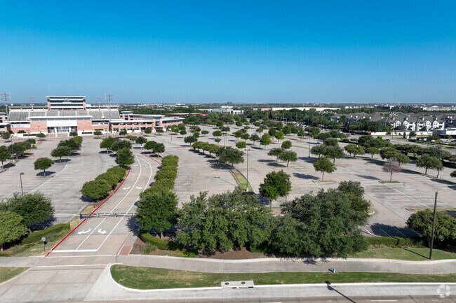
NEARBY LISTINGS FOR SALE OR LEASE
DEMOGRAPHICS near 301 Rivercrest Blvd
1 mile
3 mile
5 mile
2025 Total Population
13,150
108,742
263,175
2030 Population
14,967
124,016
299,869
Pop Growth 2025-2030
+ 13.82%
+ 14.05%
+ 13.94%
Average Age
40
39
38
2025 Total Households
4,693
38,231
95,264
HH Growth 2025-2030
+ 14.15%
+ 14.41%
+ 14.28%
Median Household Inc
$115,402
$124,516
$118,441
Avg Household Size
2.80
2.80
2.70
2025 Avg HH Vehicles
2.00
2.00
2.00
Median Home Value
$383,307
$493,736
$533,741
Median Year Built
1997
2004
2005
Nearby Places
Map Layers
Map Styles
 Street
 Aerial
Transit
 Traffic
 Biking
Places
Listings with unknown addresses are not visible on the map
- Restaurants
- Banks
- Shops
- Fitness
- Groceries
Nearby Properties
Address
Land Use
TOTAL SIZE
Lot Size
Zoning
Address
Land Use
TOTAL SIZE
Lot Size
Zoning
1,089,284 SF
90.69 AC
Address
Land Use
TOTAL SIZE
Lot Size
Zoning
472,185 SF
63.51 AC
AO
Address
Land Use
TOTAL SIZE
Lot Size
Zoning
611,780 SF
59.06 AC
L1
Address
Land Use
TOTAL SIZE
Lot Size
Zoning
720,571 SF
68.28 AC
Address
Land Use
TOTAL SIZE
Lot Size
Zoning
709,804 SF
32.68 AC
Address
Land Use
TOTAL SIZE
Lot Size
Zoning
162,000 SF
34 AC
L1
Address
Land Use
TOTAL SIZE
Lot Size
Zoning
384,753 SF
7.68 AC
Address
Land Use
TOTAL SIZE
Lot Size
Zoning
495,048 SF
7.37 AC
Address
Land Use
TOTAL SIZE
Lot Size
Zoning
479,620 SF
14.02 AC
Address
Land Use
TOTAL SIZE
Lot Size
Zoning
465,405 SF
6.47 AC
Address
Land Use
TOTAL SIZE
Lot Size
Zoning
288,826 SF
18.71 AC
CC
Address
Land Use
TOTAL SIZE
Lot Size
Zoning
586,110 SF
10.50 AC
LI
Address
Land Use
TOTAL SIZE
Lot Size
Zoning
511,383 SF
10.89 AC
PD-OC
Address
Land Use
TOTAL SIZE
Lot Size
Zoning
434,787 SF
35.90 AC
Address
Land Use
TOTAL SIZE
Lot Size
Zoning
369,702 SF
5.10 AC
Address
Land Use
TOTAL SIZE
Lot Size
Zoning
509,085 SF
11.63 AC
PD-OC
Address
Land Use
TOTAL SIZE
Lot Size
Zoning
442,695 SF
24.65 AC
MF-M
Address
Land Use
TOTAL SIZE
Lot Size
Zoning
312,870 SF
35.90 AC
Address
Land Use
TOTAL SIZE
Lot Size
Zoning
471,114 SF
26.05 AC
MF-M
Address
Land Use
TOTAL SIZE
Lot Size
Zoning
384,052 SF
7.78 AC
MF-R
Address
Land Use
TOTAL SIZE
Lot Size
Zoning
350,018 SF
7.02 AC
MF-E
Address
Land Use
TOTAL SIZE
Lot Size
Zoning
370,860 SF
25.48 AC
Address
Land Use
TOTAL SIZE
Lot Size
Zoning
379,701 SF
17.58 AC
MULTI-FAMI
Address
Land Use
TOTAL SIZE
Lot Size
Zoning
334,313 SF
13.61 AC
MF
Address
Land Use
TOTAL SIZE
Lot Size
Zoning
344,076 SF
15.49 AC
MULTI-FAMI
Address
Land Use
TOTAL SIZE
Lot Size
Zoning
212,880 SF
2.63 AC
CO-COMMERC
Address
Land Use
TOTAL SIZE
Lot Size
Zoning
382,360 SF
68.99 AC
Address
Land Use
TOTAL SIZE
Lot Size
Zoning
317,862 SF
4.04 AC
Address
Land Use
TOTAL SIZE
Lot Size
Zoning
439,754 SF
13.09 AC
SF
The World's #1 Commercial Real Estate Marketplace
Connect with us
© 2026 CoStar Group
The information above has been obtained from sources believed reliable. While we do not doubt its accuracy we have not verified it and make no guarantee, warranty or representation about it. It is your responsibility to independently confirm its accuracy and completeness. Any projections, opinions, assumptions, or estimates used are for example only and do not represent the current or future performance of the property. The value of this transaction to you depends on tax and other factors which should be evaluated by your tax, financial, and legal advisors. You and your advisors should conduct a careful, independent investigation of the property to determine to your satisfaction the suitability of the property for your needs.