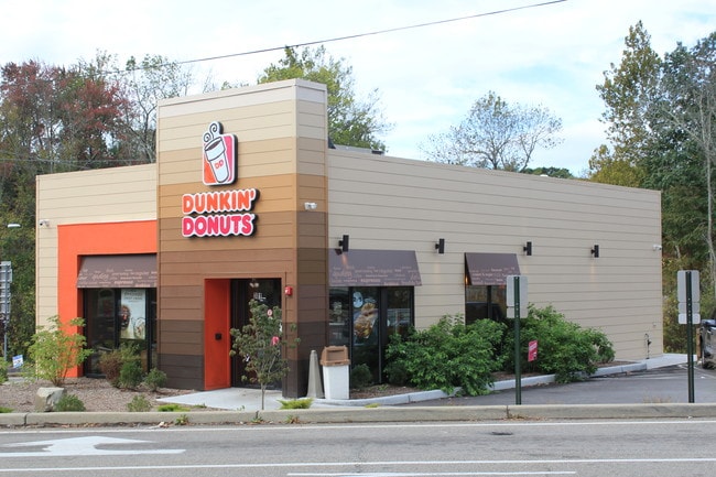
Property Record
301 State Route 32, Wallkill, NY 12589


NEARBY LISTINGS FOR SALE OR LEASE
Property Detail
301 State Route 32
334600-014-000-0001-043.000-0000
Orange
Restaurantdrivein
New York
AE
43.00
36111C0900F
0.46 AC
2024
Newburgh
2024
Northern New Jersey
955400
Kiryas Joel-Poughkeepsie-Newburgh, NY
1,856 SF
DEMOGRAPHICS near 301 State Route 32
1 Mile
3 Mile
5 Mile
2024 Total Population
2,244
23,869
73,312
2029 Population
2,298
24,364
74,384
Pop Growth 2024-2029
+ 2.41%
+ 2.07%
+ 1.46%
Average Age
41
42
39
2024 Total Households
781
8,610
26,322
HH Growth 2024-2029
+ 2.43%
+ 2.14%
+ 1.55%
Median Household Inc
$94,055
$103,823
$83,068
Avg Household Size
2.80
2.70
2.70
2024 Avg HH Vehicles
2.00
2.00
2.00
Median Home Value
$284,835
$305,377
$289,670
Median Year Built
1968
1977
1965
Nearby Places
Map Layers
Map Styles
 Street
 Aerial
- Restaurants
- Banks
- Shops
- Fitness
- Groceries
PUBLIC TRANSPORTATION
COMMUTER RAIL
Beacon Station (Hudson Line - Metro-North Commuter Railroad Company (Metro-North))
DRIVE
WALK
Distance
Beacon Station (Hudson Line - Metro-North Commuter Railroad Company (Metro-North))
14 min
7.0 mi
AIRPORT
New York Stewart International
DRIVE
WALK
Distance
New York Stewart International
15 min
7.4 mi
SALE & LEASE HISTORY
LISTING DATE
SALE/LEASE

Nov 24, 2018
For Sale
Jan 15, 2020
For Sale
Dec 11, 2017
For Sale
Nearby Properties
Address
Land Use
TOTAL SIZE
Lot Size
Zoning
Address
Land Use
TOTAL SIZE
Lot Size
Zoning
927,041 SF
104.37 AC
Address
Land Use
TOTAL SIZE
Lot Size
Zoning
130,037 SF
128.80 AC
Address
Land Use
TOTAL SIZE
Lot Size
Zoning
44.50 AC
Address
Land Use
TOTAL SIZE
Lot Size
Zoning
505,577 SF
50.50 AC
Address
Land Use
TOTAL SIZE
Lot Size
Zoning
265,660 SF
24.20 AC
Address
Land Use
TOTAL SIZE
Lot Size
Zoning
29,935 SF
31.60 AC
04
Address
Land Use
TOTAL SIZE
Lot Size
Zoning
71,379 SF
20.80 AC
Address
Land Use
TOTAL SIZE
Lot Size
Zoning
97,011 SF
19.70 AC
Address
Land Use
TOTAL SIZE
Lot Size
Zoning
215,219 SF
14.57 AC
Address
Land Use
TOTAL SIZE
Lot Size
Zoning
Address
Land Use
TOTAL SIZE
Lot Size
Zoning
173,319 SF
28.30 AC
04
Address
Land Use
TOTAL SIZE
Lot Size
Zoning
75,620 SF
12.80 AC
Address
Land Use
TOTAL SIZE
Lot Size
Zoning
61,822 SF
7.30 AC
Address
Land Use
TOTAL SIZE
Lot Size
Zoning
149,085 SF
48.90 AC
Address
Land Use
TOTAL SIZE
Lot Size
Zoning
411.40 AC
Address
Land Use
TOTAL SIZE
Lot Size
Zoning
78,750 SF
3.50 AC
IND
Address
Land Use
TOTAL SIZE
Lot Size
Zoning
320 SF
88.50 AC
Address
Land Use
TOTAL SIZE
Lot Size
Zoning
20 AC
Address
Land Use
TOTAL SIZE
Lot Size
Zoning
10.30 AC
Address
Land Use
TOTAL SIZE
Lot Size
Zoning
37.40 AC
Address
Land Use
TOTAL SIZE
Lot Size
Zoning
50,000 SF
3.20 AC
IND
Address
Land Use
TOTAL SIZE
Lot Size
Zoning
87,775 SF
5.60 AC
04
Address
Land Use
TOTAL SIZE
Lot Size
Zoning
24,431 SF
5.20 AC
IND
Address
Land Use
TOTAL SIZE
Lot Size
Zoning
Address
Land Use
TOTAL SIZE
Lot Size
Zoning
71,198 SF
15.50 AC
Address
Land Use
TOTAL SIZE
Lot Size
Zoning
10.30 AC
Address
Land Use
TOTAL SIZE
Lot Size
Zoning
75,354 SF
6.80 AC
04
Address
Land Use
TOTAL SIZE
Lot Size
Zoning
34,666 SF
5 AC
04
Address
Land Use
TOTAL SIZE
Lot Size
Zoning
Address
Land Use
TOTAL SIZE
Lot Size
Zoning
4.50 AC
The World's #1 Commercial Real Estate Marketplace
Connect with us
© 2026 CoStar Group
The information above has been obtained from sources believed reliable. While we do not doubt its accuracy we have not verified it and make no guarantee, warranty or representation about it. It is your responsibility to independently confirm its accuracy and completeness. Any projections, opinions, assumptions, or estimates used are for example only and do not represent the current or future performance of the property. The value of this transaction to you depends on tax and other factors which should be evaluated by your tax, financial, and legal advisors. You and your advisors should conduct a careful, independent investigation of the property to determine to your satisfaction the suitability of the property for your needs.