Property Record
301 S Garland Prairie Rd, Williams, AZ 86046
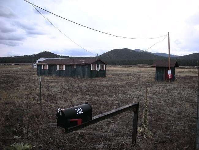


Property Detail
301 S Garland Prairie Rd
203-23-002J
TRACT: 2 QUARTER: NW SECTION: 31 TOWNSHIP: 22N RANGE: 03E POR NW4 BEG:NW COR;TH S 89-48-24 E 660.08; TH S 00-08-34 W 1923.53TO TPOB;TH N 89-50-51 E 627-96; TH N 00-15-58 E 681.37;TH N 12-03-23 W 35.51;TH S 89-50-51 W 621.92;TH S 00-08-34 W 716.11 TPO
Lumberwoodproductmanufacturingincludingfurniture
COCONINO
B and X Area of moderate flood hazard, usually the area between the limits of the 100-year and 500-year floods.
Arizona
2024
10.33 AC
2025
Grand Canyon Area
001700
Other Market Areas
768 SF
Flagstaff, AZ
NEARBY LISTINGS FOR SALE OR LEASE
-
-
View all Williams listings for sale on LoopNet.com
DEMOGRAPHICS near 301 S Garland Prairie Rd
1 mile
3 mile
5 mile
2025 Total Population
137
204
3,394
2030 Population
142
211
3,402
Pop Growth 2025-2030
+ 3.65%
+ 3.43%
+ 0.24%
Average Age
46
46
42
2025 Total Households
54
80
1,362
HH Growth 2025-2030
+ 3.70%
+ 3.75%
(0.51%)
Median Household Inc
$87,500
$87,500
$67,125
Avg Household Size
2.40
2.40
2.40
2025 Avg HH Vehicles
3.00
3.00
2.00
Median Home Value
$320,000
$321,428
$431,313
Median Year Built
1993
1994
1980
Nearby Places
Map Layers
Map Styles
 Street
 Aerial
Transit
 Traffic
 Biking
Places
Listings with unknown addresses are not visible on the map
- Restaurants
- Banks
- Shops
- Fitness
- Groceries
PUBLIC TRANSPORTATION
AIRPORT
Flagstaff Pulliam
Drive
Walk
Distance
Flagstaff Pulliam
38 min
32.1 mi
Freight Ports
Port of San Diego
Drive
Walk
Distance
Port of San Diego
532 min
480.3 mi
Nearby Properties
Address
Land Use
TOTAL SIZE
Lot Size
Zoning
Address
Land Use
TOTAL SIZE
Lot Size
Zoning
38,946 SF
155.67 AC
Address
Land Use
TOTAL SIZE
Lot Size
Zoning
27,684 SF
12.50 AC
Address
Land Use
TOTAL SIZE
Lot Size
Zoning
14,280 SF
1.50 AC
Address
Land Use
TOTAL SIZE
Lot Size
Zoning
5,828 SF
1.55 AC
Address
Land Use
TOTAL SIZE
Lot Size
Zoning
7,353 SF
136 AC
Address
Land Use
TOTAL SIZE
Lot Size
Zoning
5,500 SF
38.24 AC
Address
Land Use
TOTAL SIZE
Lot Size
Zoning
Address
Land Use
TOTAL SIZE
Lot Size
Zoning
4,503 SF
155.28 AC
Address
Land Use
TOTAL SIZE
Lot Size
Zoning
88.30 AC
Address
Land Use
TOTAL SIZE
Lot Size
Zoning
Address
Land Use
TOTAL SIZE
Lot Size
Zoning
3,300 SF
2 AC
Address
Land Use
TOTAL SIZE
Lot Size
Zoning
5,000 SF
15 AC
Address
Land Use
TOTAL SIZE
Lot Size
Zoning
Address
Land Use
TOTAL SIZE
Lot Size
Zoning
7.72 AC
Address
Land Use
TOTAL SIZE
Lot Size
Zoning
Address
Land Use
TOTAL SIZE
Lot Size
Zoning
Address
Land Use
TOTAL SIZE
Lot Size
Zoning
7.32 AC
Address
Land Use
TOTAL SIZE
Lot Size
Zoning
Address
Land Use
TOTAL SIZE
Lot Size
Zoning
Address
Land Use
TOTAL SIZE
Lot Size
Zoning
2,665 SF
4.50 AC
Address
Land Use
TOTAL SIZE
Lot Size
Zoning
Address
Land Use
TOTAL SIZE
Lot Size
Zoning
Address
Land Use
TOTAL SIZE
Lot Size
Zoning
Address
Land Use
TOTAL SIZE
Lot Size
Zoning
Address
Land Use
TOTAL SIZE
Lot Size
Zoning
11.03 AC
Address
Land Use
TOTAL SIZE
Lot Size
Zoning
The World's #1 Commercial Real Estate Marketplace
Connect with us
© 2026 CoStar Group
The information above has been obtained from sources believed reliable. While we do not doubt its accuracy we have not verified it and make no guarantee, warranty or representation about it. It is your responsibility to independently confirm its accuracy and completeness. Any projections, opinions, assumptions, or estimates used are for example only and do not represent the current or future performance of the property. The value of this transaction to you depends on tax and other factors which should be evaluated by your tax, financial, and legal advisors. You and your advisors should conduct a careful, independent investigation of the property to determine to your satisfaction the suitability of the property for your needs.