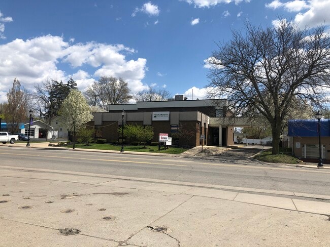
Property Record
301 S Lafayette St, South Lyon, MI 48178

NEARBY LISTINGS FOR SALE OR LEASE
Property Detail
301 S Lafayette St
Detroit-Warren-Dearborn, MI
Assessors Plat No 1
21-29-105-001
T1N, R7E, SEC 29 ASSESSOR'S PLAT NO 1 LOTS 69 & 70
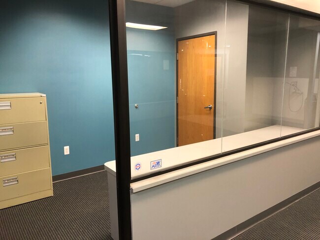
Officebuilding
Oakland
X
Michigan
26093C0484D
69-70
2024
0.32 AC
2024
Central I-96 Corridor
139400
Detroit
8,938 SF
DEMOGRAPHICS near 301 S Lafayette St
1 Mile
3 Mile
5 Mile
2024 Total Population
9,291
31,905
52,269
2029 Population
9,293
32,051
52,510
Pop Growth 2024-2029
+ 0.02%
+ 0.46%
+ 0.46%
Average Age
41
41
41
2024 Total Households
3,895
12,162
19,530
HH Growth 2024-2029
0.00%
+ 0.43%
+ 0.44%
Median Household Inc
$84,259
$104,834
$108,412
Avg Household Size
2.40
2.60
2.70
2024 Avg HH Vehicles
2.00
2.00
2.00
Median Home Value
$260,812
$336,568
$360,947
Median Year Built
1990
1994
1995
Nearby Places
Map Layers
Map Styles
 Street
 Aerial
- Restaurants
- Banks
- Shops
- Fitness
- Groceries
PUBLIC TRANSPORTATION
AIRPORT
Detroit Metro Wayne County
DRIVE
WALK
Distance
Detroit Metro Wayne County
47 min
34.9 mi
Freight Ports
Port of Toledo
DRIVE
WALK
Distance
Port of Toledo
94 min
71.6 mi
SALE & LEASE HISTORY
LISTING DATE
SALE/LEASE

Feb 19, 2019
For Sale
Feb 05, 2020
For Sale
Feb 04, 2020
For Lease
Dec 06, 2021
For Lease
Dec 06, 2021
For Sale
Nearby Properties
Address
Land Use
TOTAL SIZE
Lot Size
Zoning
Address
Land Use
TOTAL SIZE
Lot Size
Zoning
394,554 SF
28.66 AC
GI
Address
Land Use
TOTAL SIZE
Lot Size
Zoning
9,208 SF
230 AC
RE
Address
Land Use
TOTAL SIZE
Lot Size
Zoning
140,000 SF
9.08 AC
LI PUD
Address
Land Use
TOTAL SIZE
Lot Size
Zoning
164,517 SF
27.78 AC
GI
Address
Land Use
TOTAL SIZE
Lot Size
Zoning
4,228 SF
105.74 AC
DI
Address
Land Use
TOTAL SIZE
Lot Size
Zoning
137,373 SF
16.51 AC
AI
Address
Land Use
TOTAL SIZE
Lot Size
Zoning
4,885 SF
67.51 AC
Address
Land Use
TOTAL SIZE
Lot Size
Zoning
54,615 SF
6.14 AC
LI PUD
Address
Land Use
TOTAL SIZE
Lot Size
Zoning
55,744 SF
4.40 AC
Address
Land Use
TOTAL SIZE
Lot Size
Zoning
107,743 SF
8.06 AC
AI
Address
Land Use
TOTAL SIZE
Lot Size
Zoning
33,808 SF
4.16 AC
LI PUD
Address
Land Use
TOTAL SIZE
Lot Size
Zoning
53,610 SF
4.61 AC
BI
Address
Land Use
TOTAL SIZE
Lot Size
Zoning
45,340 SF
2.86 AC
LI PUD
Address
Land Use
TOTAL SIZE
Lot Size
Zoning
43,838 SF
10.05 AC
GI
Address
Land Use
TOTAL SIZE
Lot Size
Zoning
61,746 SF
20.61 AC
Address
Land Use
TOTAL SIZE
Lot Size
Zoning
49,710 SF
5.61 AC
LI PUD
Address
Land Use
TOTAL SIZE
Lot Size
Zoning
68,420 SF
6.38 AC
Address
Land Use
TOTAL SIZE
Lot Size
Zoning
18,567 SF
2.46 AC
BV
Address
Land Use
TOTAL SIZE
Lot Size
Zoning
1,472 SF
35.14 AC
MM
Address
Land Use
TOTAL SIZE
Lot Size
Zoning
45,228 SF
5.35 AC
BI
Address
Land Use
TOTAL SIZE
Lot Size
Zoning
56,780 SF
5.13 AC
BI
Address
Land Use
TOTAL SIZE
Lot Size
Zoning
64,555 SF
9.60 AC
II
Address
Land Use
TOTAL SIZE
Lot Size
Zoning
50,870 SF
3.51 AC
LI PUD
Address
Land Use
TOTAL SIZE
Lot Size
Zoning
9,914 SF
0.99 AC
LI
Address
Land Use
TOTAL SIZE
Lot Size
Zoning
30,840 SF
2.46 AC
LI PUD
Address
Land Use
TOTAL SIZE
Lot Size
Zoning
64.30 AC
AR AGR
Address
Land Use
TOTAL SIZE
Lot Size
Zoning
37,050 SF
4.18 AC
LI PUD
The World's #1 Commercial Real Estate Marketplace
Connect with us
© 2025 CoStar Group
The information above has been obtained from sources believed reliable. While we do not doubt its accuracy we have not verified it and make no guarantee, warranty or representation about it. It is your responsibility to independently confirm its accuracy and completeness. Any projections, opinions, assumptions, or estimates used are for example only and do not represent the current or future performance of the property. The value of this transaction to you depends on tax and other factors which should be evaluated by your tax, financial, and legal advisors. You and your advisors should conduct a careful, independent investigation of the property to determine to your satisfaction the suitability of the property for your needs.